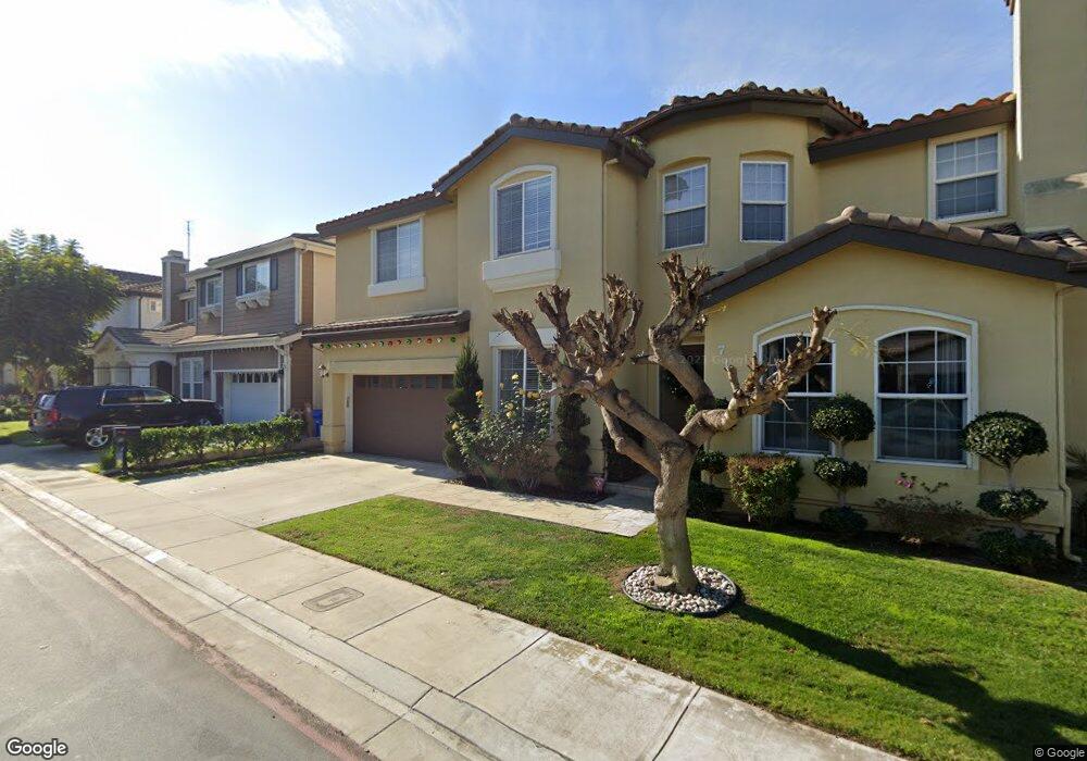
700 Meyer Ln Unit 2 Redondo Beach, CA 90278
North Redondo Beach NeighborhoodEstimated Value: $1,294,000 - $1,362,000
3
Beds
3
Baths
2,202
Sq Ft
$599/Sq Ft
Est. Value
About This Home
This home is located at 700 Meyer Ln Unit 2, Redondo Beach, CA 90278 and is currently estimated at $1,319,068, approximately $599 per square foot. 700 Meyer Ln Unit 2 is a home located in Los Angeles County with nearby schools including Washington Elementary School, Adams Middle School, and Redondo Union High School.
Ownership History
Date
Name
Owned For
Owner Type
Purchase Details
Closed on
Jul 10, 2000
Sold by
Meyer Lane Llc
Bought by
Harris Junious L
Current Estimated Value
Home Financials for this Owner
Home Financials are based on the most recent Mortgage that was taken out on this home.
Original Mortgage
$327,900
Interest Rate
7.41%
Create a Home Valuation Report for This Property
The Home Valuation Report is an in-depth analysis detailing your home's value as well as a comparison with similar homes in the area
Home Values in the Area
Average Home Value in this Area
Purchase History
| Date | Buyer | Sale Price | Title Company |
|---|---|---|---|
| Harris Junious L | $410,000 | Stewart Title |
Source: Public Records
Mortgage History
| Date | Status | Borrower | Loan Amount |
|---|---|---|---|
| Previous Owner | Harris Junious L | $327,900 | |
| Closed | Harris Junious L | $61,400 |
Source: Public Records
Tax History
| Year | Tax Paid | Tax Assessment Tax Assessment Total Assessment is a certain percentage of the fair market value that is determined by local assessors to be the total taxable value of land and additions on the property. | Land | Improvement |
|---|---|---|---|---|
| 2025 | $7,486 | $617,786 | $271,220 | $346,566 |
| 2024 | $7,486 | $605,673 | $265,902 | $339,771 |
| 2023 | $7,353 | $593,798 | $260,689 | $333,109 |
| 2022 | $7,212 | $582,156 | $255,578 | $326,578 |
| 2021 | $7,006 | $570,742 | $250,567 | $320,175 |
| 2019 | $6,827 | $553,815 | $243,136 | $310,679 |
| 2018 | $6,623 | $542,957 | $238,369 | $304,588 |
| 2016 | $6,394 | $521,875 | $229,114 | $292,761 |
| 2015 | $6,280 | $514,037 | $225,673 | $288,364 |
| 2014 | $6,190 | $503,969 | $221,253 | $282,716 |
Source: Public Records
Map
Nearby Homes
- 2345 190th St Unit 63
- 511 Meyer Ln Unit 8
- 2345 W 190th St Unit 77
- 2214 Fisher Ct
- 2217 190th St
- 606 Phelan Ln
- 531 Rindge Ln
- 2504 Fisk Ln
- 2420 Ives Ln Unit B
- 2420 Ives Ln Unit A
- 2407 Ripley Ave
- 524 Cluster Ln
- 2301 Marshallfield Ln Unit A
- 2516 185th St
- 2205 Marshallfield Ln Unit B
- 2205 Marshallfield Ln Unit A
- 2203 Marshallfield Ln Unit B
- 2114 Clark Ln
- 2220 Huntington Ln Unit 4
- 1912 Belmont Ln Unit A
- 700 Meyer Ln
- 700 Meyer Ln Unit 16
- 700 Meyer Ln Unit 14
- 700 Meyer Ln Unit 13
- 700 Meyer Ln Unit 12
- 700 Meyer Ln Unit 9
- 700 Meyer Ln Unit 8
- 700 Meyer Ln Unit 7
- 700 Meyer Ln Unit 6
- 700 Meyer Ln Unit 5
- 700 Meyer Ln Unit 3
- 700 Meyer Ln Unit 1
- 700 Meyer Ln Unit 11
- 700 Meyer Ln Unit 10
- 720 Meyer Ln Unit 201
- 720 Meyer Ln Unit 202
- 720 Meyer Ln Unit 203
- 720 Meyer Ln Unit 204
- 720 Meyer Ln Unit 108
- 720 Meyer Ln Unit 109
Your Personal Tour Guide
Ask me questions while you tour the home.