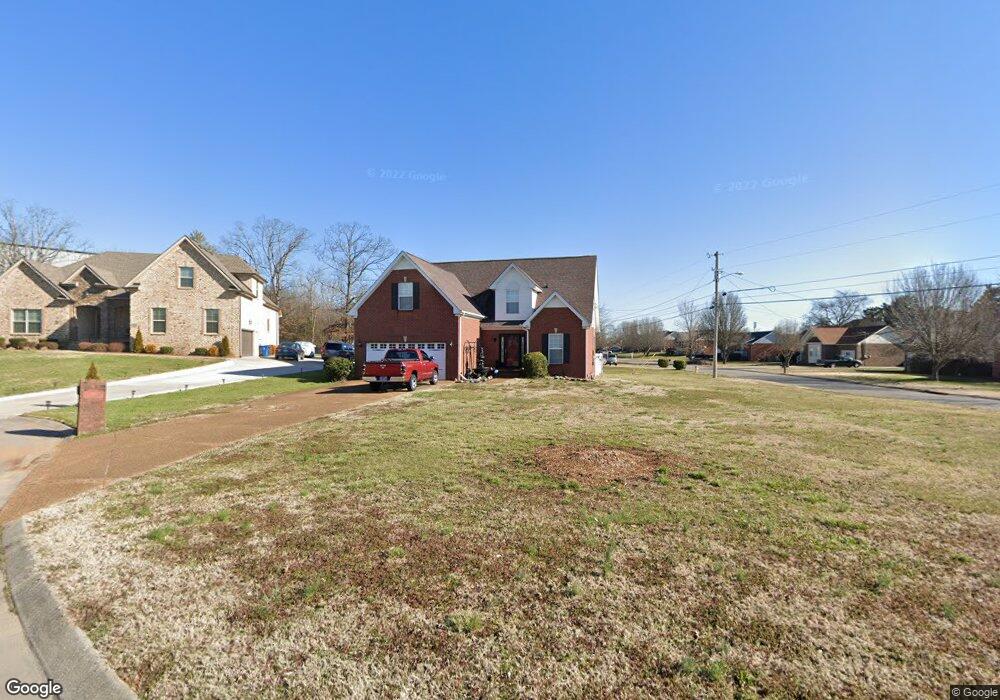
700 Poole Ct Smyrna, TN 37167
Estimated Value: $380,770 - $456,000
--
Bed
3
Baths
1,809
Sq Ft
$234/Sq Ft
Est. Value
About This Home
This home is located at 700 Poole Ct, Smyrna, TN 37167 and is currently estimated at $422,943, approximately $233 per square foot. 700 Poole Ct is a home located in Rutherford County with nearby schools including Rock Springs Elementary School, Rock Springs Middle School, and Stewarts Creek High School.
Ownership History
Date
Name
Owned For
Owner Type
Purchase Details
Closed on
Oct 22, 2002
Sold by
Continential Properties
Bought by
Partee Wesley H and Partee Stephani
Current Estimated Value
Home Financials for this Owner
Home Financials are based on the most recent Mortgage that was taken out on this home.
Original Mortgage
$167,800
Outstanding Balance
$69,577
Interest Rate
6.01%
Mortgage Type
VA
Estimated Equity
$353,366
Purchase Details
Closed on
Feb 11, 2000
Sold by
Johns A F
Bought by
Continental Properties Llc
Create a Home Valuation Report for This Property
The Home Valuation Report is an in-depth analysis detailing your home's value as well as a comparison with similar homes in the area
Home Values in the Area
Average Home Value in this Area
Purchase History
| Date | Buyer | Sale Price | Title Company |
|---|---|---|---|
| Partee Wesley H | $167,816 | -- | |
| Gaines Home Building | -- | -- | |
| Continental Properties Llc | $189,000 | -- |
Source: Public Records
Mortgage History
| Date | Status | Borrower | Loan Amount |
|---|---|---|---|
| Open | Continental Properties Llc | $167,800 | |
| Closed | Continental Properties Llc | $167,800 |
Source: Public Records
Tax History Compared to Growth
Tax History
| Year | Tax Paid | Tax Assessment Tax Assessment Total Assessment is a certain percentage of the fair market value that is determined by local assessors to be the total taxable value of land and additions on the property. | Land | Improvement |
|---|---|---|---|---|
| 2025 | $2,097 | $87,300 | $13,750 | $73,550 |
| 2024 | $2,097 | $87,300 | $13,750 | $73,550 |
| 2023 | $2,074 | $86,350 | $13,750 | $72,600 |
| 2022 | $1,850 | $86,350 | $13,750 | $72,600 |
| 2021 | $1,783 | $61,050 | $12,500 | $48,550 |
| 2020 | $1,783 | $61,050 | $12,500 | $48,550 |
| 2019 | $1,783 | $61,050 | $12,500 | $48,550 |
| 2018 | $1,710 | $61,050 | $0 | $0 |
| 2017 | $1,420 | $39,850 | $0 | $0 |
| 2016 | $1,420 | $39,850 | $0 | $0 |
| 2015 | $1,420 | $39,850 | $0 | $0 |
| 2014 | $991 | $39,850 | $0 | $0 |
| 2013 | -- | $40,125 | $0 | $0 |
Source: Public Records
Map
Nearby Homes
- 649 Woodburn Dr
- 382 Clarkston Dr
- 4015 Wisdom Way
- 466 Blair Rd
- 464 Blair Rd
- 460 Blair Rd
- 456 Blair Rd
- 450 Blair Rd
- 269 Cornice Dr
- 440 Blair Rd
- 261 Cornice Dr
- 262 Cornice Dr
- 416 Blair Rd
- 412 Blair Rd
- 406 Blair Rd
- 404 Blair Rd
- 402 Blair Rd
- STONEBROOK II Plan at Pottsview
- MILFORD A Plan at Pottsview
- SALEM Plan at Pottsview