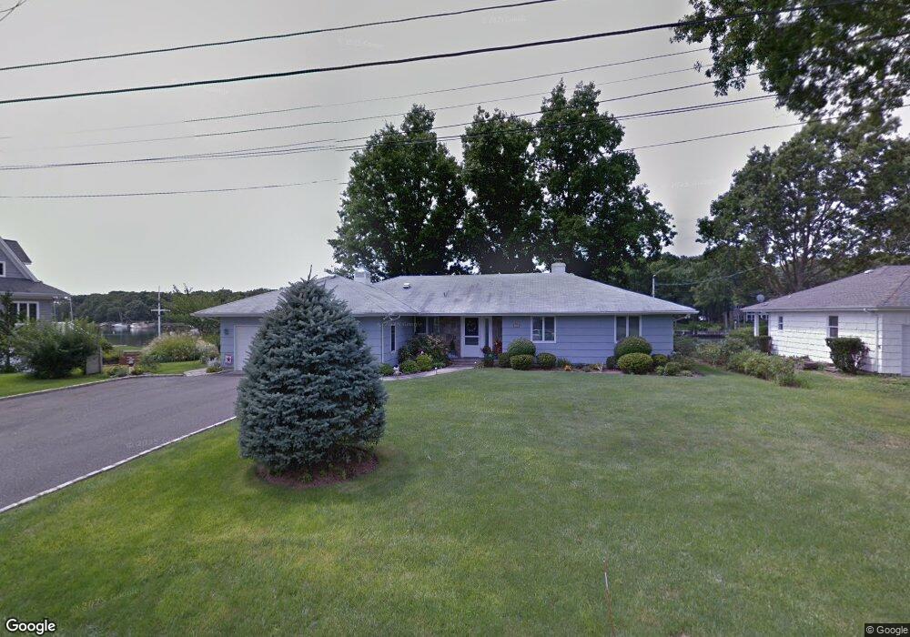
700 Snug Harbor Rd Greenport, NY 11944
North Fork NeighborhoodEstimated Value: $1,325,000 - $1,898,000
--
Bed
--
Bath
--
Sq Ft
0.43
Acres
About This Home
This home is located at 700 Snug Harbor Rd, Greenport, NY 11944 and is currently estimated at $1,725,408. 700 Snug Harbor Rd is a home located in Suffolk County with nearby schools including Greenport Elementary School and Greenport High School.
Ownership History
Date
Name
Owned For
Owner Type
Purchase Details
Closed on
Nov 18, 2015
Sold by
Sueiro Michael M and Sueiro Jane B
Bought by
Sueiro Michael M
Current Estimated Value
Purchase Details
Closed on
Oct 31, 2006
Purchase Details
Closed on
Jun 29, 2000
Sold by
Barker Evelyn L and Wilson Alice E
Bought by
Sueiro Michael M and Sueiro Jane B
Home Financials for this Owner
Home Financials are based on the most recent Mortgage that was taken out on this home.
Original Mortgage
$300,000
Interest Rate
8.5%
Mortgage Type
Credit Line Revolving
Purchase Details
Closed on
Jun 16, 1994
Sold by
Koch Elizabeth
Bought by
Koch Elizabeth
Create a Home Valuation Report for This Property
The Home Valuation Report is an in-depth analysis detailing your home's value as well as a comparison with similar homes in the area
Home Values in the Area
Average Home Value in this Area
Purchase History
| Date | Buyer | Sale Price | Title Company |
|---|---|---|---|
| Sueiro Michael M | -- | None Available | |
| -- | -- | -- | |
| Sueiro Michael M | $595,000 | Fidelity National Title | |
| Koch Elizabeth | -- | -- |
Source: Public Records
Mortgage History
| Date | Status | Borrower | Loan Amount |
|---|---|---|---|
| Previous Owner | Sueiro Michael M | $300,000 |
Source: Public Records
Tax History Compared to Growth
Tax History
| Year | Tax Paid | Tax Assessment Tax Assessment Total Assessment is a certain percentage of the fair market value that is determined by local assessors to be the total taxable value of land and additions on the property. | Land | Improvement |
|---|---|---|---|---|
| 2024 | $13,671 | $8,450 | $2,600 | $5,850 |
| 2023 | $13,671 | $8,450 | $2,600 | $5,850 |
| 2022 | $12,128 | $8,450 | $2,600 | $5,850 |
| 2021 | $11,522 | $8,450 | $2,600 | $5,850 |
| 2020 | $11,703 | $8,450 | $2,600 | $5,850 |
| 2019 | $11,703 | $0 | $0 | $0 |
| 2018 | $11,774 | $8,450 | $2,600 | $5,850 |
| 2017 | $11,802 | $8,950 | $2,600 | $6,350 |
| 2016 | $11,585 | $8,950 | $2,600 | $6,350 |
| 2015 | -- | $8,950 | $2,600 | $6,350 |
| 2014 | -- | $8,950 | $2,600 | $6,350 |
Source: Public Records
Map
Nearby Homes
- 435 Maple Ln
- 2500 Maple Ln Unit 14
- 400 Anglers Rd
- 2060 Shipyard Ln
- 2460 Shipyard Ln Unit 5E
- 2820 Shipyard Ln Unit 3M
- 2820 Shipyard Ln Unit 2C2
- 980 Manhanset Ave
- 1900 Gillette Dr
- 1545 E Gillette Dr
- 412 Atlantic Ave
- 3345 Cedar Ln
- 123 Sterling Ave Unit 8
- 7600 Main Rd
- 619 Bailey Ave
- 280 Champlin Place
- 604 Main St
- 151 Central Ave
- 609 1st St
- 1111 Main St
- 600 Snug Harbor Rd
- 800 Snug Harbor Rd
- 520 Snug Harbor Rd
- 350 Marine Place
- 365 Marine Place
- 475 Snug Harbor Rd
- 450 Snug Harbor Rd
- 1160 Snug Harbor Rd
- 265 Marine Place
- 345 Snug Harbor Rd
- 350 Osprey Nest Rd
- 190 Marine Place
- 53 Osprey Nest Rd
- 165 Marine Place
- 165 Marine Place
- 235 Snug Harbor Rd
- 1775 Gull Pond Ln
- 706 Wiggins Ln
- 1625 Gull Pond Ln
- 645 Dawn Dr