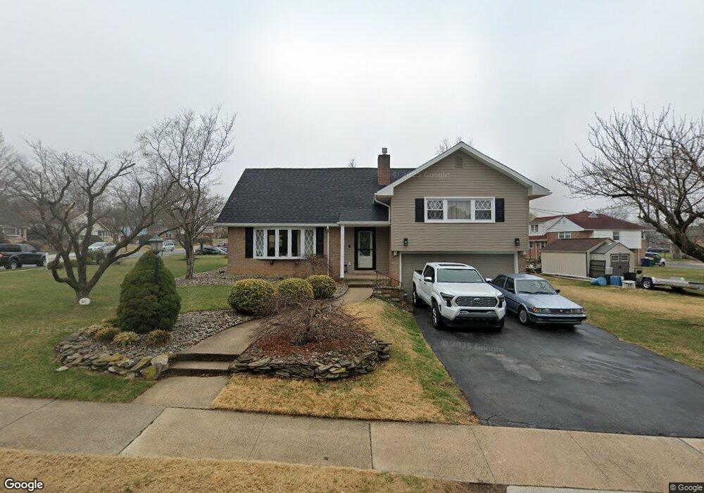
700 Snyder Rd Reading, PA 19609
Whitfield NeighborhoodEstimated Value: $331,000 - $363,000
4
Beds
2
Baths
1,771
Sq Ft
$197/Sq Ft
Est. Value
About This Home
This home is located at 700 Snyder Rd, Reading, PA 19609 and is currently estimated at $348,330, approximately $196 per square foot. 700 Snyder Rd is a home located in Berks County with nearby schools including Whitfield Elementary School, Wilson West Middle School, and Wilson High School.
Ownership History
Date
Name
Owned For
Owner Type
Purchase Details
Closed on
Mar 31, 2011
Sold by
Maldonado Celso and Morales Felix
Bought by
Rodriguez Mariam D
Current Estimated Value
Home Financials for this Owner
Home Financials are based on the most recent Mortgage that was taken out on this home.
Original Mortgage
$3,000
Outstanding Balance
$2,093
Interest Rate
5.04%
Mortgage Type
Stand Alone Second
Estimated Equity
$346,237
Purchase Details
Closed on
Nov 4, 2005
Sold by
Sallade G Dale and Sallade Linda L
Bought by
Maldonado Celso
Home Financials for this Owner
Home Financials are based on the most recent Mortgage that was taken out on this home.
Original Mortgage
$190,000
Interest Rate
6.28%
Mortgage Type
Fannie Mae Freddie Mac
Create a Home Valuation Report for This Property
The Home Valuation Report is an in-depth analysis detailing your home's value as well as a comparison with similar homes in the area
Home Values in the Area
Average Home Value in this Area
Purchase History
| Date | Buyer | Sale Price | Title Company |
|---|---|---|---|
| Rodriguez Mariam D | $144,000 | None Available | |
| Maldonado Celso | $200,000 | First American Title Ins Co |
Source: Public Records
Mortgage History
| Date | Status | Borrower | Loan Amount |
|---|---|---|---|
| Open | Rodriguez Mariam D | $3,000 | |
| Open | Rodriguez Mariam D | $140,349 | |
| Previous Owner | Maldonado Celso | $190,000 |
Source: Public Records
Tax History
| Year | Tax Paid | Tax Assessment Tax Assessment Total Assessment is a certain percentage of the fair market value that is determined by local assessors to be the total taxable value of land and additions on the property. | Land | Improvement |
|---|---|---|---|---|
| 2025 | $2,125 | $113,200 | $37,800 | $75,400 |
| 2024 | $4,843 | $113,200 | $37,800 | $75,400 |
| 2023 | $4,615 | $113,200 | $37,800 | $75,400 |
| 2022 | $4,502 | $113,200 | $37,800 | $75,400 |
| 2021 | $4,343 | $113,200 | $37,800 | $75,400 |
| 2020 | $4,343 | $113,200 | $37,800 | $75,400 |
| 2019 | $4,220 | $113,200 | $37,800 | $75,400 |
| 2018 | $4,184 | $113,200 | $37,800 | $75,400 |
| 2017 | $4,113 | $113,200 | $37,800 | $75,400 |
| 2016 | $1,484 | $113,200 | $37,800 | $75,400 |
| 2015 | $1,484 | $113,200 | $37,800 | $75,400 |
| 2014 | $1,484 | $113,200 | $37,800 | $75,400 |
Source: Public Records
Map
Nearby Homes
- 2300 Gring Dr
- 2405 Garden Ln
- 12 Kevin Ct
- 2121 Bressler Dr
- 112 Grandview Blvd
- 101 Robert Rd
- 118 Laurel Ct Unit 118B
- 130 Laurel Ct Unit 130B
- 132 Laurel Ct Unit 132A
- 2133 Fairview St
- 37 Dorchester Dr
- 162 Hawthorne Ct
- 65 Wyomissing Hills Blvd
- 103 Hawthorne Ct
- 105 Hawthorne Ct
- 14 Laird St
- 120 Coventry Ln
- 3107 Octagon Ave
- 3016 Belmont Ave
- 450 Warwick Dr
Your Personal Tour Guide
Ask me questions while you tour the home.