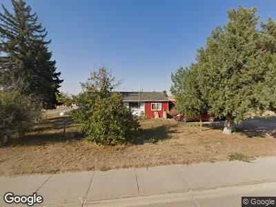
700 State Highway 151 Lagrange, WY 82221
Estimated Value: $211,813 - $289,000
2
Beds
1
Bath
1,082
Sq Ft
$224/Sq Ft
Est. Value
About This Home
This home is located at 700 State Highway 151, Lagrange, WY 82221 and is currently estimated at $242,271, approximately $223 per square foot. 700 State Highway 151 is a home with nearby schools including LaGrange Elementary School and Southeast Junior High School.
Ownership History
Date
Name
Owned For
Owner Type
Purchase Details
Closed on
Jun 6, 2024
Sold by
Bye James L
Bought by
Bye James L and Bye Lynette
Current Estimated Value
Purchase Details
Closed on
Oct 26, 2017
Sold by
Jones Raymond E and Jones Elizabeth P
Bought by
Bye Carolyn
Home Financials for this Owner
Home Financials are based on the most recent Mortgage that was taken out on this home.
Original Mortgage
$48,000
Interest Rate
3.83%
Mortgage Type
Purchase Money Mortgage
Create a Home Valuation Report for This Property
The Home Valuation Report is an in-depth analysis detailing your home's value as well as a comparison with similar homes in the area
Home Values in the Area
Average Home Value in this Area
Purchase History
| Date | Buyer | Sale Price | Title Company |
|---|---|---|---|
| Bye James L | -- | None Listed On Document | |
| Bye Carolyn | -- | First American Title |
Source: Public Records
Mortgage History
| Date | Status | Borrower | Loan Amount |
|---|---|---|---|
| Previous Owner | Bye Carolyn | $48,000 |
Source: Public Records
Tax History Compared to Growth
Tax History
| Year | Tax Paid | Tax Assessment Tax Assessment Total Assessment is a certain percentage of the fair market value that is determined by local assessors to be the total taxable value of land and additions on the property. | Land | Improvement |
|---|---|---|---|---|
| 2024 | $744 | $9,627 | $1,130 | $8,497 |
| 2023 | $720 | $9,320 | $1,130 | $8,190 |
| 2022 | $645 | $8,339 | $1,051 | $7,288 |
| 2021 | $584 | $7,559 | $876 | $6,683 |
| 2020 | $583 | $7,545 | $800 | $6,745 |
| 2019 | $542 | $7,013 | $800 | $6,213 |
| 2018 | $497 | $6,427 | $800 | $5,627 |
| 2017 | $384 | $4,974 | $1,318 | $3,656 |
| 2016 | $390 | $5,040 | $1,470 | $3,570 |
| 2015 | -- | $4,871 | $1,514 | $3,357 |
| 2014 | -- | $5,087 | $1,661 | $3,426 |
Source: Public Records
Map
Nearby Homes
- 124 4th Ave
- 517 3rd Ave
- 310 Road 18
- 0 Cr 38 Unit 20250820
- 5765 Road 46
- 90700 County Road 6
- 4686 Road 37
- 112 9th Ave
- 122 8th Ave
- 213 10th Ave
- 207 E P St
- 0 Wyoming 152
- 0 Fuller Farm Rd 43 Rd
- 5779 County Road 56
- Parcel 1d Hwy 71
- 2779 Road 139
- 4079 Billy the Kid Blvd
- 5661 Road 53
- TR 125 Bronc Busting Blvd
- Tract 139 Billy the Kid Blvd