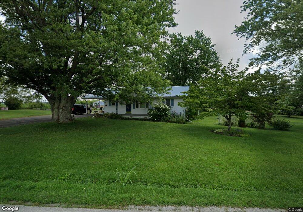
700 Wheat Ridge Rd West Union, OH 45693
Estimated Value: $152,402 - $193,000
3
Beds
1
Bath
1,328
Sq Ft
$132/Sq Ft
Est. Value
About This Home
This home is located at 700 Wheat Ridge Rd, West Union, OH 45693 and is currently estimated at $175,601, approximately $132 per square foot. 700 Wheat Ridge Rd is a home located in Adams County with nearby schools including North Adams Elementary School and North Adams High School.
Ownership History
Date
Name
Owned For
Owner Type
Purchase Details
Closed on
Mar 2, 2021
Sold by
Schrock John and Schrock Marie
Bought by
Miller Marcus and Miller Mary
Current Estimated Value
Home Financials for this Owner
Home Financials are based on the most recent Mortgage that was taken out on this home.
Original Mortgage
$161,185
Outstanding Balance
$144,976
Interest Rate
2.9%
Mortgage Type
Land Contract Argmt. Of Sale
Estimated Equity
$30,625
Purchase Details
Closed on
Dec 22, 2011
Sold by
Milller Allen and Miller Sara Sue
Bought by
Reel John F and Reel Debra L
Home Financials for this Owner
Home Financials are based on the most recent Mortgage that was taken out on this home.
Original Mortgage
$85,000
Interest Rate
3.99%
Mortgage Type
Purchase Money Mortgage
Purchase Details
Closed on
Jun 1, 1978
Bought by
Williams Michael L
Create a Home Valuation Report for This Property
The Home Valuation Report is an in-depth analysis detailing your home's value as well as a comparison with similar homes in the area
Home Values in the Area
Average Home Value in this Area
Purchase History
| Date | Buyer | Sale Price | Title Company |
|---|---|---|---|
| Miller Marcus | $161,185 | None Available | |
| Reel John F | $110,000 | None Available | |
| Williams Michael L | $33,000 | -- |
Source: Public Records
Mortgage History
| Date | Status | Borrower | Loan Amount |
|---|---|---|---|
| Open | Miller Marcus | $161,185 | |
| Closed | Reel John F | $85,000 |
Source: Public Records
Tax History Compared to Growth
Tax History
| Year | Tax Paid | Tax Assessment Tax Assessment Total Assessment is a certain percentage of the fair market value that is determined by local assessors to be the total taxable value of land and additions on the property. | Land | Improvement |
|---|---|---|---|---|
| 2024 | $1,275 | $33,850 | $4,730 | $29,120 |
| 2023 | $1,274 | $33,850 | $4,730 | $29,120 |
| 2022 | $1,274 | $29,480 | $3,470 | $26,010 |
| 2021 | $1,205 | $29,480 | $3,470 | $26,010 |
| 2020 | $1,231 | $29,480 | $3,470 | $26,010 |
| 2019 | $1,172 | $29,480 | $3,470 | $26,010 |
| 2018 | $983 | $25,140 | $3,470 | $21,670 |
| 2017 | $955 | $25,140 | $3,470 | $21,670 |
| 2016 | $954 | $25,140 | $3,470 | $21,670 |
| 2015 | $980 | $26,670 | $3,080 | $23,590 |
| 2014 | $980 | $26,670 | $3,080 | $23,590 |
Source: Public Records
Map
Nearby Homes
- 19004 State Route 41
- 0 Paradise Valley Rd Unit 1852764
- 210 Walt Alsgood Rd
- 363 Crystal Rd
- 668 Fawcett Rd
- 292 Larry Baynum Rd
- 3460 Logans Ln
- 3551 Unity Rd
- 4016 Unity Rd
- 2157 Tater Ridge Rd
- 4603 Wheat Ridge Rd
- 13465 State Route 41
- 1064 Hafer Rd
- 1011 Hafer Rd
- 831 Tom Brown Rd
- 108 Chirsdon Ln
- 0 Lawshe Rd Unit 1854673
- 1286 Steam Furnace Rd
- 0 State Route 41 Unit 1830107
- 125 Robinette Rd
- 620 Wheat Ridge Rd
- 55 Poole Rd
- 960 Wheat Ridge Rd
- 454 Wheat Ridge Rd
- 67 Poole Rd
- 869 Wheat Ridge Rd
- 181 Poole Rd
- 354 Wheat Ridge Rd
- 954 Wheat Ridge Rd
- 930 Wheat Ridge Rd
- 1081 Wheat Ridge Rd
- 283 Wheat Ridge Rd
- 222 Poole Rd
- 282 Poole Rd
- 269 Wheat Ridge Rd
- 1129 Wheat Ridge Rd
- 191 Wheat Ridge Rd
- 1205 Wheat Ridge Rd
- 1118 Wheat Ridge Rd
- 1249 Wheat Ridge Rd