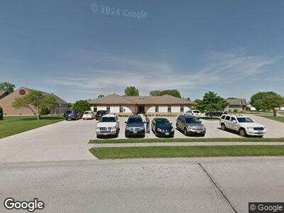
7000 Piper Glen Dr Unit D Springfield, IL 62711
Piper Glen Neighborhood
--
Bed
--
Bath
7,915
Sq Ft
2,004
Sq Ft Lot
About This Home
This home is located at 7000 Piper Glen Dr Unit D, Springfield, IL 62711. 7000 Piper Glen Dr Unit D is a home located in Sangamon County with nearby schools including Glenwood Elementary School, Glenwood Middle School, and Glenwood Intermediate School.
Ownership History
Date
Name
Owned For
Owner Type
Purchase Details
Closed on
Aug 1, 2021
Sold by
Curtis Property Management Llc
Bought by
Wheedo Properties Llc
Home Financials for this Owner
Home Financials are based on the most recent Mortgage that was taken out on this home.
Original Mortgage
$640,000
Outstanding Balance
$557,688
Interest Rate
3.5%
Mortgage Type
Credit Line Revolving
Purchase Details
Closed on
Jul 1, 2008
Purchase Details
Closed on
Jan 4, 2008
Purchase Details
Closed on
Aug 15, 2005
Create a Home Valuation Report for This Property
The Home Valuation Report is an in-depth analysis detailing your home's value as well as a comparison with similar homes in the area
Home Values in the Area
Average Home Value in this Area
Purchase History
| Date | Buyer | Sale Price | Title Company |
|---|---|---|---|
| Wheedo Properties Llc | $683,500 | None Listed On Document | |
| Wheedo Properties Llc | $683,500 | None Listed On Document | |
| -- | $399,200 | -- | |
| -- | -- | -- | |
| -- | $368,500 | -- |
Source: Public Records
Mortgage History
| Date | Status | Borrower | Loan Amount |
|---|---|---|---|
| Open | Wheedo Properties Llc | $640,000 | |
| Closed | Wheedo Properties Llc | $640,000 | |
| Previous Owner | Curtis Property Management Llc | $500,000 |
Source: Public Records
Tax History Compared to Growth
Tax History
| Year | Tax Paid | Tax Assessment Tax Assessment Total Assessment is a certain percentage of the fair market value that is determined by local assessors to be the total taxable value of land and additions on the property. | Land | Improvement |
|---|---|---|---|---|
| 2023 | $5,588 | $72,766 | $12,415 | $60,351 |
| 2022 | $5,396 | $69,025 | $11,777 | $57,248 |
| 2021 | $5,245 | $66,440 | $11,336 | $55,104 |
| 2020 | $5,220 | $66,540 | $11,353 | $55,187 |
| 2019 | $5,133 | $66,308 | $11,313 | $54,995 |
| 2018 | $5,573 | $73,170 | $11,257 | $61,913 |
| 2017 | $5,460 | $72,223 | $11,111 | $61,112 |
| 2016 | $5,369 | $71,170 | $10,949 | $60,221 |
| 2015 | $5,352 | $70,319 | $10,818 | $59,501 |
| 2014 | $5,331 | $69,865 | $10,748 | $59,117 |
| 2013 | $5,288 | $69,865 | $10,748 | $59,117 |
Source: Public Records
Map
Nearby Homes
- 7112 Preston Dr
- 7023 Kingsmill Ct
- 6409 Mcintosh Ct
- 6400 Preston Dr
- 7510 Southport Ln
- 341 Butler Ln
- 501 Garvey Ln
- 799 Titan Ct
- 413 Hodges Ct
- 405 Hodges Ct
- 180 Teal Dr Unit 1
- 2015 Fox Haven
- 305 Plover Dr Unit 1
- 523 Woodland Dr Unit 1
- 735 Evergreen Dr Unit 1
- 1835 Spartan Dr
- 27 Kirkwood St Unit 1
- 514 Eagle Ridge Dr
- 46 Bonniebrook Rd Unit 1
- 1245 Oakbrook Ave