Estimated Value: $635,715 - $765,000
3
Beds
2
Baths
2,126
Sq Ft
$319/Sq Ft
Est. Value
About This Home
This home is located at 7001 Kootenai River Rd, Libby, MT 59923 and is currently estimated at $677,929, approximately $318 per square foot. 7001 Kootenai River Rd is a home located in Lincoln County with nearby schools including Libby Elementary School and Libby High School.
Ownership History
Date
Name
Owned For
Owner Type
Purchase Details
Closed on
May 20, 2024
Sold by
Burt David W and Burt Theresa L
Bought by
Burt Family Trust and Burt
Current Estimated Value
Purchase Details
Closed on
Sep 26, 2005
Sold by
Hambleton David F and Hambleton Teddy L
Bought by
Burt Daivd W and Burt Theresa L
Home Financials for this Owner
Home Financials are based on the most recent Mortgage that was taken out on this home.
Original Mortgage
$210,000
Interest Rate
6.25%
Mortgage Type
Future Advance Clause Open End Mortgage
Create a Home Valuation Report for This Property
The Home Valuation Report is an in-depth analysis detailing your home's value as well as a comparison with similar homes in the area
Home Values in the Area
Average Home Value in this Area
Purchase History
| Date | Buyer | Sale Price | Title Company |
|---|---|---|---|
| Burt Family Trust | -- | None Listed On Document | |
| Burt Daivd W | -- | First American Title Co Of M |
Source: Public Records
Mortgage History
| Date | Status | Borrower | Loan Amount |
|---|---|---|---|
| Previous Owner | Burt Daivd W | $210,000 |
Source: Public Records
Tax History Compared to Growth
Tax History
| Year | Tax Paid | Tax Assessment Tax Assessment Total Assessment is a certain percentage of the fair market value that is determined by local assessors to be the total taxable value of land and additions on the property. | Land | Improvement |
|---|---|---|---|---|
| 2025 | $2,298 | $630,600 | $0 | $0 |
| 2024 | $3,314 | $592,000 | $0 | $0 |
| 2023 | $4,148 | $592,000 | $0 | $0 |
| 2022 | $1,949 | $307,500 | $0 | $0 |
| 2021 | $2,426 | $307,500 | $0 | $0 |
| 2020 | $2,538 | $297,900 | $0 | $0 |
| 2019 | $2,519 | $297,900 | $0 | $0 |
| 2018 | $2,156 | $266,400 | $0 | $0 |
| 2017 | $1,921 | $266,400 | $0 | $0 |
| 2016 | $1,884 | $235,800 | $0 | $0 |
| 2015 | $1,312 | $235,800 | $0 | $0 |
| 2014 | $1,895 | $170,978 | $0 | $0 |
Source: Public Records
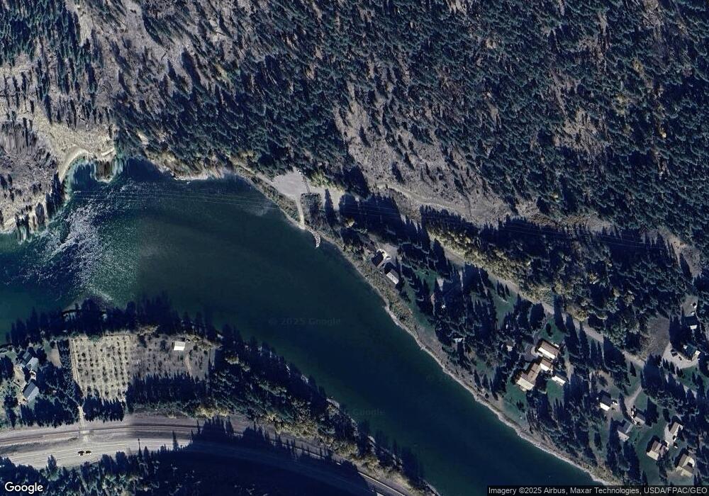
Map
Nearby Homes
- 6727 Kootenai River Rd
- 6065 Kootenai River Rd
- 248 Abby Rd
- 27989 U S 2
- 74 Cedar Creek Rd
- 28140 U S 2
- 525 Cedar Meadow Rd
- 266 Bothman Dr
- TBD Quartz Rd
- 61 Reserve Rd
- 30531 U S Route 2
- 115 Pioneer Rd
- 178 Forest Ave
- 83 Indian Head Rd
- 265 Norman Ave
- 568 Dome Mountain Ave
- 31901 U S 2
- 150 Remps Rd
- Tbd, Lot 3 Parmenter Rd
- Tbd, Lot 2 Parmenter Rd
- 6855 Kootenai River Rd
- 7031 Kootenai River Rd
- 6917 Kootenai River Rd
- 6949 Kootenai River Rd
- 7065 Kootenai River Rd
- 6967 Kootenai River Rd
- 6897 Kootenai River Rd
- 6741 Kootenai River Rd
- 6754 Kootenai River Rd
- 45 Cliffside Dr
- 83 Cliffside Dr
- 6791 Kootenai River Rd
- 35 Cliffside Dr
- 29 Cliffside Dr
- 299 Cliffside Dr
- 6633 Kootenai River Rd
- 26 Cliffside Dr
- 6561 Kootenai River Rd
- 6699 Kootenai River Rd
- 6671 Kootenai River Rd