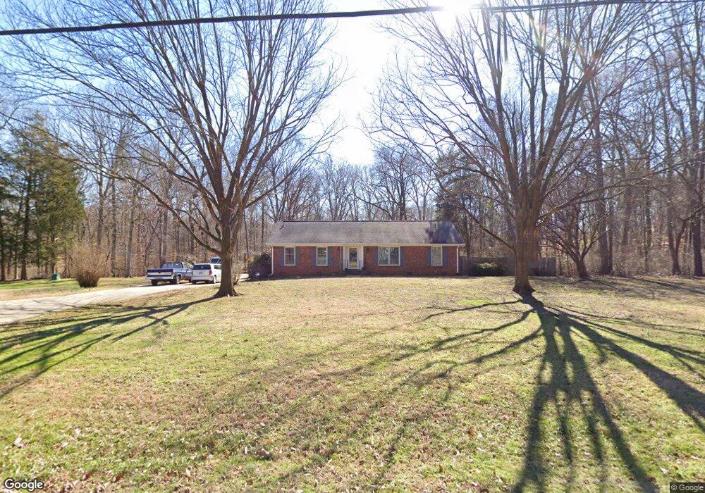
7001 Rock Island Rd Charlotte, NC 28278
Dixie-Berryhill NeighborhoodEstimated Value: $357,000 - $414,000
3
Beds
2
Baths
1,637
Sq Ft
$235/Sq Ft
Est. Value
About This Home
This home is located at 7001 Rock Island Rd, Charlotte, NC 28278 and is currently estimated at $384,520, approximately $234 per square foot. 7001 Rock Island Rd is a home located in Mecklenburg County with nearby schools including Kennedy Middle School, Olympic High School, and Southwest Charlotte STEM Academy.
Ownership History
Date
Name
Owned For
Owner Type
Purchase Details
Closed on
Oct 31, 2024
Sold by
Moore Betty Wyatt
Bought by
Moore Betty Wyatt and Moore William Timothy
Current Estimated Value
Purchase Details
Closed on
Oct 14, 2003
Sold by
Moore Betty W and Moore William Edgar
Bought by
Moore Betty W
Home Financials for this Owner
Home Financials are based on the most recent Mortgage that was taken out on this home.
Original Mortgage
$112,275
Interest Rate
6.45%
Mortgage Type
Purchase Money Mortgage
Purchase Details
Closed on
Feb 24, 2003
Sold by
Moore William Edgar and Moore Betty W
Bought by
Moore William Edgar
Create a Home Valuation Report for This Property
The Home Valuation Report is an in-depth analysis detailing your home's value as well as a comparison with similar homes in the area
Home Values in the Area
Average Home Value in this Area
Purchase History
| Date | Buyer | Sale Price | Title Company |
|---|---|---|---|
| Moore Betty Wyatt | -- | None Listed On Document | |
| Moore Betty W | -- | -- | |
| Moore William Edgar | -- | -- | |
| Moore William Edgar | -- | -- | |
| Moore Betty W | -- | -- |
Source: Public Records
Mortgage History
| Date | Status | Borrower | Loan Amount |
|---|---|---|---|
| Previous Owner | Moore William Edgar | $112,275 |
Source: Public Records
Tax History Compared to Growth
Tax History
| Year | Tax Paid | Tax Assessment Tax Assessment Total Assessment is a certain percentage of the fair market value that is determined by local assessors to be the total taxable value of land and additions on the property. | Land | Improvement |
|---|---|---|---|---|
| 2025 | $2,235 | $274,900 | $76,300 | $198,600 |
| 2024 | $2,235 | $274,900 | $76,300 | $198,600 |
| 2023 | $2,235 | $274,900 | $76,300 | $198,600 |
| 2022 | $1,995 | $193,700 | $66,100 | $127,600 |
| 2021 | $1,984 | $193,700 | $66,100 | $127,600 |
| 2020 | $1,976 | $193,700 | $66,100 | $127,600 |
| 2019 | $1,961 | $193,700 | $66,100 | $127,600 |
| 2018 | $1,960 | $143,800 | $49,200 | $94,600 |
| 2017 | $1,924 | $143,800 | $49,200 | $94,600 |
| 2016 | $1,915 | $143,800 | $49,200 | $94,600 |
| 2015 | $1,903 | $143,800 | $49,200 | $94,600 |
| 2014 | $1,909 | $143,800 | $49,200 | $94,600 |
Source: Public Records
Map
Nearby Homes
- 7010 Rock Island Rd
- 9213 Seamill Rd
- 7101 Signer Rd
- 8924 Oransay Way
- 6618 Latherton Ln
- 11331 Lamoille Ln
- 11203 Chapeclane Rd
- 4935 Spruce Peak Rd
- 11440 Lamoille Ln
- 5828 Eleanor Rigby Rd
- 9013 Gailes Dr
- 7429 Rock Island Rd
- 10817 Bere Island Dr
- 7042 Evanton Loch Rd
- 7332 Lake Front Dr Unit 6
- 9801 Emerald Point Dr Unit 2
- 9809 Emerald Point Dr Unit 11
- 10605 Bere Island Dr
- 7645 Buckland Rd
- 6227 Castlecove Rd
- 10502 Knox Farm Rd
- 7006 Rock Island Rd
- 6920 Rock Island Rd
- 10515 Steele Trace Ct
- 6839 Rock Island Rd
- 10600 Knox Farm Rd
- 10527 Steele Trace Ct
- 7014 Rock Island Rd
- 10533 Steele Trace Ct
- 10541 Knox Farm Rd
- 6900 Rock Island Rd
- 6827 Rock Island Rd
- 7101 Rock Island Rd
- 9135 Seamill Rd
- 9131 Seamill Rd
- 7100 Rock Island Rd
- 10537 Steele Trace Ct
- 10630 Knox Farm Rd
- 9127 Seamill Rd
- 6820 Rock Island Rd