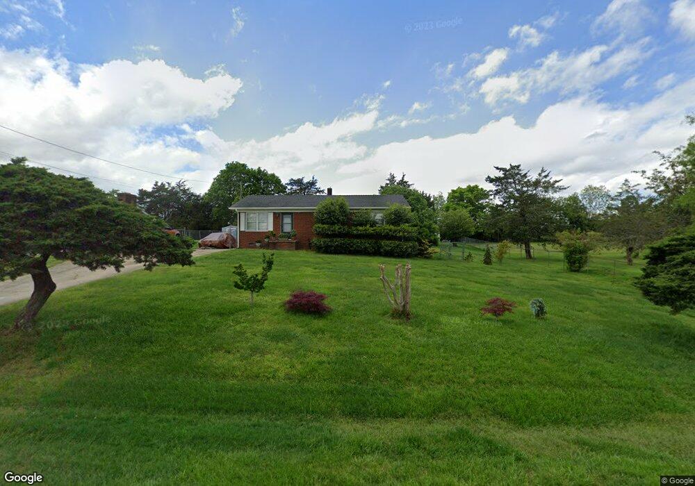
7002 Bluewood Ct High Point, NC 27263
Estimated Value: $159,000 - $276,000
3
Beds
1
Bath
1,134
Sq Ft
$187/Sq Ft
Est. Value
About This Home
This home is located at 7002 Bluewood Ct, High Point, NC 27263 and is currently estimated at $211,731, approximately $186 per square foot. 7002 Bluewood Ct is a home located in Guilford County with nearby schools including Allen Jay Elementary School, Southern Guilford Middle, and Southern Guilford High School.
Ownership History
Date
Name
Owned For
Owner Type
Purchase Details
Closed on
Nov 4, 2003
Sold by
Citifinancial Mortgage Co Inc
Bought by
Diep Thanh and Khai Mary
Current Estimated Value
Home Financials for this Owner
Home Financials are based on the most recent Mortgage that was taken out on this home.
Original Mortgage
$43,000
Interest Rate
5.93%
Mortgage Type
Purchase Money Mortgage
Purchase Details
Closed on
Aug 14, 2003
Sold by
Morris David M and Morris Pamela T
Bought by
Citifinancial Mortgage Co
Create a Home Valuation Report for This Property
The Home Valuation Report is an in-depth analysis detailing your home's value as well as a comparison with similar homes in the area
Home Values in the Area
Average Home Value in this Area
Purchase History
| Date | Buyer | Sale Price | Title Company |
|---|---|---|---|
| Diep Thanh | $60,000 | -- | |
| Citifinancial Mortgage Co | $66,600 | -- |
Source: Public Records
Mortgage History
| Date | Status | Borrower | Loan Amount |
|---|---|---|---|
| Closed | Diep Thanh | $43,000 |
Source: Public Records
Tax History
| Year | Tax Paid | Tax Assessment Tax Assessment Total Assessment is a certain percentage of the fair market value that is determined by local assessors to be the total taxable value of land and additions on the property. | Land | Improvement |
|---|---|---|---|---|
| 2025 | $803 | $91,600 | $18,000 | $73,600 |
| 2024 | $803 | $91,600 | $18,000 | $73,600 |
| 2023 | $803 | $91,600 | $18,000 | $73,600 |
| 2022 | $803 | $91,600 | $18,000 | $73,600 |
| 2021 | $742 | $84,600 | $18,000 | $66,600 |
| 2020 | $742 | $84,600 | $18,000 | $66,600 |
| 2019 | $742 | $84,600 | $0 | $0 |
| 2018 | $0 | $84,600 | $0 | $0 |
| 2017 | $0 | $84,600 | $0 | $0 |
| 2016 | $770 | $88,000 | $0 | $0 |
| 2015 | $774 | $88,000 | $0 | $0 |
| 2014 | $783 | $88,000 | $0 | $0 |
Source: Public Records
Map
Nearby Homes
- 0 Waterbury Dr
- 105 Oak Ridge Dr
- 1650 Kersey Valley Rd
- 1638 Kersey Valley Rd
- 3738 Amber Way
- 6111 Appletree Ct
- 101 Brightleaf Ct
- 4375 Huff Rd
- 510 Aldridge Rd
- 107 Autumn Hill Ct
- 6007 Checker Rd
- 6912 Harlow Dr
- 6318 Gray Farm Rd
- 147 Dove Meadows Dr
- 611 Liberty Rd
- 000 Liberty Rd
- 7002 Cruthis Rd
- 4020 Knollwood Dr
- 108 Sprucewood Ct
- 0 Sprucewood Ct
- 7004 Bluewood Ct
- 1761 Nc Highway 62 W
- 1763 Nc Highway 62 W
- 7006 Bluewood Ct
- 1759 Nc Highway 62 W
- 1765 Nc Highway 62 W
- 7003 Bluewood Ct
- 1801 Weant Rd
- 7005 Bluewood Ct
- 7008 Bluewood Ct
- 7007 Bluewood Ct
- 1768 Nc Highway 62 W
- 7010 Bluewood Ct
- 1770 Nc Highway 62 W
- 7011 Bluewood Ct
- 1749 Nc Highway 62 W
- 1747 Nc Highway 62 W
- 6309 Modlin Grove Rd
- 1820 Weant Rd
- 6305 Modlin Grove Rd
Your Personal Tour Guide
Ask me questions while you tour the home.