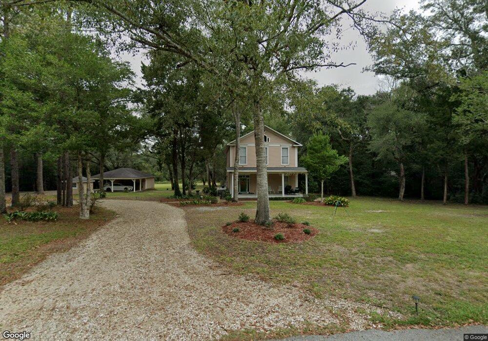
7005 Bentwood Dr Moss Point, MS 39562
Estimated Value: $343,000 - $430,000
Studio
2
Baths
2,448
Sq Ft
$162/Sq Ft
Est. Value
About This Home
This home is located at 7005 Bentwood Dr, Moss Point, MS 39562 and is currently estimated at $396,745, approximately $162 per square foot. 7005 Bentwood Dr is a home located in Jackson County with nearby schools including East Central Lower Elementary School, East Central Upper Elementary School, and East Central Middle School.
Ownership History
Date
Name
Owned For
Owner Type
Purchase Details
Closed on
Mar 2, 2018
Sold by
Vice Samuel E and Vice Susan L
Bought by
Vice Seth and Vice Sarah
Current Estimated Value
Home Financials for this Owner
Home Financials are based on the most recent Mortgage that was taken out on this home.
Original Mortgage
$72,453
Interest Rate
4.22%
Mortgage Type
Purchase Money Mortgage
Purchase Details
Closed on
Sep 8, 2011
Sold by
James David James David
Bought by
Vice Samuel D and Vice Susan L
Home Financials for this Owner
Home Financials are based on the most recent Mortgage that was taken out on this home.
Original Mortgage
$130,278
Interest Rate
6.75%
Mortgage Type
Purchase Money Mortgage
Create a Home Valuation Report for This Property
The Home Valuation Report is an in-depth analysis detailing your home's value as well as a comparison with similar homes in the area
Purchase History
| Date | Buyer | Sale Price | Title Company |
|---|---|---|---|
| Vice Seth | -- | -- | |
| Vice Samuel D | -- | -- |
Source: Public Records
Mortgage History
| Date | Status | Borrower | Loan Amount |
|---|---|---|---|
| Closed | Vice Seth | $72,453 | |
| Previous Owner | Vice Samuel D | $130,278 |
Source: Public Records
Tax History
| Year | Tax Paid | Tax Assessment Tax Assessment Total Assessment is a certain percentage of the fair market value that is determined by local assessors to be the total taxable value of land and additions on the property. | Land | Improvement |
|---|---|---|---|---|
| 2025 | $2,798 | $26,070 | $6,237 | $19,833 |
| 2024 | $2,798 | $24,863 | $6,074 | $18,789 |
| 2023 | $2,684 | $24,863 | $6,074 | $18,789 |
| 2022 | $2,600 | $24,863 | $6,074 | $18,789 |
| 2021 | $2,347 | $22,708 | $6,074 | $16,634 |
| 2020 | $1,918 | $18,362 | $4,664 | $13,698 |
| 2019 | $1,894 | $18,362 | $4,664 | $13,698 |
| 2018 | $3,355 | $27,543 | $6,996 | $20,547 |
| 2017 | $3,425 | $27,651 | $6,996 | $20,655 |
| 2016 | $3,289 | $27,651 | $6,996 | $20,655 |
| 2015 | $3,207 | $178,750 | $46,640 | $132,110 |
| 2014 | $3,236 | $27,542 | $6,996 | $20,546 |
| 2013 | $3,056 | $26,910 | $6,996 | $19,914 |
Source: Public Records
Map
Nearby Homes
- 7201 Bentwood Dr
- 26.1 Acres Brinkman Rd E
- 0 R B Dickerson Rd
- 01 Dap Rd E
- 0 Dap Rd E
- 0 Grafe Homestead Rd Unit 4137349
- 17500 Goff Farm Rd
- 7805 Songbird Ln
- -0- Rayford Shumock Rd
- 17920 Rayford Shumock Rd
- 0 Rayford Shumock Rd Unit 24406728
- 0 Rayford Shumock Rd Unit 4121875
- 8201 Pecan Ridge Dr
- 0 Ms-613 Hwy Unit 4116583
- 0 Ms-613 Hwy Unit 4107607
- 0 Ms-613 Hwy Unit 4107612
- 0 Ms-613 Hwy Unit 4116582
- 21217 E Trails End Rd
- 0 Big Point Unit 4125782
- 0 Mississippi 614
- 7101 Bentwood Dr
- 7004 Bentwood Dr
- 7001 Bentwood Dr
- 7000 Bentwood Dr
- 7105 Bentwood Dr
- 7100 Bentwood Dr
- 7104 Bentwood Dr
- 7200 Bentwood Dr
- 6909 Bentwood Dr
- 7204 Bentwood Dr
- 7301 Bentwood Dr
- 7300 Bentwood Dr
- 17825 Highway 613
- 17821 Highway 613
- 17729 Highway 613
- 17701 Highway 613
- 17713 Highway 613
- 17824 Highway 613
- 17820 Highway 613
- 17732 Highway 613
Your Personal Tour Guide
Ask me questions while you tour the home.