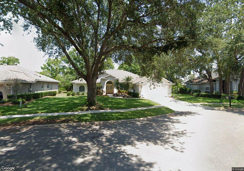
7007 Shadowood Cir Mount Dora, FL 32757
Estimated Value: $527,011 - $602,000
4
Beds
3
Baths
2,754
Sq Ft
$209/Sq Ft
Est. Value
About This Home
This home is located at 7007 Shadowood Cir, Mount Dora, FL 32757 and is currently estimated at $576,253, approximately $209 per square foot. 7007 Shadowood Cir is a home located in Lake County with nearby schools including Triangle Elementary School, Mt. Dora Middle School, and Mt. Dora High School.
Ownership History
Date
Name
Owned For
Owner Type
Purchase Details
Closed on
Apr 28, 1999
Sold by
Crosby Pete J
Bought by
Tummala Rambabu and Tummala Radha
Current Estimated Value
Home Financials for this Owner
Home Financials are based on the most recent Mortgage that was taken out on this home.
Original Mortgage
$234,175
Outstanding Balance
$56,953
Interest Rate
7.06%
Estimated Equity
$519,300
Purchase Details
Closed on
May 17, 1994
Sold by
George Wimpey Fl Inc
Bought by
Crosby Pete J and Crosby Phyllis J
Home Financials for this Owner
Home Financials are based on the most recent Mortgage that was taken out on this home.
Original Mortgage
$168,000
Interest Rate
8.24%
Create a Home Valuation Report for This Property
The Home Valuation Report is an in-depth analysis detailing your home's value as well as a comparison with similar homes in the area
Home Values in the Area
Average Home Value in this Area
Purchase History
| Date | Buyer | Sale Price | Title Company |
|---|---|---|---|
| Tummala Rambabu | $246,500 | -- | |
| Crosby Pete J | $250,000 | -- |
Source: Public Records
Mortgage History
| Date | Status | Borrower | Loan Amount |
|---|---|---|---|
| Open | Tummala Rambabu | $234,175 | |
| Previous Owner | Crosby Pete J | $168,000 |
Source: Public Records
Tax History
| Year | Tax Paid | Tax Assessment Tax Assessment Total Assessment is a certain percentage of the fair market value that is determined by local assessors to be the total taxable value of land and additions on the property. | Land | Improvement |
|---|---|---|---|---|
| 2026 | $5,094 | $318,080 | -- | -- |
| 2025 | $4,806 | $309,420 | -- | -- |
| 2024 | $4,806 | $309,420 | -- | -- |
| 2023 | $4,806 | $291,660 | $0 | $0 |
| 2022 | $4,750 | $283,170 | $0 | $0 |
| 2021 | $4,580 | $274,926 | $0 | $0 |
| 2020 | $4,748 | $271,131 | $0 | $0 |
| 2019 | $4,751 | $265,036 | $0 | $0 |
| 2018 | $4,600 | $260,095 | $0 | $0 |
| 2017 | $4,344 | $254,746 | $0 | $0 |
| 2016 | $4,242 | $249,507 | $0 | $0 |
| 2015 | $4,320 | $247,773 | $0 | $0 |
| 2014 | $4,259 | $245,807 | $0 | $0 |
Source: Public Records
Map
Nearby Homes
- 8055 Laurel Ridge Dr
- 8013 Pine Hollow Dr
- 8032 Pine Hollow Dr
- 7023 Arcadian Ct
- 6025 Spring Creek Ct
- 8000 Saint Andrews Way
- 5061 Greenbriar Trail
- 8023 Saint Andrews Way
- 3944 Kennebunk Loop
- 3016 Andover Ct
- 3963 Kennebunk Loop
- 9008 Heathland Ct
- 3969 Kennebunk Loop
- 3973 Kennebunk Loop
- 3975 Kennebunk Loop
- 3974 Kennebunk Loop
- 8599 Bridgeport Bay Cir
- 9089 Saint Andrews Way
- 9071 Saint Andrews Way
- 8612 Bridgeport Bay Cir
- 7005 Shadowood Cir
- 7009 Shadowood Cir
- 7003 Shadowood Cir
- 7006 Shadowood Cir
- 7010 Shadowood Cir
- 7004 Shadowood Cir
- 7001 Shadowood Cir
- 7008 Shadowood Cir
- 7002 Shadowood Cir
- 8060 Laurel Ridge Dr
- 8064 Laurel Ridge Dr
- 8066 Laurel Ridge Dr
- 8058 Laurel Ridge Dr
- 8059 Laurel Ridge Dr
- 8059 Laurel Ridge Dr
- 8057 Laurel Ridge Dr
- 8068 Laurel Ridge Dr
- 8061 Laurel Ridge Dr
- 7041 Pine Hollow Dr
- 8056 Laurel Ridge Dr
Your Personal Tour Guide
Ask me questions while you tour the home.