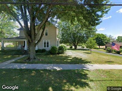
701 Burr Rd Wauseon, OH 43567
Estimated Value: $153,000 - $177,068
2
Beds
2
Baths
1,456
Sq Ft
$112/Sq Ft
Est. Value
About This Home
This home is located at 701 Burr Rd, Wauseon, OH 43567 and is currently estimated at $162,517, approximately $111 per square foot. 701 Burr Rd is a home located in Fulton County with nearby schools including Wauseon Primary School, Wauseon Elementary School, and Wauseon Middle School.
Ownership History
Date
Name
Owned For
Owner Type
Purchase Details
Closed on
Aug 26, 2021
Sold by
Lammon Glen A and Lammon Frances M
Bought by
Kolb Brett J and Glen A Lammon Family Irrevocab
Current Estimated Value
Purchase Details
Closed on
Jun 28, 2019
Sold by
Miller Edna M
Bought by
Lammon Glen A and Lammon Frances M
Home Financials for this Owner
Home Financials are based on the most recent Mortgage that was taken out on this home.
Original Mortgage
$120,000
Interest Rate
4%
Mortgage Type
Purchase Money Mortgage
Purchase Details
Closed on
Jan 1, 1990
Bought by
Boyers Jerry L
Create a Home Valuation Report for This Property
The Home Valuation Report is an in-depth analysis detailing your home's value as well as a comparison with similar homes in the area
Home Values in the Area
Average Home Value in this Area
Purchase History
| Date | Buyer | Sale Price | Title Company |
|---|---|---|---|
| Kolb Brett J | $123,900 | None Available | |
| Lammon Glen A | $127,000 | None Available | |
| Boyers Jerry L | -- | -- |
Source: Public Records
Mortgage History
| Date | Status | Borrower | Loan Amount |
|---|---|---|---|
| Previous Owner | Lammon Glen A | $120,000 |
Source: Public Records
Tax History Compared to Growth
Tax History
| Year | Tax Paid | Tax Assessment Tax Assessment Total Assessment is a certain percentage of the fair market value that is determined by local assessors to be the total taxable value of land and additions on the property. | Land | Improvement |
|---|---|---|---|---|
| 2024 | $1,739 | $44,800 | $420 | $44,380 |
| 2023 | $1,744 | $44,800 | $420 | $44,380 |
| 2022 | $2,593 | $43,370 | $350 | $43,020 |
| 2021 | $2,753 | $43,370 | $350 | $43,020 |
| 2020 | $2,548 | $43,370 | $350 | $43,020 |
| 2019 | $1,719 | $38,120 | $350 | $37,770 |
| 2018 | $1,692 | $38,120 | $350 | $37,770 |
| 2017 | $1,669 | $38,120 | $350 | $37,770 |
| 2016 | $1,835 | $41,200 | $350 | $40,850 |
| 2015 | $1,721 | $41,200 | $350 | $40,850 |
| 2014 | $1,636 | $41,200 | $350 | $40,850 |
| 2013 | $1,810 | $41,860 | $350 | $41,510 |
Source: Public Records
Map
Nearby Homes
- 223 E Leggett St
- 125 Cherry St
- 417 Indian Rd
- 403 W Chestnut St
- 755 N Harvest Ln
- 745 N Harvest Ln
- 259 W Elm St
- 00 Glenwood
- 0 Glenwood Unit 6124946
- 232 N Franklin St
- 238 N Franklin St
- 749 Parkside Dr
- 638 W Elm St
- 511 N Ottokee St
- 640 Hemlock St
- 772 Fairway Ln
- 735 Hemlock St
- 243 Maple St
- 750 E Linfoot St
- 15819 County Road D