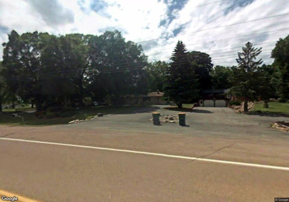
701 County Road 10 SE Watertown, MN 55388
Estimated Value: $293,000 - $320,885
3
Beds
1
Bath
2,288
Sq Ft
$132/Sq Ft
Est. Value
About This Home
This home is located at 701 County Road 10 SE, Watertown, MN 55388 and is currently estimated at $302,471, approximately $132 per square foot. 701 County Road 10 SE is a home located in Carver County with nearby schools including Watertown-Mayer Elementary School, Watertown-Mayer Middle School, and Watertown Mayer High School.
Ownership History
Date
Name
Owned For
Owner Type
Purchase Details
Closed on
Feb 27, 2020
Sold by
Larson Ben
Bought by
Brenden Matthew T
Current Estimated Value
Home Financials for this Owner
Home Financials are based on the most recent Mortgage that was taken out on this home.
Original Mortgage
$215,033
Outstanding Balance
$189,970
Interest Rate
3.37%
Mortgage Type
FHA
Estimated Equity
$112,501
Purchase Details
Closed on
Jun 20, 2001
Sold by
Heldt Lena W
Bought by
Kluetz Michael D
Create a Home Valuation Report for This Property
The Home Valuation Report is an in-depth analysis detailing your home's value as well as a comparison with similar homes in the area
Home Values in the Area
Average Home Value in this Area
Purchase History
| Date | Buyer | Sale Price | Title Company |
|---|---|---|---|
| Brenden Matthew T | $219,000 | Land Title | |
| Kluetz Michael D | $155,000 | -- |
Source: Public Records
Mortgage History
| Date | Status | Borrower | Loan Amount |
|---|---|---|---|
| Open | Brenden Matthew T | $215,033 |
Source: Public Records
Tax History Compared to Growth
Tax History
| Year | Tax Paid | Tax Assessment Tax Assessment Total Assessment is a certain percentage of the fair market value that is determined by local assessors to be the total taxable value of land and additions on the property. | Land | Improvement |
|---|---|---|---|---|
| 2025 | $3,094 | $261,600 | $99,000 | $162,600 |
| 2024 | $3,072 | $265,100 | $99,000 | $166,100 |
| 2023 | $3,022 | $264,300 | $99,000 | $165,300 |
| 2022 | $2,854 | $264,600 | $91,500 | $173,100 |
| 2021 | $2,888 | $209,500 | $76,300 | $133,200 |
| 2020 | $2,800 | $209,500 | $76,300 | $133,200 |
| 2019 | $2,666 | $195,100 | $65,900 | $129,200 |
| 2018 | $2,642 | $195,100 | $65,900 | $129,200 |
| 2017 | $2,378 | $183,500 | $65,900 | $117,600 |
| 2016 | $2,410 | $146,300 | $0 | $0 |
| 2015 | $2,078 | $137,600 | $0 | $0 |
| 2014 | $2,078 | $112,600 | $0 | $0 |
Source: Public Records
Map
Nearby Homes
- 593 Sienna Dr
- 578 Sienna Dr
- 865 Quail Ct
- XXX Newton Ave SE
- 1201 Bishop Cir
- 1221 Bishop Cir
- 1290 Knight Ln
- 12120 County Road 24
- 1316 Balsam Ln
- 115 Riverside Terrace Dr Unit 115
- 613 Hawthorne Ln
- 545 Linden Ct
- 1286 Balsam Ln
- 313 Angel Ave SW
- 653 Hawthorne Ln
- 673 Hawthorne Ln
- 648 Hawthorne Ln
- 570 Linden Ct
- 678 Hawthorne Ln
- The Calhoun Plan at Forest Hills
- 621 County Road 10 SE
- 2810 County Road 10 N
- 617 County Road 10 SE
- 937 Deerfield Rd
- 933 Deerfield Rd
- 941 Deerfield Rd
- 675 Sienna Dr
- 679 Sienna Dr
- 685 Sienna Dr
- 929 Deerfield Rd
- 609 County Road 10 SE
- 693 Sienna Dr
- 844 Southview St SE
- 699 Sienna Dr
- 925 Deerfield Rd
- 724 Nixon Ave SE
- 1005 Trebbiano Ln N
- XXX Trebbiano Ln N
- xxx Trebbiano Ln
- Multiple Trebbiano Ln N