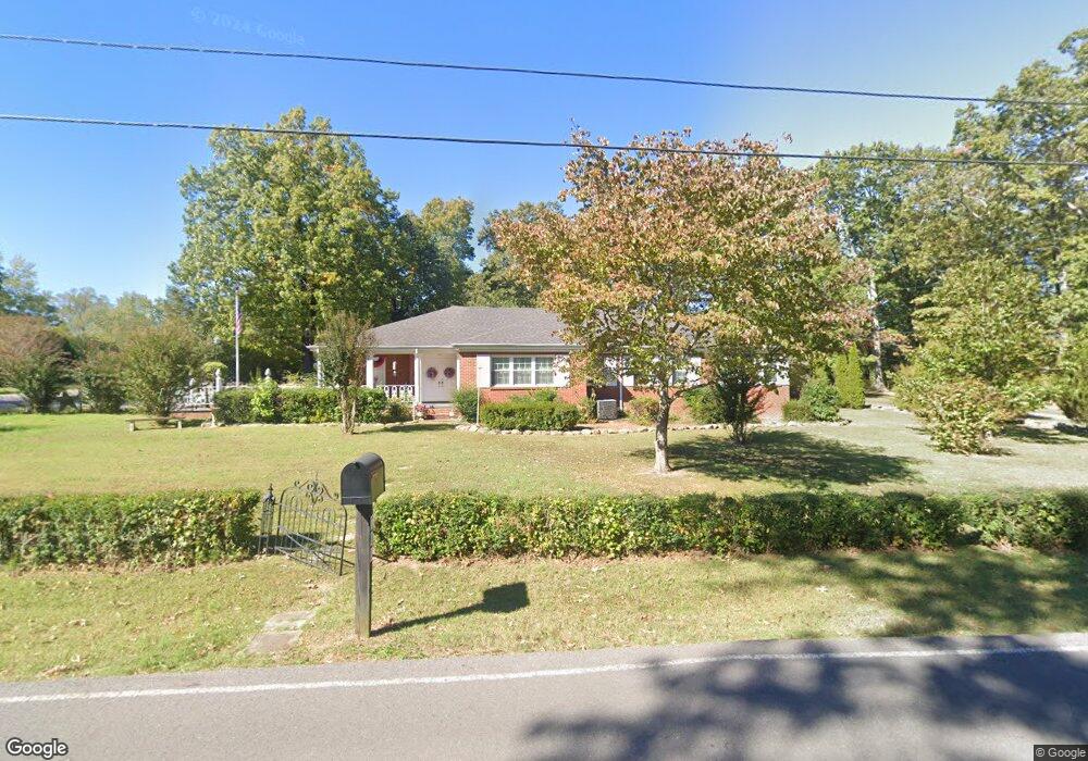
701 Forrest Dr Tullahoma, TN 37388
Estimated Value: $282,311 - $420,000
Studio
3
Baths
2,906
Sq Ft
$125/Sq Ft
Est. Value
About This Home
This home is located at 701 Forrest Dr, Tullahoma, TN 37388 and is currently estimated at $363,828, approximately $125 per square foot. 701 Forrest Dr is a home located in Coffee County with nearby schools including Tullahoma High School, Tullahoma Christian Academy, and Highland Rim Christian Academy.
Ownership History
Date
Name
Owned For
Owner Type
Purchase Details
Closed on
Feb 16, 1988
Current Estimated Value
Purchase Details
Closed on
Jan 1, 1985
Bought by
Alexander Fred and Alexander Jeannie
Create a Home Valuation Report for This Property
The Home Valuation Report is an in-depth analysis detailing your home's value as well as a comparison with similar homes in the area
Purchase History
| Date | Buyer | Sale Price | Title Company |
|---|---|---|---|
| -- | $81,800 | -- | |
| Alexander Fred | $92,000 | -- |
Source: Public Records
Tax History
| Year | Tax Paid | Tax Assessment Tax Assessment Total Assessment is a certain percentage of the fair market value that is determined by local assessors to be the total taxable value of land and additions on the property. | Land | Improvement |
|---|---|---|---|---|
| 2025 | $1,700 | $43,525 | $4,800 | $38,725 |
| 2024 | $1,700 | $43,525 | $4,800 | $38,725 |
| 2023 | $1,700 | $43,525 | $0 | $0 |
| 2022 | $1,745 | $43,525 | $4,800 | $38,725 |
| 2021 | $1,728 | $34,475 | $4,000 | $30,475 |
| 2020 | $1,728 | $34,475 | $4,000 | $30,475 |
| 2019 | $1,728 | $34,475 | $4,000 | $30,475 |
| 2018 | $1,728 | $34,475 | $4,000 | $30,475 |
| 2017 | $1,783 | $32,600 | $4,000 | $28,600 |
| 2016 | $1,784 | $32,600 | $4,000 | $28,600 |
| 2015 | $1,783 | $32,600 | $4,000 | $28,600 |
| 2014 | $1,783 | $32,599 | $0 | $0 |
Source: Public Records
Map
Nearby Homes
- 609 Country Club Dr
- 324 Druid Ln
- 207 E Fort St
- 504 N Washington St
- 102 Essex Ct
- 913 Ovoca Rd
- 409 E Moore St
- 1003 Pickett Dr
- 408 NE Atlantic St
- 406 N College St
- 604 E Moore St
- 601 E Grundy St
- 601 E Grundy St Unit B
- 412 E Grundy St
- 805 E Grizzard St
- 300 Layne St
- 804 E Grundy St
- 808 E Grundy St
- 90 Kings Ln
- 105 Kings Place
- 702 Forrest Dr
- 703 Forrest Dr
- 318 E Fort St
- 313 E Fort St
- 316 E Fort St
- 320 E Fort St
- 124 Bradbury Ct
- 604 N Anderson St
- 122 Bradbury Ct
- 314 E Fort St
- 700 Forrest Dr
- 311 E Fort St
- 602 N Anderson St
- 707 Forrest Dr
- 127 Bradbury Ct
- 120 Bradbury Ct
- 312 E Fort St
- 313 Steagall St
- 600 N Anderson St
- 311 Steagall St
Your Personal Tour Guide
Ask me questions while you tour the home.