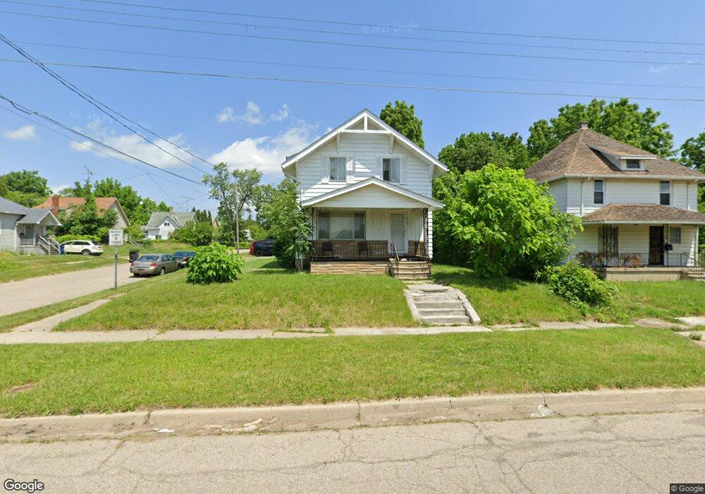
701 Lippincott Blvd Flint, MI 48503
South Parks NeighborhoodEstimated Value: $46,000 - $74,168
4
Beds
2
Baths
1,523
Sq Ft
$37/Sq Ft
Est. Value
About This Home
This home is located at 701 Lippincott Blvd, Flint, MI 48503 and is currently estimated at $55,792, approximately $36 per square foot. 701 Lippincott Blvd is a home located in Genesee County with nearby schools including Freeman Elementary School, Flint Southwestern Classical Academy, and International Academy of Flint (K-12).
Ownership History
Date
Name
Owned For
Owner Type
Purchase Details
Closed on
Dec 14, 2022
Sold by
2 Fish 5 Loaves
Bought by
A Fresh Start 4 Li Llc
Current Estimated Value
Purchase Details
Closed on
Nov 15, 2022
Sold by
Jarrett Janel
Bought by
2 Fish & 5 Loaves
Purchase Details
Closed on
Nov 4, 2022
Sold by
Richards Shaun
Bought by
Jarrett Janel
Purchase Details
Closed on
Mar 17, 2021
Sold by
Jarrett Janel
Bought by
Richards Shaun
Purchase Details
Closed on
Nov 9, 2020
Sold by
Davis Eva E and Jarrett Eva E
Bought by
Richards Shaun and Jarrett Ja Nel
Purchase Details
Closed on
Jan 31, 2011
Sold by
Johnson Ruby L and Joint Trust Agreement Of Amos
Bought by
Johnson Ruby L and Ruby L Johnson Revocable Trust
Create a Home Valuation Report for This Property
The Home Valuation Report is an in-depth analysis detailing your home's value as well as a comparison with similar homes in the area
Home Values in the Area
Average Home Value in this Area
Purchase History
| Date | Buyer | Sale Price | Title Company |
|---|---|---|---|
| A Fresh Start 4 Li Llc | -- | -- | |
| 2 Fish & 5 Loaves | -- | -- | |
| Jarrett Janel | -- | -- | |
| Richards Shaun | -- | None Available | |
| Richards Shaun | $15,000 | None Available | |
| Johnson Ruby L | -- | None Available |
Source: Public Records
Tax History Compared to Growth
Tax History
| Year | Tax Paid | Tax Assessment Tax Assessment Total Assessment is a certain percentage of the fair market value that is determined by local assessors to be the total taxable value of land and additions on the property. | Land | Improvement |
|---|---|---|---|---|
| 2025 | $1,451 | $22,000 | $0 | $0 |
| 2024 | $1,337 | $18,600 | $0 | $0 |
| 2023 | $1,301 | $15,800 | $0 | $0 |
| 2022 | $0 | $13,900 | $0 | $0 |
| 2021 | $1,136 | $12,000 | $0 | $0 |
| 2020 | $870 | $11,700 | $0 | $0 |
| 2019 | $853 | $10,200 | $0 | $0 |
| 2018 | $837 | $9,200 | $0 | $0 |
| 2017 | $816 | $0 | $0 | $0 |
| 2016 | $811 | $0 | $0 | $0 |
| 2015 | -- | $0 | $0 | $0 |
| 2014 | -- | $0 | $0 | $0 |
| 2012 | -- | $11,600 | $0 | $0 |
Source: Public Records
Map
Nearby Homes
- 2050 Ferris Ave
- 2121 Dwight Ave
- 2010 Crocker Ave
- 420 Pingree Ave
- 2224 Crocker Ave
- 2029 Aitken Ave
- 1110 Pingree Ave
- 2221 Howard Ave
- 1628 Broad Ct
- 1601 Wayne St
- 133 E Oakley St
- 2618 Pinetree Dr
- 1917 Whittlesey St
- 930 Belmont Ave
- 1937 Chelan St
- 517 Morley Ave
- 1510 S Franklin Ave
- 213 E Lakeview Ave
- 639 Monroe St
- 647 Monroe St
- 705 Lippincott Blvd
- 2051 Dwight Ave
- 615 Lippincott Blvd
- 2050 Dwight Ave
- 2050 Stanford Ave
- 2043 Dwight Ave
- 2046 Stanford Ave
- 2042 Stanford Ave
- 2042 Dwight Ave
- 2037 Dwight Ave
- 2049 Ferris Ave
- 603 Lippincott Blvd
- 2038 Dwight Ave
- 801 Lippincott Blvd
- 2033 Dwight Ave
- 2041 Ferris Ave
- 714 Lippincott Blvd Unit Bldg-Unit
- 714 Lippincott Blvd
- 2049 Stanford Ave
- 2034 Dwight Ave