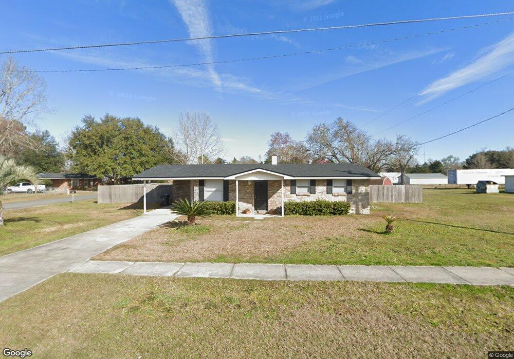
701 Miltondale Rd MacClenny, FL 32063
Estimated Value: $180,273 - $211,000
3
Beds
1
Bath
960
Sq Ft
$208/Sq Ft
Est. Value
About This Home
This home is located at 701 Miltondale Rd, MacClenny, FL 32063 and is currently estimated at $200,068, approximately $208 per square foot. 701 Miltondale Rd is a home located in Baker County with nearby schools including Keller Intermediate School, MacClenny Elementary School, and Baker County Middle School.
Ownership History
Date
Name
Owned For
Owner Type
Purchase Details
Closed on
Oct 28, 2004
Sold by
Sperry Neil Allen and Sperry Yvette
Bought by
Hodges Johnny A
Current Estimated Value
Home Financials for this Owner
Home Financials are based on the most recent Mortgage that was taken out on this home.
Original Mortgage
$69,900
Interest Rate
5.64%
Mortgage Type
Balloon
Create a Home Valuation Report for This Property
The Home Valuation Report is an in-depth analysis detailing your home's value as well as a comparison with similar homes in the area
Home Values in the Area
Average Home Value in this Area
Purchase History
| Date | Buyer | Sale Price | Title Company |
|---|---|---|---|
| Hodges Johnny A | $89,000 | -- |
Source: Public Records
Mortgage History
| Date | Status | Borrower | Loan Amount |
|---|---|---|---|
| Closed | Hodges Johnny A | $69,900 |
Source: Public Records
Tax History Compared to Growth
Tax History
| Year | Tax Paid | Tax Assessment Tax Assessment Total Assessment is a certain percentage of the fair market value that is determined by local assessors to be the total taxable value of land and additions on the property. | Land | Improvement |
|---|---|---|---|---|
| 2024 | $2,081 | $116,631 | -- | -- |
| 2023 | $1,958 | $106,028 | $0 | $0 |
| 2022 | $1,782 | $96,389 | $0 | $0 |
| 2021 | $1,577 | $87,626 | $20,000 | $67,626 |
| 2020 | $1,472 | $80,939 | $0 | $0 |
| 2019 | $1,388 | $75,696 | $17,500 | $58,196 |
| 2018 | $1,334 | $71,951 | $0 | $0 |
| 2017 | $1,308 | $69,849 | $0 | $0 |
| 2016 | $1,291 | $67,641 | $0 | $0 |
| 2015 | $1,255 | $64,415 | $0 | $0 |
| 2014 | $1,227 | $63,245 | $0 | $0 |
Source: Public Records
Map
Nearby Homes
- 639 W Ohio Ave
- 650 Towers Ct
- 748 Constitution Place
- 720 Constitution Place
- 752 Constitution Place
- 768 Constitution Place
- 724 Liberty Cir
- 718 Eagle Dr
- 570 Independence Dr
- 583 Heritage Crossing
- 586 Independence Dr
- 477 Susie Ct
- 801 N Lowder St
- 520 W Railroad Ave
- 113 W Ohio Ave
- 518 Lissie Ct
- 506 Ivy St
- No address Highway 90
- 712 N 7th St
- 6121 Michele Rd
- 365 Barbara Cir
- 386 N Lowder St
- 702 Miltondale Rd
- 375 Barbara Cir
- 0 Cr 23a N Unit 970076
- 716 Miltondale Rd
- 384 N Lowder St
- 406 Barbara Cir
- 426 Barbara Cir
- 718 Miltondale Rd
- 426 Barbara Cc
- 703 Shortputt Dr
- 385 Barbara Cir
- 403 N Lowder St
- 416 N Lowder St
- 412 Barbara Cir
- 705 Shortputt Dr
- 705 Short Putt
- 684 Katie Ct
- 420 N Lowder St