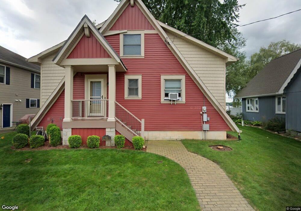
701 N Shore Dr Springport, MI 49284
Estimated Value: $466,000 - $495,262
--
Bed
--
Bath
1,475
Sq Ft
$325/Sq Ft
Est. Value
About This Home
This home is located at 701 N Shore Dr, Springport, MI 49284 and is currently estimated at $479,754, approximately $325 per square foot. 701 N Shore Dr is a home located in Calhoun County with nearby schools including Springport Elementary School, Springport Middle School, and Springport High School.
Ownership History
Date
Name
Owned For
Owner Type
Purchase Details
Closed on
Oct 8, 2003
Sold by
Elesser James and Elesser Karen
Bought by
Goodman Randall and Goodman Regina
Current Estimated Value
Purchase Details
Closed on
May 4, 1998
Sold by
Rochester Carl A
Bought by
Elesser James and Elesser Karen
Create a Home Valuation Report for This Property
The Home Valuation Report is an in-depth analysis detailing your home's value as well as a comparison with similar homes in the area
Home Values in the Area
Average Home Value in this Area
Purchase History
| Date | Buyer | Sale Price | Title Company |
|---|---|---|---|
| Goodman Randall | $295,000 | -- | |
| Elesser James | $139,500 | -- |
Source: Public Records
Tax History Compared to Growth
Tax History
| Year | Tax Paid | Tax Assessment Tax Assessment Total Assessment is a certain percentage of the fair market value that is determined by local assessors to be the total taxable value of land and additions on the property. | Land | Improvement |
|---|---|---|---|---|
| 2025 | $6,019 | $188,300 | $0 | $0 |
| 2024 | $1,287 | $160,900 | $0 | $0 |
| 2023 | $5,326 | $149,500 | $0 | $0 |
| 2022 | $5,326 | $134,400 | $0 | $0 |
| 2021 | $5,097 | $122,700 | $0 | $0 |
| 2020 | $5,097 | $123,100 | $0 | $0 |
| 2019 | $0 | $114,200 | $0 | $0 |
| 2018 | $0 | $105,000 | $50,800 | $54,200 |
| 2017 | $0 | $105,600 | $0 | $0 |
| 2016 | $0 | $102,000 | $0 | $0 |
| 2015 | -- | $98,300 | $1,638 | $96,662 |
| 2014 | -- | $93,000 | $1,638 | $91,362 |
Source: Public Records
Map
Nearby Homes
- 2321 Country Club Way
- 21602 26 Mile Rd
- 23240 26 Mile Rd
- 21133 26 Mile Rd
- 26452 E Baseline Hwy
- 4643 Anderson Rd
- 26838 Q-Drive N
- 19822 27 1 2 Mile Rd
- 29510 S Dr N
- 0 R-Drive N
- 261 Mechanic St
- 16711 Stark Rd
- 16594 Stark Rd
- 21879 V Dr N
- 0 V-Drive N
- 0 Green St
- 403 Green St
- 231 Bay Port Cir Unit 68
- 252 Bay Port Cir Unit 19
- 598 E Main St
- 701 N Shore Dr
- 681 N Shore Dr
- 721 N Shore Dr
- 751 N Shore Dr
- 28 N Shore Dr
- 661 N Shore Dr
- 661 N Shore Dr
- 761 N Shore Dr
- 781 N Shore Dr
- 801 N Shore Dr
- 568 N Shore Dr Unit 3
- 728 N Shore Dr
- 780 N Shore Dr
- 821 N Shore Dr
- 548 N Shore Dr
- 548 N Shore Dr
- 831 N Shore Dr
- 831 N Shore Dr
- 0 N Shore Dr
- 762 N Shore Dr