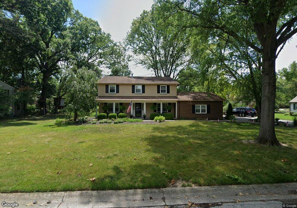
701 Old Farm Rd Lafayette, IN 47909
Estimated Value: $333,000 - $359,610
--
Bed
1
Bath
2,936
Sq Ft
$119/Sq Ft
Est. Value
About This Home
This home is located at 701 Old Farm Rd, Lafayette, IN 47909 and is currently estimated at $349,403, approximately $119 per square foot. 701 Old Farm Rd is a home located in Tippecanoe County with nearby schools including Amelia Earhart Elementary School, Lafayette Tecumseh Junior High School, and Sunnyside Intermediate School.
Ownership History
Date
Name
Owned For
Owner Type
Purchase Details
Closed on
Sep 14, 2006
Sold by
Scott Michael D and Scott Geraldine D
Bought by
Obryan Timothy S and Obryan Elizabeth
Current Estimated Value
Home Financials for this Owner
Home Financials are based on the most recent Mortgage that was taken out on this home.
Original Mortgage
$152,000
Outstanding Balance
$91,431
Interest Rate
6.7%
Mortgage Type
Unknown
Estimated Equity
$257,972
Create a Home Valuation Report for This Property
The Home Valuation Report is an in-depth analysis detailing your home's value as well as a comparison with similar homes in the area
Home Values in the Area
Average Home Value in this Area
Purchase History
| Date | Buyer | Sale Price | Title Company |
|---|---|---|---|
| Obryan Timothy S | -- | None Available |
Source: Public Records
Mortgage History
| Date | Status | Borrower | Loan Amount |
|---|---|---|---|
| Open | Obryan Timothy S | $152,000 |
Source: Public Records
Tax History Compared to Growth
Tax History
| Year | Tax Paid | Tax Assessment Tax Assessment Total Assessment is a certain percentage of the fair market value that is determined by local assessors to be the total taxable value of land and additions on the property. | Land | Improvement |
|---|---|---|---|---|
| 2024 | $3,118 | $311,800 | $59,900 | $251,900 |
| 2023 | $2,910 | $288,200 | $59,900 | $228,300 |
| 2022 | $2,323 | $234,200 | $50,000 | $184,200 |
| 2021 | $2,204 | $217,200 | $50,000 | $167,200 |
| 2020 | $2,176 | $214,400 | $50,000 | $164,400 |
| 2019 | $2,104 | $207,300 | $50,000 | $157,300 |
| 2018 | $2,105 | $207,300 | $50,000 | $157,300 |
| 2017 | $2,082 | $205,800 | $50,000 | $155,800 |
| 2016 | $2,039 | $201,600 | $50,000 | $151,600 |
| 2014 | $2,000 | $197,700 | $50,000 | $147,700 |
| 2013 | $1,911 | $188,800 | $50,000 | $138,800 |
Source: Public Records
Map
Nearby Homes
- 12 Brookhill Ct
- 51 Brookberry Dr
- 936 Brookridge Ct
- 1007 Waterstone Dr
- 3416 Coventry Ln
- 318 Thames Ave
- 3429 Trafalgar Ct
- 1301 Norma Jean Dr
- 3638 Round Rock Ct
- 1120 Stoneripple Cir
- 304 Jersey Ln
- 3303 Crosspoint Ct S
- 904 N Southland Dr
- 1401 Normandy Dr
- 1512 Sherwood Dr
- 3244 Walton St
- 1018 Southport Dr
- 126 Kensal Ct
- 3320 Norwegian Dr
- 3906 John Adams Rd