Estimated Value: $181,000 - $240,701
3
Beds
2
Baths
1,706
Sq Ft
$125/Sq Ft
Est. Value
About This Home
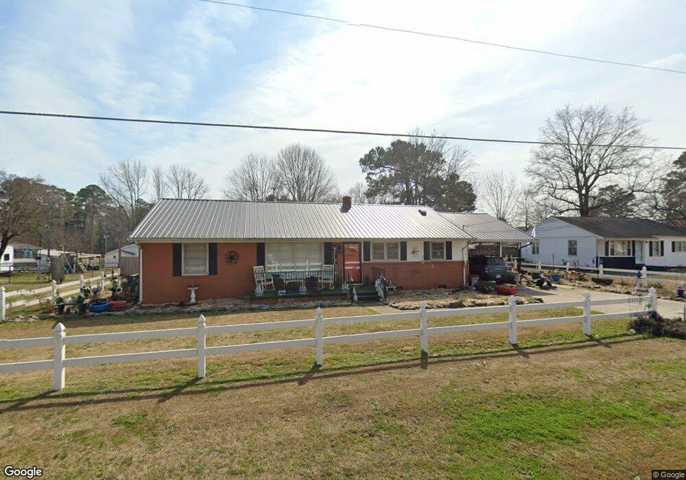
This home is located at 701 Old Post Rd, Erwin, NC 28339 and is currently estimated at $213,925, approximately $125 per square foot. 701 Old Post Rd is a home located in Harnett County with nearby schools including Erwin Elementary School, Coats-Erwin Middle School, and Triton High School.
Ownership History
Date
Name
Owned For
Owner Type
Purchase Details
Closed on
Nov 28, 2023
Sold by
Woodard James Albert and Woodard Nellie Grey
Bought by
Woodard James Albert and Woodard Nellie Grey
Current Estimated Value
Purchase Details
Closed on
Jun 10, 2016
Sold by
Ballard Revonda B
Bought by
Woodard James A and Woodard Nellie S
Home Financials for this Owner
Home Financials are based on the most recent Mortgage that was taken out on this home.
Original Mortgage
$74,000
Interest Rate
3.57%
Create a Home Valuation Report for This Property
The Home Valuation Report is an in-depth analysis detailing your home's value as well as a comparison with similar homes in the area
Home Values in the Area
Average Home Value in this Area
Purchase History
| Date | Buyer | Sale Price | Title Company |
|---|---|---|---|
| Woodard James Albert | -- | None Listed On Document | |
| Woodard Nellie Grey | -- | None Listed On Document | |
| Woodard James A | $89,000 | -- |
Source: Public Records
Mortgage History
| Date | Status | Borrower | Loan Amount |
|---|---|---|---|
| Previous Owner | Woodard James A | $74,000 |
Source: Public Records
Tax History
| Year | Tax Paid | Tax Assessment Tax Assessment Total Assessment is a certain percentage of the fair market value that is determined by local assessors to be the total taxable value of land and additions on the property. | Land | Improvement |
|---|---|---|---|---|
| 2025 | $1,950 | $159,916 | $0 | $0 |
| 2024 | $1,950 | $159,916 | $0 | $0 |
| 2023 | $1,366 | $159,916 | $0 | $0 |
| 2022 | $1,366 | $159,916 | $0 | $0 |
| 2021 | $1,366 | $94,570 | $0 | $0 |
| 2020 | $1,366 | $94,570 | $0 | $0 |
| 2019 | $1,351 | $94,570 | $0 | $0 |
| 2018 | $1,342 | $94,570 | $0 | $0 |
| 2017 | $1,342 | $94,570 | $0 | $0 |
| 2016 | $1,473 | $104,720 | $0 | $0 |
| 2015 | $1,431 | $104,720 | $0 | $0 |
| 2014 | $1,431 | $104,720 | $0 | $0 |
Source: Public Records
Map
Nearby Homes
- 301 S 7th St
- 205 4th St
- 203 4th St
- 207 4th St
- 0 Masonic Rd
- 49 Cypress Hollow Ln Unit 118p
- 40 Birchstone Trail Unit 225p
- 202 N 6th St
- 0 Denim Dr
- 110 1st St
- 207 2nd St
- 0 E Jackson Blvd Unit 10140762
- 660 E Jackson Blvd
- 650 E Jackson Blvd
- 112 Morgan St
- 303 Denim Dr
- 1000 Butler Dr
- 113 Holmes St
- 301 E H St
- 0 E I St Unit 10098436
- 703 Old Post Rd
- 611 Old Post Rd
- 001 Masonic Rd
- 608 Mckay St
- 610 Mckay St
- 606 Mckay St
- 705 Old Post Rd
- 700 Old Post Rd
- 607 Old Post Rd
- 604 Mckay St
- 608 Old Post Rd
- 202 S 6th St
- 602 Mckay St
- 614 Mckay St
- 605 Old Post Rd
- 0 Mckay St Unit 2112088
- 0 Mckay St Unit 1836906
- 0 Mckay St Unit Lot 3 TR2112088
- 0 Mckay St Unit TR2158500
- 0 Mckay St Unit 2355373
Your Personal Tour Guide
Ask me questions while you tour the home.