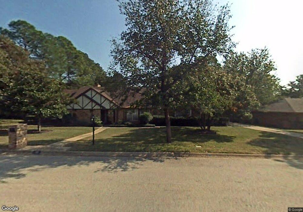
701 Pennsylvania Dr Denton, TX 76205
South Denton NeighborhoodEstimated Value: $521,271 - $588,000
4
Beds
3
Baths
2,693
Sq Ft
$202/Sq Ft
Est. Value
About This Home
This home is located at 701 Pennsylvania Dr, Denton, TX 76205 and is currently estimated at $542,818, approximately $201 per square foot. 701 Pennsylvania Dr is a home located in Denton County with nearby schools including Houston Elementary School, McMath Middle School, and Denton High School.
Ownership History
Date
Name
Owned For
Owner Type
Purchase Details
Closed on
May 15, 2015
Sold by
Perry Ronald L and Perry Carol
Bought by
Biggerstaff Kyle and Biggerstaff Rachel
Current Estimated Value
Home Financials for this Owner
Home Financials are based on the most recent Mortgage that was taken out on this home.
Original Mortgage
$200,000
Outstanding Balance
$74,546
Interest Rate
3.73%
Mortgage Type
New Conventional
Estimated Equity
$468,272
Purchase Details
Closed on
Nov 2, 2012
Sold by
Prather Robert Paul
Bought by
Perry Ronald L and Perry Carol
Home Financials for this Owner
Home Financials are based on the most recent Mortgage that was taken out on this home.
Original Mortgage
$186,000
Interest Rate
3.52%
Mortgage Type
New Conventional
Purchase Details
Closed on
Aug 4, 2010
Sold by
Richey Edward Duke and Richey Sarah
Bought by
Prather Robert Paul
Home Financials for this Owner
Home Financials are based on the most recent Mortgage that was taken out on this home.
Original Mortgage
$213,750
Interest Rate
4.69%
Mortgage Type
Purchase Money Mortgage
Purchase Details
Closed on
Jun 25, 2008
Sold by
Vaughn Donald E and Vaughn Lottie S
Bought by
Richey Edward Duke
Home Financials for this Owner
Home Financials are based on the most recent Mortgage that was taken out on this home.
Original Mortgage
$169,600
Interest Rate
6.05%
Mortgage Type
Purchase Money Mortgage
Purchase Details
Closed on
Jul 2, 1996
Sold by
Teeuwen Keith R
Bought by
Vaughn Donald E and Vaughn Lottie S
Home Financials for this Owner
Home Financials are based on the most recent Mortgage that was taken out on this home.
Original Mortgage
$110,000
Interest Rate
8.02%
Purchase Details
Closed on
Jan 31, 1996
Sold by
Trapani Teresa and Teeuwen Teresa
Bought by
Teeuwen Keith R
Create a Home Valuation Report for This Property
The Home Valuation Report is an in-depth analysis detailing your home's value as well as a comparison with similar homes in the area
Home Values in the Area
Average Home Value in this Area
Purchase History
| Date | Buyer | Sale Price | Title Company |
|---|---|---|---|
| Biggerstaff Kyle | -- | None Available | |
| Perry Ronald L | -- | Title Resources | |
| Prather Robert Paul | -- | Fatco | |
| Richey Edward Duke | -- | Fatco | |
| Vaughn Donald E | -- | -- | |
| Teeuwen Keith R | -- | -- |
Source: Public Records
Mortgage History
| Date | Status | Borrower | Loan Amount |
|---|---|---|---|
| Open | Biggerstaff Kyle | $200,000 | |
| Previous Owner | Perry Ronald L | $186,000 | |
| Previous Owner | Prather Robert Paul | $213,750 | |
| Previous Owner | Richey Edward Duke | $169,600 | |
| Previous Owner | Vaughn Donald E | $110,000 | |
| Closed | Teeuwen Keith R | $0 |
Source: Public Records
Tax History Compared to Growth
Tax History
| Year | Tax Paid | Tax Assessment Tax Assessment Total Assessment is a certain percentage of the fair market value that is determined by local assessors to be the total taxable value of land and additions on the property. | Land | Improvement |
|---|---|---|---|---|
| 2025 | $7,868 | $479,763 | $114,975 | $364,788 |
| 2024 | $9,064 | $469,581 | $114,975 | $354,606 |
| 2023 | $7,166 | $437,979 | $114,975 | $345,155 |
| 2022 | $7,876 | $398,163 | $101,449 | $341,016 |
| 2021 | $8,047 | $361,966 | $67,633 | $294,333 |
| 2020 | $7,744 | $338,777 | $67,633 | $271,144 |
| 2019 | $8,122 | $340,398 | $67,633 | $272,765 |
| 2018 | $7,854 | $325,130 | $67,633 | $257,497 |
| 2017 | $7,459 | $301,761 | $67,633 | $234,351 |
| 2016 | $6,781 | $274,328 | $67,633 | $206,695 |
| 2015 | $5,716 | $252,037 | $67,633 | $184,404 |
| 2014 | $5,716 | $228,455 | $78,243 | $150,212 |
| 2013 | -- | $231,030 | $78,243 | $152,787 |
Source: Public Records
Map
Nearby Homes
- 1000 Lynhurst Ln
- 2226 Savannah Trail
- 924 Ridgecrest Cir
- 829 Skylark Dr
- 916 Smokerise Cir
- 1012 Indian Ridge Dr
- 2216 Jefferson Trail
- 821 Sandpiper Dr
- 824 Sandpiper Dr
- 2012 Hollyhill Ln
- 816 Chapel Dr
- 2253 Hollyhill Ln
- 720 Smokerise Cir
- 2218 Southridge Dr
- 1108 Ellison Park Cir
- 2272 Hollyhill Ln
- 2120 Fairfax Rd
- 209 Pennsylvania Dr
- 2100 Fairfax Rd
- 2009 Lake Fork Ct
- 609 Pennsylvania Dr
- 705 Pennsylvania Dr
- 612 Tennyson Trail
- 608 Tennyson Trail
- 2224 Woodbrook St
- 605 Pennsylvania Dr
- 704 Pennsylvania Dr
- 709 Pennsylvania Dr
- 616 Tennyson Trail
- 708 Pennsylvania Dr
- 604 Tennyson Trail
- 2225 Woodbrook St
- 712 Pennsylvania Dr
- 601 Pennsylvania Dr
- 2220 Woodbrook St
- 609 Tennyson Trail
- 2225 Pembrooke Place
- 600 Tennyson Trail
- 617 Tennyson Trail
- 2221 Pembrooke Place