701 S Branch Dr Unit 8A Whitehouse Station, NJ 08889
Readington NeighborhoodEstimated Value: $579,000 - $680,000
3
Beds
3
Baths
2,127
Sq Ft
$296/Sq Ft
Est. Value
About This Home
This home is located at 701 S Branch Dr Unit 8A, Whitehouse Station, NJ 08889 and is currently estimated at $629,222, approximately $295 per square foot. 701 S Branch Dr Unit 8A is a home located in Hunterdon County with nearby schools including Hunterdon Central Regional High School District and Whitehouse Preparatory School.
Ownership History
Date
Name
Owned For
Owner Type
Purchase Details
Closed on
Dec 20, 2024
Sold by
Colandrea Edward R and Hare Dawn M
Bought by
Hare Dawn M
Current Estimated Value
Home Financials for this Owner
Home Financials are based on the most recent Mortgage that was taken out on this home.
Original Mortgage
$200,000
Outstanding Balance
$199,829
Interest Rate
6.78%
Mortgage Type
New Conventional
Estimated Equity
$420,749
Purchase Details
Closed on
Jan 24, 2018
Sold by
Donohue Eileen N
Bought by
Colandrea Edward R and Hare Dawn M
Purchase Details
Closed on
Jun 30, 1995
Sold by
K Hovnanian At Readington Inc
Bought by
Donohue Robert A and Donohue Eileen N
Create a Home Valuation Report for This Property
The Home Valuation Report is an in-depth analysis detailing your home's value as well as a comparison with similar homes in the area
Home Values in the Area
Average Home Value in this Area
Purchase History
| Date | Buyer | Sale Price | Title Company |
|---|---|---|---|
| Hare Dawn M | -- | Break Water Title | |
| Hare Dawn M | -- | Break Water Title | |
| Colandrea Edward R | $385,000 | Chicago Title Co |
Source: Public Records
Mortgage History
| Date | Status | Borrower | Loan Amount |
|---|---|---|---|
| Open | Hare Dawn M | $200,000 | |
| Closed | Hare Dawn M | $200,000 | |
| Previous Owner | Donohue Robert | $380,545 | |
| Previous Owner | Donohue Robert | $360,000 | |
| Previous Owner | Donohue Robert A | $316,673 | |
| Previous Owner | Donahue Robert A | $15,000 | |
| Previous Owner | Donahue Robert A | $288,000 |
Source: Public Records
Tax History Compared to Growth
Tax History
| Year | Tax Paid | Tax Assessment Tax Assessment Total Assessment is a certain percentage of the fair market value that is determined by local assessors to be the total taxable value of land and additions on the property. | Land | Improvement |
|---|---|---|---|---|
| 2024 | $11,378 | $437,800 | $77,000 | $360,800 |
| 2023 | $11,378 | $437,800 | $77,000 | $360,800 |
| 2022 | $11,085 | $437,800 | $77,000 | $360,800 |
| 2021 | $10,181 | $437,800 | $77,000 | $360,800 |
| 2020 | $10,379 | $341,300 | $166,800 | $174,500 |
| 2019 | $10,181 | $341,300 | $166,800 | $174,500 |
| 2018 | $10,021 | $341,300 | $166,800 | $174,500 |
| 2017 | $9,788 | $341,300 | $166,800 | $174,500 |
| 2016 | $9,556 | $341,300 | $166,800 | $174,500 |
| 2015 | $9,403 | $341,300 | $166,800 | $174,500 |
| 2014 | $9,287 | $341,300 | $166,800 | $174,500 |
Source: Public Records
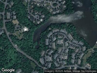
Map
Nearby Homes
- 1006 S Branch Dr Unit 30B
- 4 Millstone Ln
- 9 Magriet Rd
- 266 Main St
- 11 Oldwick Rd
- 18 Daisy Ct
- 474 Us Highway 22 and 3
- 474 U S 22
- 207 Teasel Ct Unit B207
- 474 Rt 22
- 251 Laurel Ct
- 521 County Road 523
- 11 Creek Rd
- 7 Deer Path Rd
- 1326 Berry Farm Rd
- 602 Route 523
- 3 Cedar Rd
- 143 Kosciuszko Rd
- 73 Ditmar Blvd
- 74 Ditmar Blvd
- 701 S Branch Dr Unit 8A
- 703 S Branch Dr Unit 8B
- 705 S Branch Dr
- 707 S Branch Dr Unit 8D
- 511 S Branch Dr Unit 7F
- 709 S Branch Dr Unit 8E
- 509 S Branch Dr Unit 7E
- 507 S Branch Dr Unit 7D
- 1002 S Branch Dr Unit 30D
- 1004 S Branch Dr Unit 3
- 505 S Branch Dr Unit 7C
- 1008 S Branch Dr Unit 30A
- 901 S Branch Dr Unit 9A
- 503 S Branch Dr Unit 7B
- 903 S Branch Dr
- 501 S Branch Dr Unit 7A
- 810 S Branch Dr
- 905 S Branch Dr
- 808 S Branch Dr Unit B
- 907 S Branch Dr Unit 9D