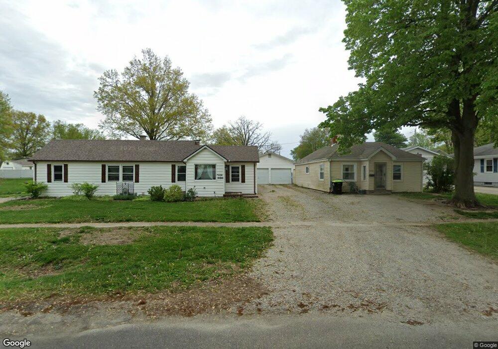
701 S Marion St Mount Pulaski, IL 62548
Estimated Value: $105,000 - $152,000
3
Beds
--
Bath
1,404
Sq Ft
$90/Sq Ft
Est. Value
About This Home
This home is located at 701 S Marion St, Mount Pulaski, IL 62548 and is currently estimated at $126,265, approximately $89 per square foot. 701 S Marion St is a home located in Logan County with nearby schools including Mount Pulaski Elementary School, Mount Pulaski High School, and Zion Lutheran School.
Ownership History
Date
Name
Owned For
Owner Type
Purchase Details
Closed on
Mar 23, 2011
Sold by
Homesales Inc
Bought by
Short Teresa D
Current Estimated Value
Home Financials for this Owner
Home Financials are based on the most recent Mortgage that was taken out on this home.
Original Mortgage
$48,900
Outstanding Balance
$33,804
Interest Rate
4.92%
Mortgage Type
Purchase Money Mortgage
Estimated Equity
$92,461
Purchase Details
Closed on
Aug 9, 2010
Sold by
Sheriff Of Logan County
Bought by
Homesales Inc
Create a Home Valuation Report for This Property
The Home Valuation Report is an in-depth analysis detailing your home's value as well as a comparison with similar homes in the area
Home Values in the Area
Average Home Value in this Area
Purchase History
| Date | Buyer | Sale Price | Title Company |
|---|---|---|---|
| Short Teresa D | $24,565 | -- | |
| Homesales Inc | -- | -- |
Source: Public Records
Mortgage History
| Date | Status | Borrower | Loan Amount |
|---|---|---|---|
| Open | Short Teresa D | $48,900 |
Source: Public Records
Tax History Compared to Growth
Tax History
| Year | Tax Paid | Tax Assessment Tax Assessment Total Assessment is a certain percentage of the fair market value that is determined by local assessors to be the total taxable value of land and additions on the property. | Land | Improvement |
|---|---|---|---|---|
| 2024 | $2,197 | $33,100 | $5,230 | $27,870 |
| 2023 | $2,023 | $30,090 | $4,750 | $25,340 |
| 2022 | $1,874 | $27,860 | $4,400 | $23,460 |
| 2021 | $1,854 | $27,360 | $4,320 | $23,040 |
| 2020 | $1,903 | $27,360 | $4,320 | $23,040 |
| 2019 | $1,926 | $27,360 | $4,320 | $23,040 |
| 2018 | $1,802 | $26,830 | $4,240 | $22,590 |
| 2017 | $1,761 | $26,310 | $4,160 | $22,150 |
| 2016 | $1,716 | $25,800 | $4,080 | $21,720 |
| 2015 | $1,538 | $25,340 | $3,870 | $21,470 |
| 2014 | $1,538 | $25,340 | $3,870 | $21,470 |
| 2013 | $1,538 | $22,870 | $3,490 | $19,380 |
| 2012 | $1,538 | $23,800 | $3,630 | $20,170 |
Source: Public Records
Map
Nearby Homes
- 121 W Wayne St
- 321 S Vine St
- 113 N Mason St
- 207 N Lafayette St
- 508 N Washington St
- 235-171 County Road 2000 E
- 0 1025th St
- 0 Route 12 Hwy
- 2136 950th St
- 100 N Joynt St
- 210 N Kiick St
- 1021 Crosby St
- 1022 Sheldon St
- 1329 1300th St
- 1193 2175th Ave
- 0 Prairie Pointe Dr Unit RMACA1028503
- 0 Prairie Pointe Dr Unit RMACA1027909
- 1601 Home Ave
- 1351 Home Ave
- 1600 Pulaski St
- 703 S Marion St
- 709 S Marion St
- 624 S Illinois Ave
- 706 S Illinois Ave
- 618 S Illinois Ave
- 704 S Marion St
- 708 S Marion St
- 712 S Illinois Ave
- 716 S Marion St
- 121 W German Ave
- 615 S Spring St
- 213 W German Ave
- 203 W German Ave
- 705 S Kentucky St
- 0 S Kentucky St Unit CA20120343
- 0 S Kentucky St Unit CA1005339
- 0 McDonald St
- 606 McDonald St
- 218 W McDonald St
- 705 S Kentucky Ave