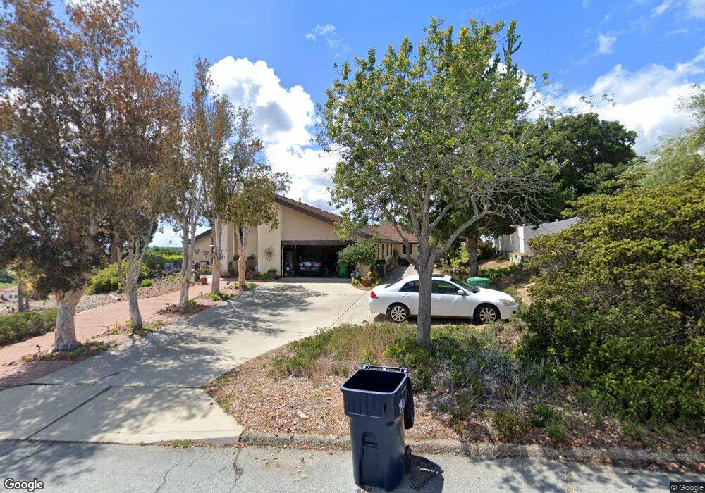
701 Saint Andrews Way Lompoc, CA 93436
Estimated Value: $885,000 - $970,000
4
Beds
3
Baths
2,553
Sq Ft
$364/Sq Ft
Est. Value
About This Home
This home is located at 701 Saint Andrews Way, Lompoc, CA 93436 and is currently estimated at $929,636, approximately $364 per square foot. 701 Saint Andrews Way is a home located in Santa Barbara County with nearby schools including Buena Vista Elementary School and Cabrillo High School.
Ownership History
Date
Name
Owned For
Owner Type
Purchase Details
Closed on
Aug 24, 2016
Sold by
Konrade Jack and Konrade Gail Cooper
Bought by
Konrade Jack and Konrade Gail Cooper
Current Estimated Value
Home Financials for this Owner
Home Financials are based on the most recent Mortgage that was taken out on this home.
Original Mortgage
$171,000
Outstanding Balance
$136,306
Interest Rate
3.45%
Mortgage Type
New Conventional
Estimated Equity
$793,330
Purchase Details
Closed on
Dec 5, 2014
Sold by
Greene Jan L and Dales Beth L
Bought by
Konrade Jack D and Cooper Konrade Gail
Home Financials for this Owner
Home Financials are based on the most recent Mortgage that was taken out on this home.
Original Mortgage
$175,000
Interest Rate
4.25%
Mortgage Type
Adjustable Rate Mortgage/ARM
Purchase Details
Closed on
Feb 24, 1997
Sold by
Graham Mary Ann and M R & M A Graham Revocable Tru
Bought by
Cooper Kenneth W and Cooper Dorothy A
Create a Home Valuation Report for This Property
The Home Valuation Report is an in-depth analysis detailing your home's value as well as a comparison with similar homes in the area
Home Values in the Area
Average Home Value in this Area
Purchase History
| Date | Buyer | Sale Price | Title Company |
|---|---|---|---|
| Konrade Jack | -- | Nations Title Company | |
| Konrade Jack D | $475,000 | First American Title | |
| Cooper Kenneth W | $340,000 | Chicago Title Co |
Source: Public Records
Mortgage History
| Date | Status | Borrower | Loan Amount |
|---|---|---|---|
| Open | Konrade Jack | $171,000 | |
| Closed | Konrade Jack D | $175,000 |
Source: Public Records
Tax History
| Year | Tax Paid | Tax Assessment Tax Assessment Total Assessment is a certain percentage of the fair market value that is determined by local assessors to be the total taxable value of land and additions on the property. | Land | Improvement |
|---|---|---|---|---|
| 2025 | $6,996 | $621,975 | $225,383 | $396,592 |
| 2023 | $6,996 | $597,825 | $216,632 | $381,193 |
| 2022 | $6,882 | $586,104 | $212,385 | $373,719 |
| 2021 | $6,957 | $574,613 | $208,221 | $366,392 |
| 2020 | $6,885 | $568,722 | $206,086 | $362,636 |
| 2019 | $6,779 | $557,572 | $202,046 | $355,526 |
| 2018 | $6,679 | $546,640 | $198,085 | $348,555 |
| 2017 | $6,473 | $535,922 | $194,201 | $341,721 |
| 2016 | $6,089 | $525,415 | $190,394 | $335,021 |
| 2015 | $5,568 | $470,245 | $187,535 | $282,710 |
| 2014 | $5,296 | $451,717 | $159,428 | $292,289 |
Source: Public Records
Map
Nearby Homes
- 4473 Greenbrier Rd
- 649 Burning Tree Way
- 0 Oak Hill Dr Unit 24-783
- 4173 Oakwood Ct
- 240 Oak Hill Dr
- 4166 Oakwood Ct
- 73 Stanford Cir
- 6 Stanford Cir
- 18 Galaxy Way
- 384 Falcon Crest Dr
- 372 Falcon Crest Dr
- 131 Deneb Place
- 113 Gemini Ave
- 4447 Falcon Dr
- 259 Burton Mesa Blvd Unit A
- 3939 Mesa Circle Dr
- 3922 Mesa Circle Dr
- 3825 Saturn Ave Unit 1
- 3770 Rucker Rd
- 3838 Via Mitad
- 705 Saint Andrews Way
- 481 Oak Hill Dr
- 490 Oak Hill Dr
- 699 Saint Andrews Way
- 471 Oak Hill Dr
- 707 Saint Andrews Way
- 688 Saint Andrews Way
- 700 Saint Andrews Way
- 140 La Costa Ln
- 480 Oak Hill Dr
- 142 La Costa Ln
- 706 Saint Andrews Way
- 668 Saint Andrews Way
- 461 Oak Hill Dr
- 689 Saint Andrews Way
- 709 Saint Andrews Way Unit 2
- 136 La Costa Ln
- 470 Oak Hill Dr
- 710 Saint Andrews Way
- 648 Saint Andrews Way
Your Personal Tour Guide
Ask me questions while you tour the home.