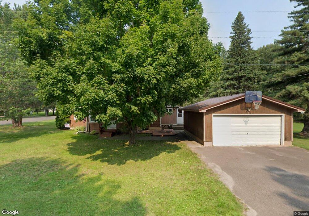
701 Scovia Ave Ontonagon, MI 49953
Estimated Value: $109,006 - $145,000
3
Beds
1
Bath
1,408
Sq Ft
$92/Sq Ft
Est. Value
About This Home
This home is located at 701 Scovia Ave, Ontonagon, MI 49953 and is currently estimated at $129,002, approximately $91 per square foot. 701 Scovia Ave is a home located in Ontonagon County with nearby schools including Ontonagon Area Junior/Senior High School.
Ownership History
Date
Name
Owned For
Owner Type
Purchase Details
Closed on
Sep 18, 2008
Sold by
Yonker Harbison Edna R Sur Paul
Bought by
Yonker Edna R and Bradley Wayne
Current Estimated Value
Purchase Details
Closed on
May 24, 2005
Sold by
Domitrovich Matthew L and Domitrovich Nicholas
Bought by
Harbison Edna R
Purchase Details
Closed on
Jan 11, 2005
Sold by
Blezek Charles E and Blezek Judy I
Bought by
Domitrovich Matthew L and Domitrovich Nicholas F
Purchase Details
Closed on
Jan 6, 2005
Sold by
Department Of Veterans Affairs
Bought by
Blezek Charles E
Purchase Details
Closed on
May 4, 2004
Sold by
Midfirst Bank
Purchase Details
Closed on
Apr 2, 2004
Sold by
Rust Robin Renae
Purchase Details
Closed on
Apr 17, 2002
Sold by
Marley Steven A
Bought by
Rust Robin Renae
Purchase Details
Closed on
Jul 9, 2001
Sold by
Peterson Michelle
Bought by
Marley Steven A and Marley Robin R
Purchase Details
Closed on
Jun 3, 1997
Sold by
Fleming Jaccquline J
Bought by
Peterson Michelle
Create a Home Valuation Report for This Property
The Home Valuation Report is an in-depth analysis detailing your home's value as well as a comparison with similar homes in the area
Home Values in the Area
Average Home Value in this Area
Purchase History
| Date | Buyer | Sale Price | Title Company |
|---|---|---|---|
| Yonker Edna R | -- | -- | |
| Harbison Edna R | $52,000 | -- | |
| Domitrovich Matthew L | $20,000 | -- | |
| Blezek Charles E | $20,000 | -- | |
| -- | -- | -- | |
| -- | $38,800 | -- | |
| Rust Robin Renae | $100 | -- | |
| Marley Steven A | $54,000 | -- | |
| Peterson Michelle | $27,000 | -- |
Source: Public Records
Tax History Compared to Growth
Tax History
| Year | Tax Paid | Tax Assessment Tax Assessment Total Assessment is a certain percentage of the fair market value that is determined by local assessors to be the total taxable value of land and additions on the property. | Land | Improvement |
|---|---|---|---|---|
| 2025 | $1,155 | $51,550 | $0 | $0 |
| 2024 | $456 | $46,000 | $0 | $0 |
| 2023 | $796 | $33,500 | $0 | $0 |
| 2022 | $758 | $29,200 | $0 | $0 |
| 2021 | $1,020 | $25,700 | $0 | $0 |
| 2020 | $906 | $22,900 | $0 | $0 |
| 2019 | $662 | $22,350 | $0 | $0 |
| 2018 | -- | $20,800 | $0 | $0 |
| 2017 | -- | $19,450 | $0 | $0 |
| 2016 | -- | $18,750 | $0 | $0 |
| 2015 | -- | $17,650 | $0 | $0 |
| 2014 | -- | $17,700 | $0 | $0 |
| 2013 | -- | $18,050 | $0 | $0 |
Source: Public Records
Map
Nearby Homes
- 505 Pennsylvania Ave
- 18001 Lakeshore Dr
- 501 Minnesota Ave
- 110 E River St
- 610 S 4th St
- 217 Mulock St
- 806 Rockland Rd
- 18418 Lakeshore Dr
- TBD2 Cedar Balsam Station
- 40378 Superior Ln
- 34770 Calumet Rd
- 32432 U S 45
- TBD Forest Road 690 Camp
- 32954 Kingbird Ln
- TBD102 Firesteel Rd
- TBDC20 Firesteel Rd
- TBD M38
- TBD Lakeshore Dr Unit 57
- TBD Lakeshore Dr Unit 75-79
- TBD 57 Lakeshore Dr Unit 57