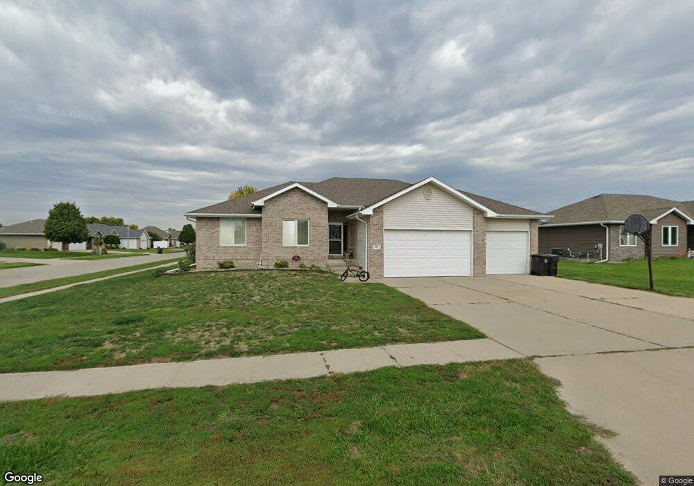
701 Stable Path Sergeant Bluff, IA 51054
Estimated Value: $317,000 - $437,000
3
Beds
4
Baths
1,502
Sq Ft
$263/Sq Ft
Est. Value
About This Home
This home is located at 701 Stable Path, Sergeant Bluff, IA 51054 and is currently estimated at $394,395, approximately $262 per square foot. 701 Stable Path is a home located in Woodbury County with nearby schools including Sergeant Bluff-Luton Primary School, Sergeant Bluff-Luton Elementary School, and Sergeant Bluff-Luton Middle School.
Ownership History
Date
Name
Owned For
Owner Type
Purchase Details
Closed on
Nov 17, 2006
Sold by
Lenz Construction Llc
Bought by
Moreau Jeffrey L and Moreau Julie L
Current Estimated Value
Home Financials for this Owner
Home Financials are based on the most recent Mortgage that was taken out on this home.
Original Mortgage
$175,000
Outstanding Balance
$104,384
Interest Rate
6.36%
Mortgage Type
New Conventional
Estimated Equity
$290,011
Purchase Details
Closed on
Mar 28, 2005
Sold by
Settlers Point Llc
Bought by
Lenz Construction Llc
Home Financials for this Owner
Home Financials are based on the most recent Mortgage that was taken out on this home.
Original Mortgage
$140,000
Interest Rate
5.88%
Mortgage Type
Construction
Create a Home Valuation Report for This Property
The Home Valuation Report is an in-depth analysis detailing your home's value as well as a comparison with similar homes in the area
Home Values in the Area
Average Home Value in this Area
Purchase History
| Date | Buyer | Sale Price | Title Company |
|---|---|---|---|
| Moreau Jeffrey L | $185,000 | -- | |
| Lenz Construction Llc | $31,500 | None Available |
Source: Public Records
Mortgage History
| Date | Status | Borrower | Loan Amount |
|---|---|---|---|
| Open | Moreau Jeffrey L | $175,000 | |
| Previous Owner | Lenz Construction Llc | $140,000 |
Source: Public Records
Tax History
| Year | Tax Paid | Tax Assessment Tax Assessment Total Assessment is a certain percentage of the fair market value that is determined by local assessors to be the total taxable value of land and additions on the property. | Land | Improvement |
|---|---|---|---|---|
| 2025 | $5,206 | $365,010 | $50,000 | $315,010 |
| 2024 | $5,050 | $337,590 | $40,560 | $297,030 |
| 2023 | $5,548 | $337,590 | $40,560 | $297,030 |
| 2022 | $5,500 | $315,720 | $40,560 | $275,160 |
| 2021 | $5,500 | $315,720 | $40,560 | $275,160 |
| 2020 | $4,426 | $249,180 | $43,400 | $205,780 |
| 2019 | $4,312 | $249,180 | $43,400 | $205,780 |
| 2018 | $4,208 | $239,380 | $43,400 | $195,980 |
| 2017 | $4,208 | $239,380 | $43,400 | $195,980 |
| 2016 | $4,650 | $239,380 | $0 | $0 |
| 2015 | $4,104 | $223,720 | $40,560 | $183,160 |
| 2014 | $3,872 | $205,410 | $40,560 | $164,850 |
Source: Public Records
Map
Nearby Homes
- 703 Stable Path
- 415 Wild Plum Way
- 413 Wild Plum Way
- 705 Stable Path
- 502 Wild Plum Way
- 702 Coffie Farm Rd
- 704 Coffie Farm Rd
- 801 Cottonwood Trail
- 411 Wild Plum Way
- 504 Wild Plum Way
- 501 Wild Plum Way
- 707 Stable Path
- 706 Coffie Farm Rd
- 803 Cottonwood Trail
- 409 Wild Plum Way
- 505 Wild Plum Way
- 709 Stable Path
- 802 Cottonwood Trail
- 506 Wild Plum Way
- 708 Coffie Farm Rd
Your Personal Tour Guide
Ask me questions while you tour the home.