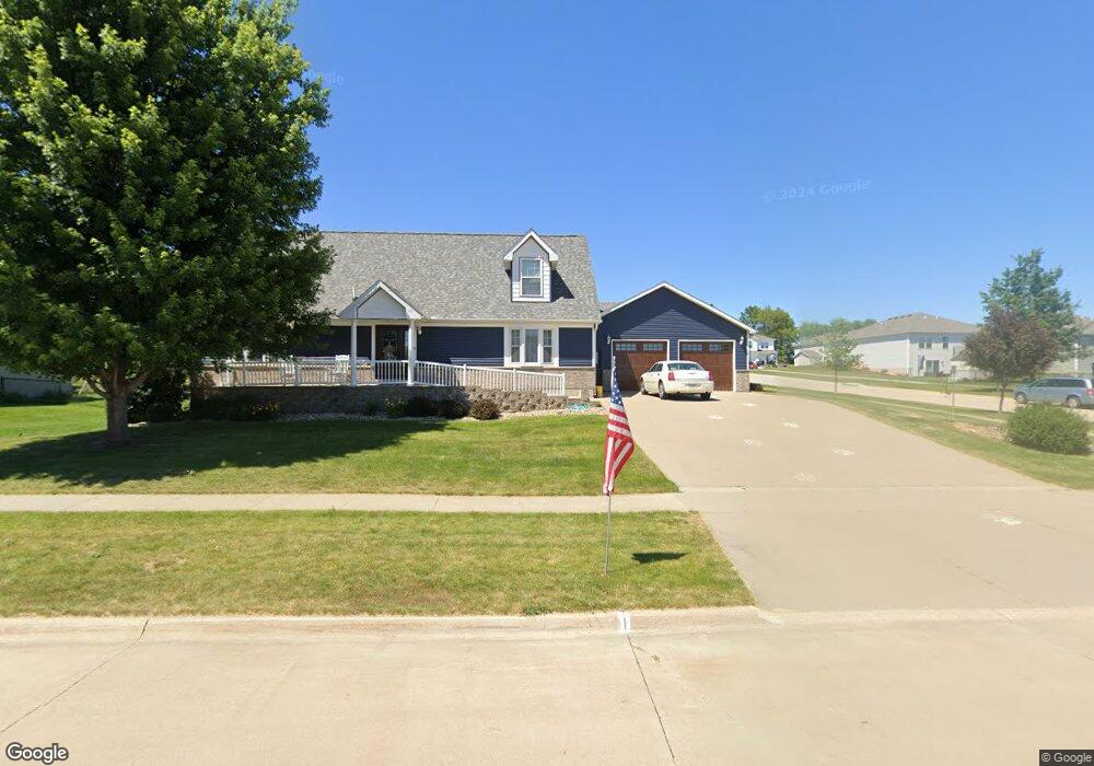
701 Sullivan St West Branch, IA 52358
Estimated Value: $372,000 - $515,000
4
Beds
3
Baths
2,232
Sq Ft
$192/Sq Ft
Est. Value
About This Home
This home is located at 701 Sullivan St, West Branch, IA 52358 and is currently estimated at $427,896, approximately $191 per square foot. 701 Sullivan St is a home with nearby schools including Hoover Elementary School, West Branch Middle School, and West Branch High School.
Ownership History
Date
Name
Owned For
Owner Type
Purchase Details
Closed on
Feb 14, 2006
Sold by
Pv Properties L L C
Bought by
Thein Todd M and Thein Terra M
Current Estimated Value
Create a Home Valuation Report for This Property
The Home Valuation Report is an in-depth analysis detailing your home's value as well as a comparison with similar homes in the area
Home Values in the Area
Average Home Value in this Area
Purchase History
| Date | Buyer | Sale Price | Title Company |
|---|---|---|---|
| Thein Todd M | $35,000 | None Available |
Source: Public Records
Tax History Compared to Growth
Tax History
| Year | Tax Paid | Tax Assessment Tax Assessment Total Assessment is a certain percentage of the fair market value that is determined by local assessors to be the total taxable value of land and additions on the property. | Land | Improvement |
|---|---|---|---|---|
| 2025 | $6,770 | $411,580 | $95,760 | $315,820 |
| 2024 | $6,770 | $398,430 | $95,760 | $302,670 |
| 2023 | $6,440 | $383,620 | $95,760 | $287,860 |
| 2022 | $5,890 | $304,620 | $69,160 | $235,460 |
| 2021 | $5,948 | $304,620 | $69,160 | $235,460 |
| 2020 | $5,764 | $293,980 | $58,520 | $235,460 |
| 2019 | $4,810 | $263,750 | $58,520 | $235,460 |
| 2018 | $4,710 | $263,750 | $0 | $0 |
| 2017 | $4,710 | $244,740 | $0 | $0 |
| 2016 | $4,640 | $244,740 | $0 | $0 |
| 2015 | $4,626 | $243,010 | $0 | $0 |
| 2014 | $4,440 | $243,010 | $0 | $0 |
Source: Public Records
Map
Nearby Homes
- 609 W Orange St
- Lot 17 Meadows Subdivision Part 5
- 611 Riley Ln
- 719 Sullivan St
- 173 Hilltop Dr
- 212 Dawson Dr
- 817 Prairie View Dr
- Lot 17 the Meadows Subdivision Part 5
- 436 Dawson Dr
- Lot 19 Meadows Subdivision Part 6
- Lot 17 Meadows Subdivision Part 6
- Lot 16 Meadows Subdivision Part 6
- Lot 18 Meadows Subdivision Part 6
- Lot 15 Meadows Subdivision Part 6
- Lot 14 Meadows Subdivision Part 6
- Lot 6 Meadows Subdivision Part 6
- Lot 12 Meadows Subdivision Part 6
- Lot 13 Meadows Subdivision Part 6
- Lot 3 Meadows Subdivision Part 6
- Lot 11 Meadows Subdivision Part 6
- 703 Sullivan St
- Lot 39 Sullivan St
- Lot 38 Sullivan St
- Lot 37 Sullivan St
- Lot 36 Sullivan St
- Lot 35 Sullivan St
- Lot 34 Sullivan St
- Lot 24 Sullivan St
- Lot 23 Sullivan St
- Lot 22 Sullivan St
- Lot 21 Sullivan St
- 611 Sullivan St
- 700 Sullivan St
- 700 Prairie View Dr
- 702 Sullivan St
- 705 Sullivan St
- 704 Prairie View Dr
- 721 Sullivan St
- 610 Sullivan St
- 630 Prairie View Dr