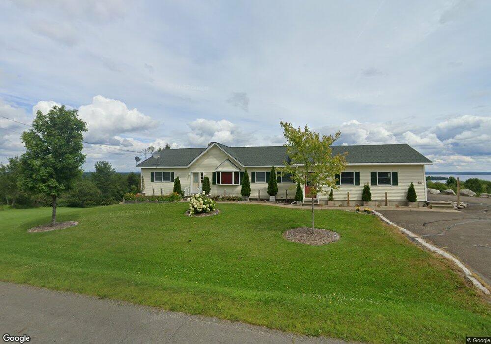
701 Us Route 1 Weston, ME 04424
Estimated Value: $216,000 - $382,000
3
Beds
2
Baths
1,596
Sq Ft
$169/Sq Ft
Est. Value
About This Home
This home is located at 701 Us Route 1, Weston, ME 04424 and is currently estimated at $269,774, approximately $169 per square foot. 701 Us Route 1 is a home located in Aroostook County with nearby schools including East Grand School.
Ownership History
Date
Name
Owned For
Owner Type
Purchase Details
Closed on
Apr 1, 2025
Sold by
Stevens Walter A
Bought by
Walter A Stevens Jr Ret
Current Estimated Value
Purchase Details
Closed on
Nov 8, 2023
Sold by
Stevens Walter A
Bought by
Stevens Nicholai A and Vetter Rachel S
Purchase Details
Closed on
Aug 5, 2014
Sold by
Gardner Johnson G and Gardner Lilly M
Bought by
Stevens Walter A
Purchase Details
Closed on
Sep 8, 2009
Sold by
Plourde Gregory S and Plourde Rebecca A
Bought by
Johnson Gary Alan and Gardner Lilly M
Home Financials for this Owner
Home Financials are based on the most recent Mortgage that was taken out on this home.
Original Mortgage
$133,110
Interest Rate
5.21%
Mortgage Type
FHA
Create a Home Valuation Report for This Property
The Home Valuation Report is an in-depth analysis detailing your home's value as well as a comparison with similar homes in the area
Home Values in the Area
Average Home Value in this Area
Purchase History
| Date | Buyer | Sale Price | Title Company |
|---|---|---|---|
| Walter A Stevens Jr Ret | -- | None Available | |
| Walter A Stevens Jr Ret | -- | None Available | |
| Walter A Stevens Jr Ret | -- | None Available | |
| Stevens Nicholai A | -- | None Available | |
| Stevens Nicholai A | -- | None Available | |
| Stevens Walter A | -- | -- | |
| Stevens Walter A | -- | -- | |
| Johnson Gary Alan | -- | -- | |
| Johnson Gary Alan | -- | -- |
Source: Public Records
Mortgage History
| Date | Status | Borrower | Loan Amount |
|---|---|---|---|
| Previous Owner | Johnson Gary Alan | $133,110 |
Source: Public Records
Tax History Compared to Growth
Tax History
| Year | Tax Paid | Tax Assessment Tax Assessment Total Assessment is a certain percentage of the fair market value that is determined by local assessors to be the total taxable value of land and additions on the property. | Land | Improvement |
|---|---|---|---|---|
| 2024 | $2,336 | $133,500 | $20,500 | $113,000 |
| 2023 | $1,969 | $112,500 | $17,100 | $95,400 |
| 2022 | $2,005 | $102,300 | $15,600 | $86,700 |
| 2021 | $1,975 | $103,400 | $15,600 | $87,800 |
| 2020 | $1,933 | $104,500 | $15,600 | $88,900 |
| 2019 | $1,912 | $104,500 | $15,600 | $88,900 |
| 2018 | $1,873 | $105,500 | $15,600 | $89,900 |
| 2017 | $1,866 | $106,600 | $15,600 | $91,000 |
| 2016 | $1,839 | $106,600 | $15,600 | $91,000 |
| 2015 | $1,885 | $107,100 | $15,000 | $92,100 |
| 2014 | $1,580 | $108,200 | $15,000 | $93,200 |
| 2013 | $1,697 | $94,300 | $12,500 | $81,800 |
Source: Public Records
Map
Nearby Homes
- 32 S Nagle Ln
- 1058 U S 1
- 341 US Route 1
- 18 Bass Ln
- 479 Harris Hill Rd
- 69 Deering Lake Rd
- Lot 1 Woodland Ridge Rd
- 0 Woodland Ridge Rd Unit 35 24449234
- Lot 2 Woodland Ridge Rd
- 38 Bancroft Rd
- 358 Springfield Rd
- M26L11.2 Boulder Rd
- 52 Irish Settlement Rd
- Lot 3 Woodland Ridge Rd
- Lot 5 Woodland Ridge Rd
- Lot 35 Woodland Ridge Rd
- Lot 4 Woodland Ridge Rd
- Lot 6 Woodland Ridge Rd
- 178 Irish Settlement Rd
- 39 Pratt Ln
- 701 Us Route 1
- 701 Us Route 1
- 761 Us Route 1
- 768 Us Route 1
- Lot 10 Us Route One Rd
- 701 U S 1
- 693 Us Route 1
- 821 Us Route 1
- 680 Us Route 1
- 690 Us Route 1
- Lot 1A Us Rt 1 Hwy
- Map1Lot29 Us Route 1 Route
- 850 U S Route 1
- 850 Us Route 1
- 626 Us Route 1
- 669 Us Route 1
- 864 Us Route 1
- 860 Us Route 1
- 863 Us Route 1
- 837 Us Route 1