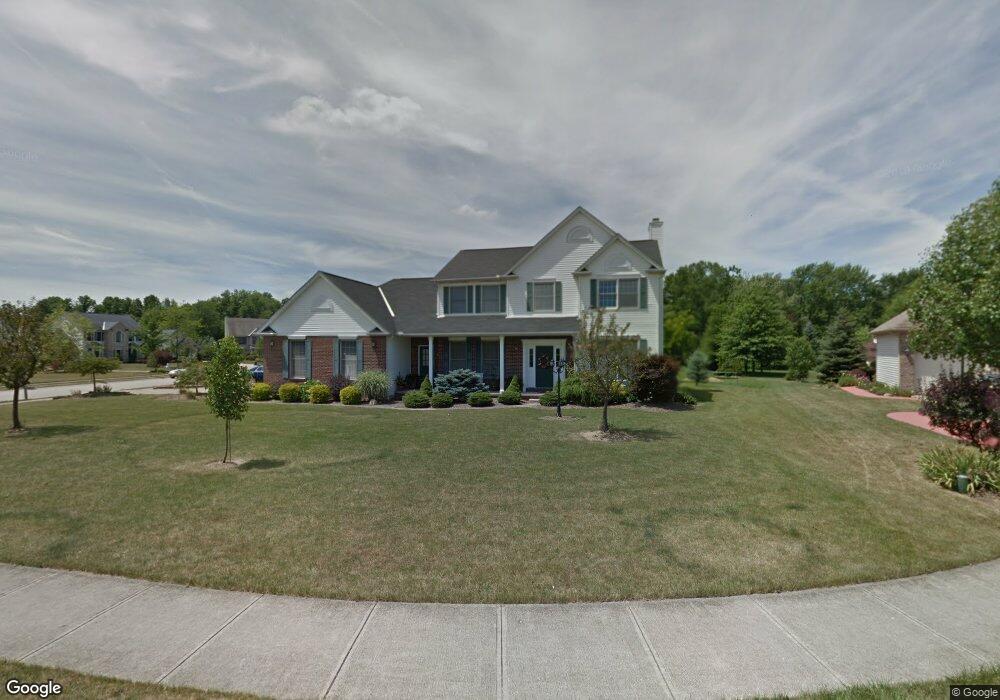
7012 Shadetree Ct Olmsted Falls, OH 44138
Estimated Value: $409,000 - $514,000
5
Beds
4
Baths
3,006
Sq Ft
$151/Sq Ft
Est. Value
About This Home
This home is located at 7012 Shadetree Ct, Olmsted Falls, OH 44138 and is currently estimated at $453,458, approximately $150 per square foot. 7012 Shadetree Ct is a home located in Cuyahoga County with nearby schools including Olmsted Falls Intermediate Building, Falls-Lenox Primary Elementary School, and Olmsted Falls Middle School.
Ownership History
Date
Name
Owned For
Owner Type
Purchase Details
Closed on
Mar 31, 1999
Sold by
Shore West Construction Company
Bought by
Miller Alan E and Miller Jill H
Current Estimated Value
Home Financials for this Owner
Home Financials are based on the most recent Mortgage that was taken out on this home.
Original Mortgage
$176,000
Interest Rate
7.43%
Create a Home Valuation Report for This Property
The Home Valuation Report is an in-depth analysis detailing your home's value as well as a comparison with similar homes in the area
Home Values in the Area
Average Home Value in this Area
Purchase History
| Date | Buyer | Sale Price | Title Company |
|---|---|---|---|
| Miller Alan E | $288,500 | Cleveland Title |
Source: Public Records
Mortgage History
| Date | Status | Borrower | Loan Amount |
|---|---|---|---|
| Previous Owner | Miller Alan E | $176,000 |
Source: Public Records
Tax History Compared to Growth
Tax History
| Year | Tax Paid | Tax Assessment Tax Assessment Total Assessment is a certain percentage of the fair market value that is determined by local assessors to be the total taxable value of land and additions on the property. | Land | Improvement |
|---|---|---|---|---|
| 2024 | $9,870 | $133,000 | $30,625 | $102,375 |
| 2023 | $10,493 | $115,990 | $25,760 | $90,230 |
| 2022 | $10,424 | $115,990 | $25,760 | $90,230 |
| 2021 | $10,331 | $115,990 | $25,760 | $90,230 |
| 2020 | $10,209 | $101,750 | $22,610 | $79,140 |
| 2019 | $9,242 | $290,700 | $64,600 | $226,100 |
| 2018 | $8,829 | $101,750 | $22,610 | $79,140 |
| 2017 | $9,417 | $100,700 | $21,950 | $78,750 |
| 2016 | $9,376 | $100,700 | $21,950 | $78,750 |
| 2015 | $13,828 | $100,700 | $21,950 | $78,750 |
| 2014 | $13,828 | $97,760 | $21,320 | $76,440 |
Source: Public Records
Map
Nearby Homes
- 7411 Stearns Rd
- 7097 Stearns Rd
- 7087 Mackenzie Rd
- 27097 Oakwood Cir Unit 208Z
- 6926 Mackenzie Rd
- 27202 Cook Rd Unit 95
- 27202 Cook Rd Unit 127
- 6979 Warrington Dr
- 29651 Westminster Dr
- 7224 Pine Woods Way
- 6752 Cypress Dr
- 29880 Westminster Dr
- 28130 Angela Dr
- 29695 Bretton Ridge Dr
- 27259 Cook Rd
- 6706 Crestwood Ln
- 6560 Mackenzie Rd
- 6556 Louann Dr
- 6427 Mackenzie Rd
- 30251 Ginger Ln Unit 53A
- 7008 Shadetree Ct
- 27086 Sanctuary Ln
- 27079 Sanctuary Ln
- 27083 Sanctuary Ln
- 7004 Shadetree Ct
- 7011 Shadetree Ct
- 27090 Sanctuary Ln
- 27075 Sanctuary Ln
- 27087 Sanctuary Ln
- 27083 Cook Rd
- 7007 Shadetree Ct
- 7000 Shadetree Ct
- 27095 Sanctuary Ln
- 7003 Shadetree Ct
- 27087 Cook Rd
- 27071 Sanctuary Ln
- 27091 Sanctuary Ln
- 27092 Dogwood Ln
- 27096 Dogwood Ln
- 27070 Sanctuary Ln