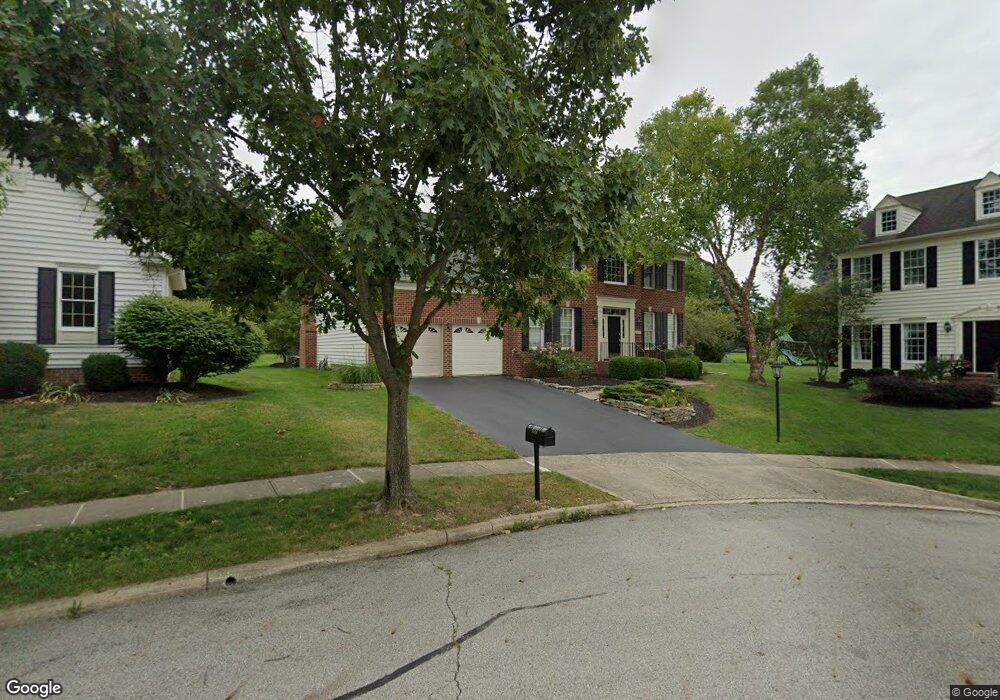
7018 Gray Loop New Albany, OH 43054
Estimated Value: $699,329 - $784,000
4
Beds
3
Baths
3,229
Sq Ft
$228/Sq Ft
Est. Value
About This Home
This home is located at 7018 Gray Loop, New Albany, OH 43054 and is currently estimated at $735,582, approximately $227 per square foot. 7018 Gray Loop is a home located in Franklin County with nearby schools including New Albany Primary School, New Albany Intermediate School, and New Albany Middle School.
Ownership History
Date
Name
Owned For
Owner Type
Purchase Details
Closed on
Aug 29, 2000
Sold by
Toll Land Xxvi Lp
Bought by
Karolin Andres V and Karolin Debra L
Current Estimated Value
Home Financials for this Owner
Home Financials are based on the most recent Mortgage that was taken out on this home.
Original Mortgage
$252,700
Outstanding Balance
$93,144
Interest Rate
8.26%
Estimated Equity
$642,438
Create a Home Valuation Report for This Property
The Home Valuation Report is an in-depth analysis detailing your home's value as well as a comparison with similar homes in the area
Home Values in the Area
Average Home Value in this Area
Purchase History
| Date | Buyer | Sale Price | Title Company |
|---|---|---|---|
| Karolin Andres V | $342,300 | -- |
Source: Public Records
Mortgage History
| Date | Status | Borrower | Loan Amount |
|---|---|---|---|
| Open | Karolin Andres V | $252,700 |
Source: Public Records
Tax History Compared to Growth
Tax History
| Year | Tax Paid | Tax Assessment Tax Assessment Total Assessment is a certain percentage of the fair market value that is determined by local assessors to be the total taxable value of land and additions on the property. | Land | Improvement |
|---|---|---|---|---|
| 2024 | $12,323 | $198,070 | $40,250 | $157,820 |
| 2023 | $11,675 | $198,065 | $40,250 | $157,815 |
| 2022 | $12,140 | $156,880 | $36,230 | $120,650 |
| 2021 | $11,684 | $156,880 | $36,230 | $120,650 |
| 2020 | $11,626 | $156,880 | $36,230 | $120,650 |
| 2019 | $11,073 | $136,120 | $31,500 | $104,620 |
| 2018 | $10,852 | $136,120 | $31,500 | $104,620 |
| 2017 | $11,072 | $136,120 | $31,500 | $104,620 |
| 2016 | $10,742 | $121,700 | $32,590 | $89,110 |
| 2015 | $10,762 | $121,700 | $32,590 | $89,110 |
| 2014 | $10,090 | $121,700 | $32,590 | $89,110 |
| 2013 | $5,194 | $115,920 | $31,045 | $84,875 |
Source: Public Records
Map
Nearby Homes
- 7061 Maynard Place
- 7075 Maynard Place
- 5685 Jersey Dr
- 5692 Sugarwood Dr
- 6925 Joysmith Cir
- 6500 Cedar Glen Ct
- 7485 Central College Rd
- 6935 Kindler Dr
- 6834 Cedar Brook Glen
- 7185 Dean Farm Rd
- 6869 Cedar Brook Place
- 5510 Steele Ct
- 7125 Longfield Ct
- 6947 Hollyhock Dr
- 6964 Aster Dr
- 10087 Johnstown Rd
- 7013 Cunningham Dr
- 7033 Cunningham Dr
- 8951 Grate Park Square
- 7301 Wood Edge Ln
- 7016 Gray Loop
- 7022 Gray Loop
- 7014 Gray Loop
- 7024 Gray Loop
- 7166 Central College Rd
- 7166 Central College Rd
- 7120 Central College Rd
- 7010 Dean Farm Rd
- 7026 Gray Loop
- 7215 Bevelhymer Rd
- 7215 Bevelhymer Rd
- 6922 Harlan Square
- 7019 Dean Farm Rd
- 7021 Dean Farm Rd
- 7023 Dean Farm Rd
- 6913 Harlan Square
- 7025 Dean Farm Rd
- 7206 Central College Rd
- 6920 Harlan Square
- 6910 Harlan Square