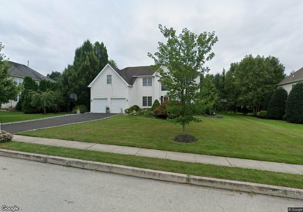
7019 Redcoat Dr Flourtown, PA 19031
Estimated Value: $892,000 - $932,000
5
Beds
4
Baths
2,898
Sq Ft
$313/Sq Ft
Est. Value
About This Home
This home is located at 7019 Redcoat Dr, Flourtown, PA 19031 and is currently estimated at $908,312, approximately $313 per square foot. 7019 Redcoat Dr is a home located in Montgomery County with nearby schools including Whitemarsh El School, Colonial Elementary School, and Colonial Middle School.
Ownership History
Date
Name
Owned For
Owner Type
Purchase Details
Closed on
Jul 17, 2007
Sold by
Malik Marilyn L
Bought by
Piroso Grace and Piroso Giuseppe
Current Estimated Value
Home Financials for this Owner
Home Financials are based on the most recent Mortgage that was taken out on this home.
Original Mortgage
$119,000
Outstanding Balance
$75,268
Interest Rate
6.73%
Estimated Equity
$833,044
Purchase Details
Closed on
Jun 5, 1998
Sold by
Westrum Whitemarsh Ltd Partnership
Bought by
Malik Marilyn L
Create a Home Valuation Report for This Property
The Home Valuation Report is an in-depth analysis detailing your home's value as well as a comparison with similar homes in the area
Home Values in the Area
Average Home Value in this Area
Purchase History
| Date | Buyer | Sale Price | Title Company |
|---|---|---|---|
| Piroso Grace | $599,900 | None Available | |
| Malik Marilyn L | $323,610 | -- |
Source: Public Records
Mortgage History
| Date | Status | Borrower | Loan Amount |
|---|---|---|---|
| Open | Piroso Grace | $119,000 | |
| Open | Piroso Grace | $359,940 |
Source: Public Records
Tax History Compared to Growth
Tax History
| Year | Tax Paid | Tax Assessment Tax Assessment Total Assessment is a certain percentage of the fair market value that is determined by local assessors to be the total taxable value of land and additions on the property. | Land | Improvement |
|---|---|---|---|---|
| 2025 | $10,050 | $308,670 | $85,010 | $223,660 |
| 2024 | $10,050 | $308,670 | $85,010 | $223,660 |
| 2023 | $9,687 | $308,670 | $85,010 | $223,660 |
| 2022 | $9,467 | $308,670 | $85,010 | $223,660 |
| 2021 | $9,183 | $308,670 | $85,010 | $223,660 |
| 2020 | $8,846 | $308,670 | $85,010 | $223,660 |
| 2019 | $8,582 | $308,670 | $85,010 | $223,660 |
| 2018 | $2,109 | $308,670 | $85,010 | $223,660 |
| 2017 | $8,288 | $308,670 | $85,010 | $223,660 |
| 2016 | $8,168 | $308,670 | $85,010 | $223,660 |
| 2015 | $7,809 | $308,670 | $85,010 | $223,660 |
| 2014 | $7,809 | $308,670 | $85,010 | $223,660 |
Source: Public Records
Map
Nearby Homes
- 6313 Sunnybrook Rd
- 2106 Carolton Way
- 522 Pennsylvania Ave
- 9 Comly Ct
- 238 Plymouth Ave
- 28 Grove Ave
- 500 E Mill Rd
- 7238 Hollywood Rd
- Redford Plan at The Towns at Pennybrook
- 407 Pennybrook Ct Unit 4 REDFORD END
- 405 Pennybrook Ct Unit 3 REDFORD INTERIOR
- 001 Pennybrook Ct Unit REDFORD INTERIOR
- 401 Pennybrook Ct Unit 1 REDFORD END
- 403 Pennybrook Ct Unit 2 REDFORD INTERIOR
- 406 Pennybrook Ct Unit 14 REDFORD INTERIOR
- 404 Pennybrook Ct Unit 15 REDFORD INTERIOR
- 21 Jones Ave
- 32 Jones Ave
- 1005 Harston Ln
- 21 Franklin Ave
- 7021 Redcoat Dr
- 7017 Redcoat Dr
- 7033 Redcoat Dr
- 7031 Redcoat Dr
- 7022 Redcoat Dr
- 7023 Redcoat Dr
- 7020 Redcoat Dr
- 7029 Redcoat Dr
- 7024 Redcoat Dr
- 7018 Redcoat Dr
- 7015 Redcoat Dr
- 7056 Redcoat Dr
- 7026 Redcoat Dr
- 7025 Redcoat Dr
- 7048 Redcoat Dr
- 7027 Redcoat Dr
- 7046 Redcoat Dr
- 7016 Redcoat Dr
- 7050 Redcoat Dr
- 7054 Redcoat Dr