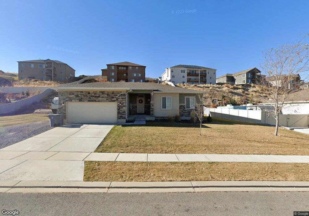
702 Crest Dale Ln Santaquin, UT 84655
Estimated Value: $576,000 - $645,000
3
Beds
2
Baths
1,789
Sq Ft
$342/Sq Ft
Est. Value
About This Home
This home is located at 702 Crest Dale Ln, Santaquin, UT 84655 and is currently estimated at $612,313, approximately $342 per square foot. 702 Crest Dale Ln is a home with nearby schools including Santaquin Elementary School, Payson Junior High School, and Payson High School.
Ownership History
Date
Name
Owned For
Owner Type
Purchase Details
Closed on
Nov 20, 2017
Sold by
Salisbury Developers Inc
Bought by
Brown Austin K and Brown Alexa M
Current Estimated Value
Home Financials for this Owner
Home Financials are based on the most recent Mortgage that was taken out on this home.
Original Mortgage
$274,652
Outstanding Balance
$230,267
Interest Rate
3.87%
Mortgage Type
FHA
Estimated Equity
$382,046
Purchase Details
Closed on
Apr 20, 2017
Sold by
Salisbury Land Llc
Bought by
Saailsbury Developers Inc
Home Financials for this Owner
Home Financials are based on the most recent Mortgage that was taken out on this home.
Original Mortgage
$218,900
Interest Rate
4.3%
Mortgage Type
Construction
Purchase Details
Closed on
Sep 29, 2011
Sold by
Summit Ridge Communities Llc
Bought by
Central Bank
Create a Home Valuation Report for This Property
The Home Valuation Report is an in-depth analysis detailing your home's value as well as a comparison with similar homes in the area
Home Values in the Area
Average Home Value in this Area
Purchase History
| Date | Buyer | Sale Price | Title Company |
|---|---|---|---|
| Brown Austin K | -- | Cottonwood Title Ins Agency | |
| Saailsbury Developers Inc | -- | Cottonwood Title Ins Ag | |
| Central Bank | -- | None Available |
Source: Public Records
Mortgage History
| Date | Status | Borrower | Loan Amount |
|---|---|---|---|
| Open | Brown Austin K | $274,652 | |
| Previous Owner | Saailsbury Developers Inc | $218,900 |
Source: Public Records
Tax History Compared to Growth
Tax History
| Year | Tax Paid | Tax Assessment Tax Assessment Total Assessment is a certain percentage of the fair market value that is determined by local assessors to be the total taxable value of land and additions on the property. | Land | Improvement |
|---|---|---|---|---|
| 2025 | $2,672 | $535,300 | $179,900 | $355,400 |
| 2024 | $2,672 | $266,090 | $0 | $0 |
| 2023 | $2,776 | $277,365 | $0 | $0 |
| 2022 | $2,678 | $275,990 | $0 | $0 |
| 2021 | $2,309 | $368,800 | $107,400 | $261,400 |
| 2020 | $2,119 | $328,000 | $76,700 | $251,300 |
| 2019 | $1,840 | $291,200 | $72,700 | $218,500 |
| 2018 | $1,802 | $272,000 | $67,000 | $205,000 |
| 2017 | $831 | $67,000 | $0 | $0 |
| 2016 | $654 | $51,700 | $0 | $0 |
| 2015 | $626 | $48,500 | $0 | $0 |
| 2014 | $574 | $44,400 | $0 | $0 |
Source: Public Records
Map
Nearby Homes
- 583 Sunset Dr
- 490 Firestone Dr
- 926 S Tanner Rd
- 402 Topaz Dr
- 519 Stone Way
- 633 Little Rock Dr
- 1022 Vista Ridge Dr Unit 149
- 449 Travertine Way
- 346 Red Rock Dr
- 1103 Vista Ridge Dr
- 1144 Crest Dale Ln
- 1217 Crest Dale Ln
- 1208 Crest Dale Ln
- 1226 Crest Dale Ln
- 1858 W View Cove
- 1263 Crest Dale Ln
- 1260 Crest Dale Ln
- 1267 W View Dr
- 1859 W View Cove
- 1851 W View Cove
- 680 Crest Dale Ln Unit CALDWE
- 680 Crest Dale Ln
- 691 Summit Trails
- 691 Summit Trails Unit 10
- 724 Crest Dale Ln
- 691 Summit Trail Unit CLDWL
- 530 Crest Dale Ln
- 530 Crest Dale Ln
- 675 Summit Trails
- 675 Summit Trails Unit 9
- 709 Summit Trail Unit 11
- 709 Summit Trail
- 709 Crest Dale Ln Unit 89
- 693 Crest Dale Ln Unit 88
- 693 Crest Dale Ln
- 723 Crest Dale Ln Unit 90
- 723 Crest Dale Ln Unit COLUMB
- 660 Crest Dale Ln
- 679 Crest Dale Ln Unit 87
- 744 Crest Dale Ln Unit WORTHI