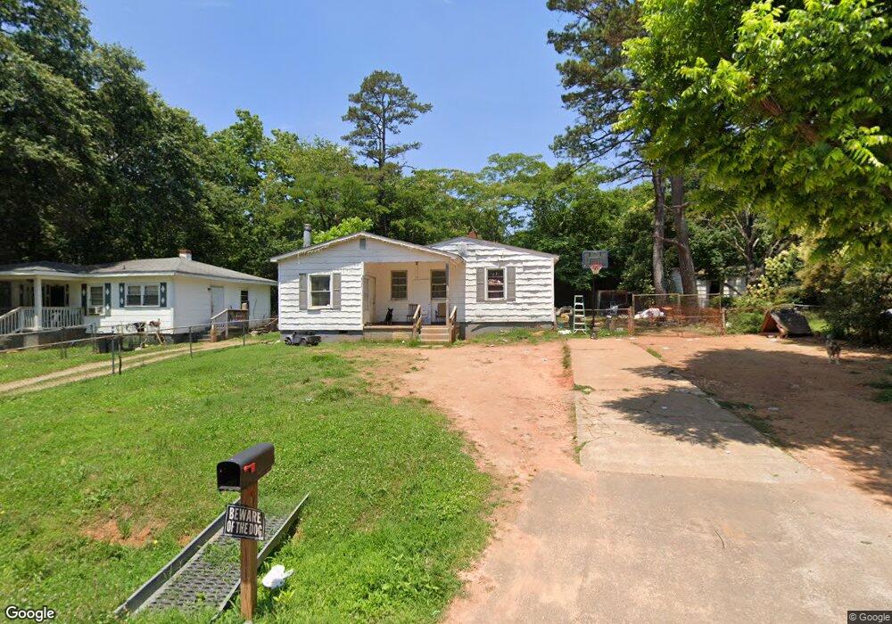
702 Hack St Anderson, SC 29624
Estimated Value: $50,643 - $124,000
2
Beds
--
Bath
780
Sq Ft
$119/Sq Ft
Est. Value
About This Home
This home is located at 702 Hack St, Anderson, SC 29624 and is currently estimated at $92,911, approximately $119 per square foot. 702 Hack St is a home located in Anderson County with nearby schools including Varennes Elementary School, Robert Anderson Middle School, and Westside High School.
Ownership History
Date
Name
Owned For
Owner Type
Purchase Details
Closed on
Mar 11, 2025
Sold by
702 Hack Street Land Trust and Boyd Derek
Bought by
Gonzalez Mario Alvarez
Current Estimated Value
Purchase Details
Closed on
Dec 7, 2018
Sold by
Hampton Ronald E
Bought by
Boyd Derek and The 702 Hack Street Land Trust
Purchase Details
Closed on
Jun 12, 2018
Sold by
Estate Of Charles Eugene Hampton and Hampton Ronald E
Bought by
Hampton Ronald E
Purchase Details
Closed on
Aug 6, 2001
Sold by
Kay Charles L
Bought by
Norris Thadis
Create a Home Valuation Report for This Property
The Home Valuation Report is an in-depth analysis detailing your home's value as well as a comparison with similar homes in the area
Home Values in the Area
Average Home Value in this Area
Purchase History
| Date | Buyer | Sale Price | Title Company |
|---|---|---|---|
| Gonzalez Mario Alvarez | -- | None Listed On Document | |
| Boyd Derek | $5,000 | None Available | |
| Hampton Ronald E | -- | None Available | |
| Norris Thadis | $25,000 | -- |
Source: Public Records
Tax History
| Year | Tax Paid | Tax Assessment Tax Assessment Total Assessment is a certain percentage of the fair market value that is determined by local assessors to be the total taxable value of land and additions on the property. | Land | Improvement |
|---|---|---|---|---|
| 2024 | $582 | $1,540 | $300 | $1,240 |
| 2023 | $579 | $1,540 | $300 | $1,240 |
| 2022 | $537 | $1,540 | $300 | $1,240 |
| 2021 | $534 | $1,410 | $210 | $1,200 |
| 2020 | $524 | $1,410 | $210 | $1,200 |
| 2019 | $524 | $1,410 | $210 | $1,200 |
| 2018 | $517 | $1,410 | $210 | $1,200 |
| 2017 | -- | $1,410 | $210 | $1,200 |
| 2016 | $527 | $1,600 | $210 | $1,390 |
| 2015 | $529 | $1,600 | $210 | $1,390 |
| 2014 | $518 | $1,600 | $210 | $1,390 |
Source: Public Records
Map
Nearby Homes
- 431 Lewis St
- 00 Crescent Dr
- 115 Hillcrest Cir
- 114 Hillcrest Cir
- 719 Dora Dr
- 825 Dora Dr
- 222 Hillcrest Cir
- 701 Delia St Unit B
- 701 Delia St Unit A
- 701 Delia St
- 00 Ila St
- 601 Don Ave
- Lt 0 Harris St
- 1103 Scott Dr
- 00 Hwy 28 Bypass New Pond Rd
- 0 W Franklin St
- 0 W Reed St
- 1606 S Murray Avenue Extension
- 16 N Prince St
- 310 W Hampton St
Your Personal Tour Guide
Ask me questions while you tour the home.