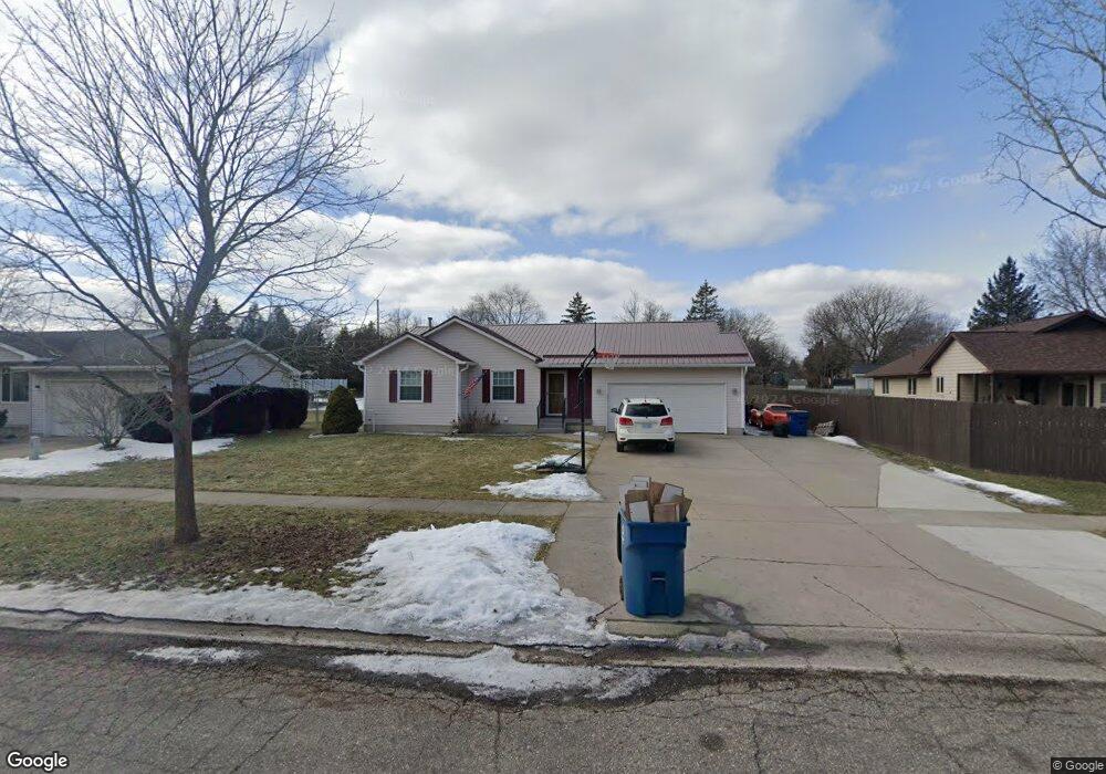
702 Locust Dr Davison, MI 48423
Estimated Value: $240,000 - $270,495
3
Beds
2
Baths
1,295
Sq Ft
$199/Sq Ft
Est. Value
About This Home
This home is located at 702 Locust Dr, Davison, MI 48423 and is currently estimated at $258,124, approximately $199 per square foot. 702 Locust Dr is a home located in Genesee County with nearby schools including Thomson Elementary School, Hill Elementary School, and Gates Elementary School.
Ownership History
Date
Name
Owned For
Owner Type
Purchase Details
Closed on
Apr 1, 2021
Sold by
Rose Jeffrey D and Rose Pamela
Bought by
Tubbs Ryan P and Tubbs Cassandra M
Current Estimated Value
Purchase Details
Closed on
Mar 29, 2021
Sold by
Rose Daniel P
Bought by
Rose Jeffrey D and Rose Pamela
Purchase Details
Closed on
May 13, 2013
Sold by
Rose Daniel P
Bought by
Rose Jeffrey and Rose Pamela
Purchase Details
Closed on
Sep 7, 2012
Sold by
Rose Daniel P and Rose Helen
Bought by
Rose Daniel P and Rose Jeffrey
Purchase Details
Closed on
May 24, 2002
Sold by
Crowder Lawrence J and Crowder Susan K
Bought by
Rose Daniel P and Rose Helen
Create a Home Valuation Report for This Property
The Home Valuation Report is an in-depth analysis detailing your home's value as well as a comparison with similar homes in the area
Home Values in the Area
Average Home Value in this Area
Purchase History
We collect this data history from publicly available records. To have your information removed, we recommend requesting removal directly through your county’s website.
| Date | Buyer | Sale Price | Title Company |
|---|---|---|---|
| Tubbs Ryan P | $175,000 | Sargents Title Company Llc | |
| Rose Jeffrey D | $127,000 | Sargents Title Company Llc | |
| Rose Jeffrey | -- | None Available | |
| Rose Daniel P | -- | None Available | |
| Rose Daniel P | $149,000 | Sargents Title Company |
Source: Public Records
Tax History
| Year | Tax Paid | Tax Assessment Tax Assessment Total Assessment is a certain percentage of the fair market value that is determined by local assessors to be the total taxable value of land and additions on the property. | Land | Improvement |
|---|---|---|---|---|
| 2025 | $5,297 | $135,100 | $0 | $0 |
| 2024 | $3,258 | $119,700 | $0 | $0 |
| 2023 | $3,117 | $109,500 | $0 | $0 |
| 2022 | $4,021 | $96,000 | $0 | $0 |
| 2021 | $2,682 | $90,000 | $0 | $0 |
| 2020 | $1,629 | $88,000 | $0 | $0 |
| 2019 | $1,608 | $82,000 | $0 | $0 |
| 2018 | $2,373 | $71,700 | $0 | $0 |
| 2017 | $2,266 | $72,900 | $0 | $0 |
| 2016 | $2,247 | $65,800 | $0 | $0 |
| 2015 | $2,240 | $47,600 | $0 | $0 |
| 2012 | -- | $46,900 | $46,900 | $0 |
Source: Public Records
Map
Nearby Homes
- 425 Juniper Dr
- 334 E Clark St Unit 340 344
- 729 Fitzner Dr
- 719 Fitzner Dr
- 1024 Foxglove Ln
- 814 Cypress Dr
- 000 Foxglove Ln
- 325 Viet St
- 10.63(+/-) Acres Lapeer Rd
- 0000 S State Rd
- 1215 N Oak Rd
- 9469 Parkwood N
- 1085 Linda Dr
- 612 Carriage Way
- 10294 Carriage Way
- 1084 Linda Dr
- 706 Salem Dr
- 218 N Lapeer St
- 297 Carriage Way
- 9448 Linda Dr
Your Personal Tour Guide
Ask me questions while you tour the home.