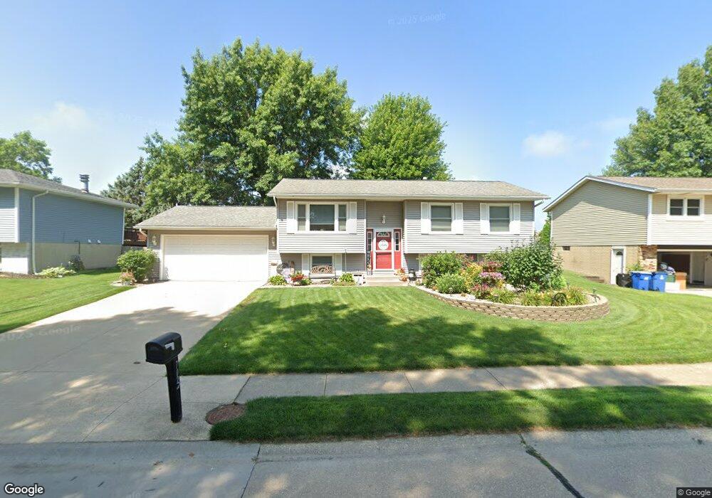
702 N 8th St Eldridge, IA 52748
Estimated Value: $256,000 - $316,000
3
Beds
2
Baths
1,795
Sq Ft
$161/Sq Ft
Est. Value
About This Home
This home is located at 702 N 8th St, Eldridge, IA 52748 and is currently estimated at $289,137, approximately $161 per square foot. 702 N 8th St is a home located in Scott County with nearby schools including Edward White Elementary School, North Scott Junior High School, and North Scott Senior High School.
Ownership History
Date
Name
Owned For
Owner Type
Purchase Details
Closed on
Sep 23, 2019
Sold by
Gluesing Alyssa M and Gluesing Brian
Bought by
Gluesing Alyssa M and Gluesing Brian
Current Estimated Value
Purchase Details
Closed on
Aug 10, 2015
Sold by
Frazier Brandon K and Frazier Kayla
Bought by
Linnenbrink Alyssa M
Home Financials for this Owner
Home Financials are based on the most recent Mortgage that was taken out on this home.
Original Mortgage
$166,725
Interest Rate
4.03%
Mortgage Type
New Conventional
Purchase Details
Closed on
Aug 23, 2007
Sold by
Carlson Marc A and Carlson Nicole M
Bought by
Frazier Brandon K
Home Financials for this Owner
Home Financials are based on the most recent Mortgage that was taken out on this home.
Original Mortgage
$145,000
Interest Rate
6.72%
Mortgage Type
New Conventional
Create a Home Valuation Report for This Property
The Home Valuation Report is an in-depth analysis detailing your home's value as well as a comparison with similar homes in the area
Home Values in the Area
Average Home Value in this Area
Purchase History
| Date | Buyer | Sale Price | Title Company |
|---|---|---|---|
| Gluesing Alyssa M | -- | -- | |
| Linnenbrink Alyssa M | $175,500 | Attorney | |
| Frazier Brandon K | $145,000 | None Available |
Source: Public Records
Mortgage History
| Date | Status | Borrower | Loan Amount |
|---|---|---|---|
| Previous Owner | Linnenbrink Alyssa M | $166,725 | |
| Previous Owner | Frazier Brandon K | $145,000 |
Source: Public Records
Tax History
| Year | Tax Paid | Tax Assessment Tax Assessment Total Assessment is a certain percentage of the fair market value that is determined by local assessors to be the total taxable value of land and additions on the property. | Land | Improvement |
|---|---|---|---|---|
| 2025 | $2,940 | $265,600 | $54,000 | $211,600 |
| 2024 | $2,862 | $239,600 | $36,000 | $203,600 |
| 2023 | $2,516 | $239,600 | $36,000 | $203,600 |
| 2022 | $2,438 | $181,950 | $31,050 | $150,900 |
| 2021 | $2,438 | $181,950 | $31,050 | $150,900 |
| 2020 | $2,398 | $175,340 | $31,050 | $144,290 |
| 2019 | $2,492 | $165,750 | $24,150 | $141,600 |
| 2018 | $2,546 | $165,750 | $24,150 | $141,600 |
| 2017 | $2,232 | $165,750 | $24,150 | $141,600 |
| 2016 | $2,048 | $141,430 | $0 | $0 |
| 2015 | $2,048 | $135,570 | $0 | $0 |
| 2014 | $1,990 | $135,570 | $0 | $0 |
| 2013 | $1,954 | $0 | $0 | $0 |
| 2012 | -- | $136,810 | $24,150 | $112,660 |
Source: Public Records
Map
Nearby Homes
Your Personal Tour Guide
Ask me questions while you tour the home.