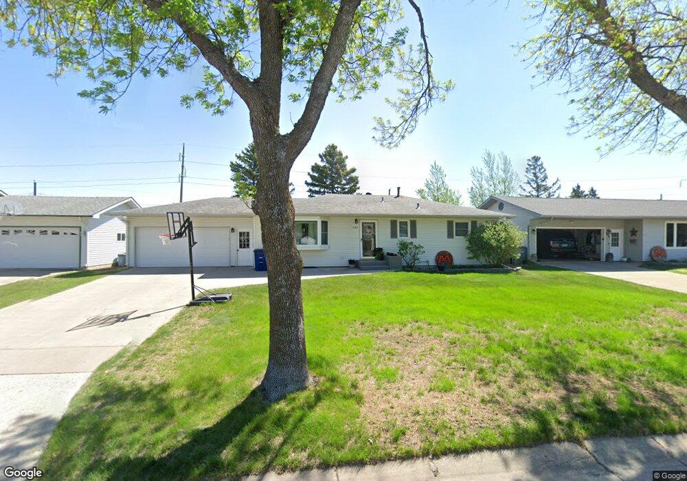
702 Rensvold Blvd Moorhead, MN 56560
Estimated Value: $276,634 - $303,000
--
Bed
--
Bath
--
Sq Ft
9,583
Sq Ft Lot
About This Home
This home is located at 702 Rensvold Blvd, Moorhead, MN 56560 and is currently estimated at $290,659. 702 Rensvold Blvd is a home located in Clay County with nearby schools including Dorothy Dodds Elementary School, Horizon Middle School, and Moorhead High School.
Ownership History
Date
Name
Owned For
Owner Type
Purchase Details
Closed on
Aug 6, 2021
Sold by
Hesby Susan B
Bought by
Bogenreif Michael J and Bogenreif Nicole M
Current Estimated Value
Home Financials for this Owner
Home Financials are based on the most recent Mortgage that was taken out on this home.
Original Mortgage
$213,750
Outstanding Balance
$194,655
Interest Rate
3%
Mortgage Type
New Conventional
Estimated Equity
$96,004
Purchase Details
Closed on
Apr 9, 2019
Sold by
Hesby Gerald E and Hesby Susan B
Bought by
Hesby Susan B
Purchase Details
Closed on
Apr 8, 2019
Sold by
Millar Cynthia K and Millar Darin
Bought by
Hesby Gerald E and Hesby Susan B
Purchase Details
Closed on
Jul 25, 2017
Sold by
Hesby Gerald E and Hesby Susan B
Bought by
Millar Cynthia K and Millar Darin
Create a Home Valuation Report for This Property
The Home Valuation Report is an in-depth analysis detailing your home's value as well as a comparison with similar homes in the area
Home Values in the Area
Average Home Value in this Area
Purchase History
| Date | Buyer | Sale Price | Title Company |
|---|---|---|---|
| Bogenreif Michael J | $225,000 | None Available | |
| Hesby Susan B | -- | None Available | |
| Hesby Gerald E | -- | None Available | |
| Millar Cynthia K | -- | -- | |
| Bogenreif Michael Michael | $225,000 | -- |
Source: Public Records
Mortgage History
| Date | Status | Borrower | Loan Amount |
|---|---|---|---|
| Open | Bogenreif Michael J | $213,750 | |
| Closed | Bogenreif Michael Michael | $213,750 |
Source: Public Records
Tax History Compared to Growth
Tax History
| Year | Tax Paid | Tax Assessment Tax Assessment Total Assessment is a certain percentage of the fair market value that is determined by local assessors to be the total taxable value of land and additions on the property. | Land | Improvement |
|---|---|---|---|---|
| 2025 | $3,746 | $271,300 | $47,800 | $223,500 |
| 2024 | $3,746 | $257,500 | $47,800 | $209,700 |
| 2023 | $3,568 | $243,200 | $47,800 | $195,400 |
| 2022 | $3,212 | $234,700 | $44,100 | $190,600 |
| 2021 | $3,204 | $212,000 | $40,400 | $171,600 |
| 2020 | $3,096 | $209,600 | $40,400 | $169,200 |
| 2019 | $1,716 | $207,900 | $40,400 | $167,500 |
| 2018 | $2,534 | $183,700 | $40,400 | $143,300 |
| 2017 | $2,322 | $183,700 | $40,400 | $143,300 |
| 2016 | $2,092 | $174,500 | $40,400 | $134,100 |
| 2015 | $1,812 | $145,200 | $34,500 | $110,700 |
| 2014 | $937 | $145,200 | $34,500 | $110,700 |
Source: Public Records
Map
Nearby Homes
- 530 Cedar Ln
- 525 Maple Ln
- 453 Rensvold Blvd
- 638 Appletree Ln
- 509 Birch Ln
- 2225 4th Ave S
- 2203 4th Ave S Unit 4
- 766 36th St S
- 1325 32nd Street Cir S
- 1715 33rd St S
- 3724 27th St S
- 3718 27th St S
- 1218 35th Street Cir S
- 419 18th St S
- 1516 19 1 2 St S Unit 6
- 1515 19 1 2 St S
- 516 16th St S
- 1822 33rd St S
- 1107 17th St S
- 1512 10th Ave S
- 614 Rensvold Blvd
- 706 Rensvold Blvd
- 610 Rensvold Blvd
- 710 Rensvold Blvd
- 629 Maple Ln
- 621 Rensvold Blvd
- 606 Rensvold Blvd
- 714 Rensvold Blvd
- 642 Cedar Ln
- 617 Rensvold Blvd
- 625 Maple Ln
- 528 Rensvold Blvd
- 618 Maple Ln
- 718 Rensvold Blvd
- 638 Cedar Ln
- 613 Rensvold Blvd
- 621 Maple Ln
- 614 Maple Ln
- 722 Rensvold Blvd
- 524 Rensvold Blvd