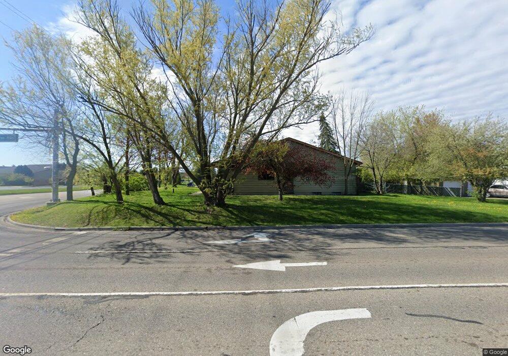
702 S Canal Rd Lansing, MI 48917
Estimated Value: $241,000 - $264,000
2
Beds
1
Bath
1,870
Sq Ft
$136/Sq Ft
Est. Value
About This Home
This home is located at 702 S Canal Rd, Lansing, MI 48917 and is currently estimated at $253,412, approximately $135 per square foot. 702 S Canal Rd is a home located in Eaton County with nearby schools including Delta Center Elementary School, Leon W. Hayes Middle School, and Grand Ledge High School.
Ownership History
Date
Name
Owned For
Owner Type
Purchase Details
Closed on
Jun 27, 2022
Sold by
Isaiah Jones Austin
Bought by
Edward & Sons Investments Llc
Current Estimated Value
Purchase Details
Closed on
Sep 15, 2018
Sold by
Harris Derrick
Bought by
Jonej Edward J
Purchase Details
Closed on
Apr 10, 2014
Sold by
Jones Edward J
Bought by
Jones Edward J and Harris Derrick J
Purchase Details
Closed on
Aug 25, 2004
Sold by
Hall Kathleen A
Bought by
Jones Edward J
Home Financials for this Owner
Home Financials are based on the most recent Mortgage that was taken out on this home.
Original Mortgage
$130,351
Interest Rate
6.1%
Mortgage Type
Purchase Money Mortgage
Create a Home Valuation Report for This Property
The Home Valuation Report is an in-depth analysis detailing your home's value as well as a comparison with similar homes in the area
Home Values in the Area
Average Home Value in this Area
Purchase History
| Date | Buyer | Sale Price | Title Company |
|---|---|---|---|
| Edward & Sons Investments Llc | -- | -- | |
| Edward & Sons Investments Llc | -- | None Listed On Document | |
| Jonej Edward J | -- | None Available | |
| Jones Edward J | -- | None Available | |
| Jones Edward J | $186,217 | Midstate Title |
Source: Public Records
Mortgage History
| Date | Status | Borrower | Loan Amount |
|---|---|---|---|
| Previous Owner | Jones Edward J | $130,351 |
Source: Public Records
Tax History Compared to Growth
Tax History
| Year | Tax Paid | Tax Assessment Tax Assessment Total Assessment is a certain percentage of the fair market value that is determined by local assessors to be the total taxable value of land and additions on the property. | Land | Improvement |
|---|---|---|---|---|
| 2025 | $4,667 | $108,200 | $0 | $0 |
| 2024 | $3,104 | $99,400 | $0 | $0 |
| 2023 | $2,922 | $92,900 | $0 | $0 |
| 2022 | $4,035 | $85,100 | $0 | $0 |
| 2021 | $3,875 | $80,000 | $0 | $0 |
| 2020 | $4,598 | $76,700 | $0 | $0 |
| 2019 | $3,768 | $160,341 | $0 | $0 |
| 2018 | $3,938 | $67,900 | $0 | $0 |
| 2017 | $3,515 | $67,900 | $0 | $0 |
| 2016 | -- | $65,700 | $0 | $0 |
| 2015 | -- | $65,700 | $0 | $0 |
| 2014 | -- | $63,100 | $0 | $0 |
| 2013 | -- | $64,800 | $0 | $0 |
Source: Public Records
Map
Nearby Homes
- 611 S Canal Rd
- 7635 Blue Spruce Ln
- 7327 Golf Gate Dr
- 7520 Williamsburg Rd
- 7304 Player's Club Dr
- 229 Williamsburg Rd
- 110 N Canal Rd
- Lot 30 Doe Pass
- 7115 Ravenna Trail Unit 74
- 7119 Ravenna Trail Unit 73
- Lot 61 Doe Pass
- Lot 47 Doe Pass
- Lot 60 Doe Pass
- Lot 2 Laurelwood
- Lot 53 Doe Pass
- 1010 Firwood St
- 8522 Ember Glen Pass
- 11195 Prestwick Dr
- 7671 Royal Cove Dr
- 2122 NE 14th Place
- 716 S Canal Rd
- 707 Blue Lagoon Dr
- 724 S Canal Rd
- 717 Blue Lagoon Dr
- 7607 Sugar Maple Cir
- 7605 Sugar Maple Cir
- 725 Blue Lagoon Dr
- 7609 Sugar Maple Cir
- 7601 Sugar Maple Cir
- 7601 Sugar Maple Cir Unit 6
- 7615 Sugar Maple Cir Unit 2
- 736 S Canal Rd
- 7617 Sugar Maple Cir
- 7600 Sugar Maple Cir
- 735 Blue Lagoon Dr
- 708 Blue Lagoon Dr
- 7534 W St Joe Hwy
- 7534 W St Joe Hwy
- 730 Blue Lagoon Dr