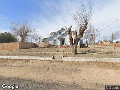
702 S Carhart Clarendon, TX 79226
Estimated Value: $172,000 - $242,000
5
Beds
3
Baths
3,365
Sq Ft
$58/Sq Ft
Est. Value
About This Home
This home is located at 702 S Carhart, Clarendon, TX 79226 and is currently estimated at $193,626, approximately $57 per square foot. 702 S Carhart is a home located in Donley County with nearby schools including Clarendon Elementary School, Clarendon Junior High School, and Clarendon High School.
Ownership History
Date
Name
Owned For
Owner Type
Purchase Details
Closed on
May 31, 2024
Sold by
Dale Antony and Dale Deborah
Bought by
Bezner Zachary James and Bezner Chantelle Brooke
Current Estimated Value
Home Financials for this Owner
Home Financials are based on the most recent Mortgage that was taken out on this home.
Original Mortgage
$5,155
Outstanding Balance
$5,109
Interest Rate
7.17%
Estimated Equity
$188,517
Create a Home Valuation Report for This Property
The Home Valuation Report is an in-depth analysis detailing your home's value as well as a comparison with similar homes in the area
Home Values in the Area
Average Home Value in this Area
Purchase History
| Date | Buyer | Sale Price | Title Company |
|---|---|---|---|
| Bezner Zachary James | -- | None Listed On Document |
Source: Public Records
Mortgage History
| Date | Status | Borrower | Loan Amount |
|---|---|---|---|
| Open | Bezner Zachary James | $5,155 | |
| Open | Bezner Zachary James | $171,830 | |
| Previous Owner | Dale Deborah | $135,000 |
Source: Public Records
Tax History Compared to Growth
Tax History
| Year | Tax Paid | Tax Assessment Tax Assessment Total Assessment is a certain percentage of the fair market value that is determined by local assessors to be the total taxable value of land and additions on the property. | Land | Improvement |
|---|---|---|---|---|
| 2024 | $4,100 | $169,514 | $2,660 | $166,854 |
| 2023 | $3,351 | $137,294 | $2,660 | $134,634 |
| 2022 | $2,923 | $137,294 | $2,660 | $134,634 |
| 2021 | $2,671 | $101,814 | $2,660 | $99,154 |
| 2020 | $2,505 | $98,439 | $2,660 | $95,779 |
| 2019 | $3,113 | $86,564 | $2,660 | $83,904 |
| 2018 | $1,816 | $59,780 | $2,660 | $57,120 |
| 2017 | $1,797 | $59,780 | $2,660 | $57,120 |
| 2016 | $1,748 | $59,780 | $2,660 | $57,120 |
| 2015 | -- | $59,780 | $2,660 | $57,120 |
| 2014 | -- | $57,358 | $2,660 | $54,698 |
Source: Public Records
Map
Nearby Homes
- 300 E 4th St
- 507 W 5th
- 721 W 7th St
- 318 S Koogle St
- 305 White St
- 1010 E 3rd St
- 510 Bugbee Ave
- 614 S Bond St
- 609 S Johns St
- 507 S Leroy St
- 0 F M Highway No 3257 Unit 25-4271
- 155 Sadie Dr
- 91 Janny Dr
- 65 Greenbelt Way
- 401 Ten Bears Trail
- 401 Meredith Cir
- 0 Rick Husband Blvd
- 110 Trout St
- 173 Texas Dr
- 94 Libern Dr
- 702 Carhart St
- 208 E Wood Ave
- 701 S Carhart St
- 618 S Carhart St
- 619 S Gorst St
- 703 S Carhart St
- 202 E Wood Ave
- 701 Carhart St
- 720 S Carhart St
- 617 S Gorst St
- 621 S Gorst St
- 207 E Montgomery
- 617 Carhart St
- 203 E Montgomery St
- 613 S Gorst St
- 602 S Carhart St
- 620 S Gorst St
- 611 S Gorst St
- 702 Gorst St
- 702 S Goodnight St