Estimated Value: $336,000 - $390,000
3
Beds
4
Baths
1,949
Sq Ft
$181/Sq Ft
Est. Value
About This Home
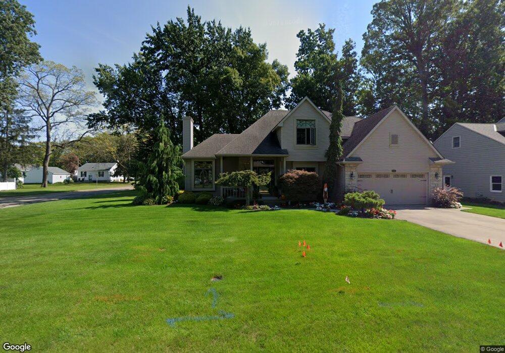
This home is located at 702 S Oakhurst Ct, Huron, OH 44839 and is currently estimated at $353,563, approximately $181 per square foot. 702 S Oakhurst Ct is a home located in Erie County with nearby schools including Shawnee Elementary School, Woodlands Intermediate School, and McCormick Junior High School.
Ownership History
Date
Name
Owned For
Owner Type
Purchase Details
Closed on
Jul 31, 1996
Sold by
Associates Relocation
Bought by
Buathier Richard E
Current Estimated Value
Home Financials for this Owner
Home Financials are based on the most recent Mortgage that was taken out on this home.
Original Mortgage
$60,000
Outstanding Balance
$4,500
Interest Rate
7.63%
Mortgage Type
New Conventional
Estimated Equity
$349,063
Create a Home Valuation Report for This Property
The Home Valuation Report is an in-depth analysis detailing your home's value as well as a comparison with similar homes in the area
Home Values in the Area
Average Home Value in this Area
Purchase History
| Date | Buyer | Sale Price | Title Company |
|---|---|---|---|
| Buathier Richard E | $171,000 | -- |
Source: Public Records
Mortgage History
| Date | Status | Borrower | Loan Amount |
|---|---|---|---|
| Open | Buathier Richard E | $60,000 |
Source: Public Records
Tax History
| Year | Tax Paid | Tax Assessment Tax Assessment Total Assessment is a certain percentage of the fair market value that is determined by local assessors to be the total taxable value of land and additions on the property. | Land | Improvement |
|---|---|---|---|---|
| 2024 | $4,165 | $107,649 | $14,346 | $93,303 |
| 2023 | $4,278 | $75,288 | $12,614 | $62,674 |
| 2022 | $3,120 | $75,285 | $12,614 | $62,671 |
| 2021 | $3,112 | $75,280 | $12,610 | $62,670 |
| 2020 | $2,915 | $68,700 | $12,610 | $56,090 |
| 2019 | $3,043 | $68,700 | $12,610 | $56,090 |
| 2018 | $3,059 | $68,700 | $12,610 | $56,090 |
| 2017 | $3,039 | $66,320 | $10,720 | $55,600 |
| 2016 | $2,942 | $66,320 | $10,720 | $55,600 |
| 2015 | $2,938 | $66,320 | $10,720 | $55,600 |
| 2014 | $2,973 | $66,320 | $10,720 | $55,600 |
| 2013 | $2,930 | $66,320 | $10,720 | $55,600 |
Source: Public Records
Map
Nearby Homes
- 535 Wilbor Ave
- 919 Glenview Dr
- 418 Adams Ave
- 525 Liberty Dr Unit A
- 323 Portland Dr
- 706 Creekside Dr
- 721 Creekside Dr
- 0 Main St
- 11 Turtle Bay
- 937 Main St
- 676 Salem Dr
- 0 W Cleveland Rd
- 807 Cleveland Rd W
- 927 Dallas Dr
- 28 Turtle Bay
- 128 N Port Ln
- 216 Chevy Dr
- 317 Chevy Dr
- 1 Cleveland Rd W
- 304 Lisa Ann Dr
- 704 S Oakhurst Ct
- 703 Taylor Ave
- 705 Taylor Ave
- 620 N Oakhurst Ct
- 706 S Oakhurst Ct
- 701 S Oakhurst Ct
- 711 Taylor Ave
- 703 S Oakhurst Ct
- 637 Taylor Ave
- 621 N Oakhurst Ct
- 713 Taylor Ave
- 705 S Oakhurst Ct
- 633 Taylor Ave
- 708 S Oakhurst Ct
- 618 N Oakhurst Ct
- 619 N Oakhurst Ct
- 802 Glenview Dr
- 715 Taylor Ave
- 629 Taylor Ave
- 707 S Oakhurst Ct
Your Personal Tour Guide
Ask me questions while you tour the home.