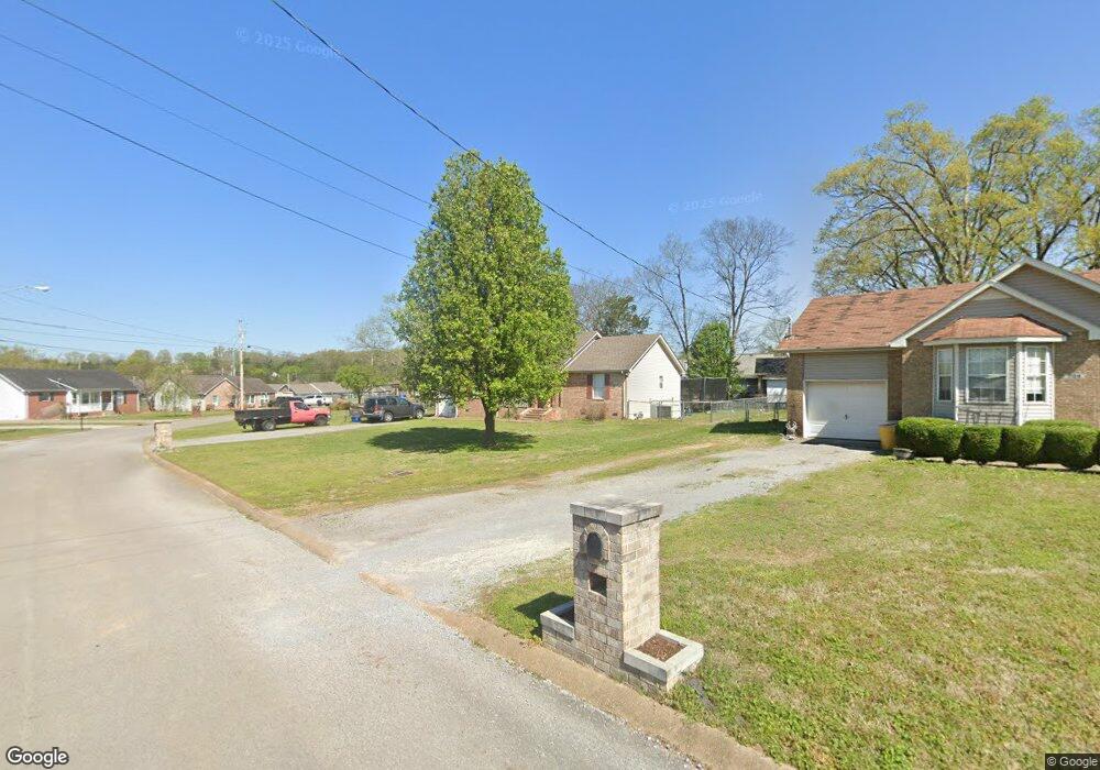
702 Thurman Ct Smyrna, TN 37167
Estimated Value: $291,177 - $378,000
--
Bed
2
Baths
1,205
Sq Ft
$281/Sq Ft
Est. Value
About This Home
This home is located at 702 Thurman Ct, Smyrna, TN 37167 and is currently estimated at $338,294, approximately $280 per square foot. 702 Thurman Ct is a home located in Rutherford County with nearby schools including David Youree Elementary School, Rocky Fork Middle School, and Smyrna High School.
Ownership History
Date
Name
Owned For
Owner Type
Purchase Details
Closed on
May 13, 2004
Sold by
Pate Douglas B and Pate Gina D
Bought by
Raye Navarro Gloria
Current Estimated Value
Home Financials for this Owner
Home Financials are based on the most recent Mortgage that was taken out on this home.
Original Mortgage
$107,563
Outstanding Balance
$50,396
Interest Rate
5.49%
Estimated Equity
$287,898
Purchase Details
Closed on
Sep 10, 1996
Sold by
Johnson and Spivey
Bought by
Pate Douglas B and Pate Gina
Create a Home Valuation Report for This Property
The Home Valuation Report is an in-depth analysis detailing your home's value as well as a comparison with similar homes in the area
Home Values in the Area
Average Home Value in this Area
Purchase History
| Date | Buyer | Sale Price | Title Company |
|---|---|---|---|
| Raye Navarro Gloria | $110,974 | -- | |
| Pate Douglas B | $87,250 | -- |
Source: Public Records
Mortgage History
| Date | Status | Borrower | Loan Amount |
|---|---|---|---|
| Open | Pate Douglas B | $107,563 |
Source: Public Records
Tax History Compared to Growth
Tax History
| Year | Tax Paid | Tax Assessment Tax Assessment Total Assessment is a certain percentage of the fair market value that is determined by local assessors to be the total taxable value of land and additions on the property. | Land | Improvement |
|---|---|---|---|---|
| 2025 | $1,467 | $61,075 | $13,750 | $47,325 |
| 2024 | $1,467 | $61,075 | $13,750 | $47,325 |
| 2023 | $1,484 | $61,750 | $13,750 | $48,000 |
| 2022 | $1,323 | $61,750 | $13,750 | $48,000 |
| 2021 | $1,222 | $41,875 | $8,750 | $33,125 |
| 2020 | $1,222 | $41,875 | $8,750 | $33,125 |
| 2019 | $1,222 | $41,875 | $8,750 | $33,125 |
| 2018 | $1,172 | $41,875 | $0 | $0 |
| 2017 | $982 | $27,550 | $0 | $0 |
| 2016 | $982 | $27,550 | $0 | $0 |
| 2015 | $982 | $27,550 | $0 | $0 |
| 2014 | $685 | $27,550 | $0 | $0 |
| 2013 | -- | $30,425 | $0 | $0 |
Source: Public Records
Map
Nearby Homes
- 630 Rock Springs Rd
- 726 Mason Tucker Dr
- 1226 Bronte Dr Unit 23D
- 1222 Bronte Dr Unit 23C
- 1226 Bronte Dr
- 1222 Bronte Dr
- 4026 Gaskill Dr Unit 118D
- 4042 Gaskill Dr Unit 113C
- 1305 Reinfield Ct
- 4046 Gaskill Dr Unit 113D
- 4018 Gaskill Dr
- 570 Rock Springs Rd
- 1102 Forestwood Ct
- 1412 Saint Edmonds Ct
- Caroline Plan at Spring Branch - Townhomes
- Bruckner Plan at Spring Branch - Townhomes
- Mozart Plan at Spring Branch - Townhomes
- 4372 Spregan Way
- 107 Irish Place
- 304 Short Ct
- 704 Thurman Ct
- 641 Rock Springs Rd
- 639 Rock Springs Rd
- 637 Rock Springs Rd
- 707 Thurman Ct
- 709 Thurman Ct
- 706 Thurman Ct
- 705 Thurman Ct
- 701 Thurman Ct
- 711 Thurman Ct
- 635 Rock Springs Rd
- 703 Thurman Ct
- 708 Thurman Ct
- 713 Thurman Ct
- 1004 Cedarstone Ct
- 715 Rock Springs Rd
- 633 Rock Springs Rd
- 640 Rock Springs Rd
- 638 Rock Springs Rd
- 636 Rock Springs Rd