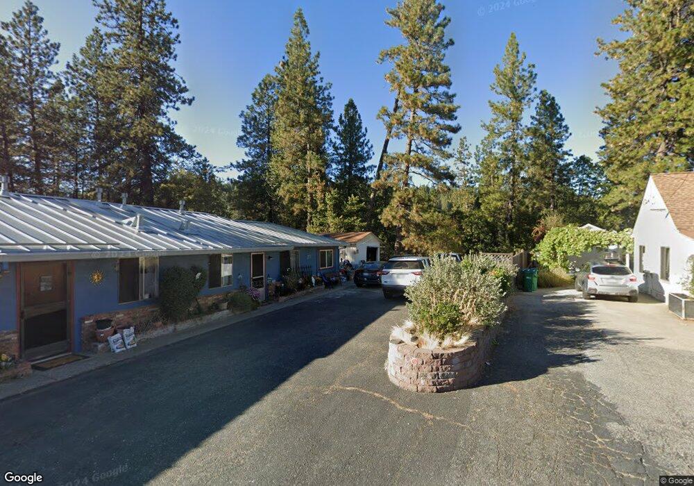
702 W Broad St Nevada City, CA 95959
Estimated Value: $323,892 - $797,000
4
Beds
2
Baths
1,696
Sq Ft
$352/Sq Ft
Est. Value
About This Home
This home is located at 702 W Broad St, Nevada City, CA 95959 and is currently estimated at $596,473, approximately $351 per square foot. 702 W Broad St is a home located in Nevada County with nearby schools including Deer Creek Elementary School, Seven Hills Intermediate School, and Forest Charter School.
Ownership History
Date
Name
Owned For
Owner Type
Purchase Details
Closed on
Mar 15, 2017
Sold by
Gray Ann and Ann Gray Revocable Living Trus
Bought by
Gray Allison
Current Estimated Value
Home Financials for this Owner
Home Financials are based on the most recent Mortgage that was taken out on this home.
Original Mortgage
$230,743
Outstanding Balance
$191,344
Interest Rate
4.17%
Mortgage Type
FHA
Estimated Equity
$405,129
Purchase Details
Closed on
Dec 15, 2005
Sold by
Gray Ann
Bought by
Gray Ann
Create a Home Valuation Report for This Property
The Home Valuation Report is an in-depth analysis detailing your home's value as well as a comparison with similar homes in the area
Home Values in the Area
Average Home Value in this Area
Purchase History
| Date | Buyer | Sale Price | Title Company |
|---|---|---|---|
| Gray Allison | $235,000 | Placer Title Co | |
| Gray Ann | -- | United Independent Title Ins |
Source: Public Records
Mortgage History
| Date | Status | Borrower | Loan Amount |
|---|---|---|---|
| Open | Gray Allison | $230,743 |
Source: Public Records
Tax History Compared to Growth
Tax History
| Year | Tax Paid | Tax Assessment Tax Assessment Total Assessment is a certain percentage of the fair market value that is determined by local assessors to be the total taxable value of land and additions on the property. | Land | Improvement |
|---|---|---|---|---|
| 2025 | $1,741 | $164,663 | $51,993 | $112,670 |
| 2024 | $1,710 | $161,435 | $50,974 | $110,461 |
| 2023 | $1,710 | $158,271 | $49,975 | $108,296 |
| 2022 | $1,676 | $155,169 | $48,996 | $106,173 |
| 2021 | $1,616 | $152,128 | $48,036 | $104,092 |
| 2020 | $1,613 | $150,569 | $47,544 | $103,025 |
| 2019 | $1,581 | $147,617 | $46,612 | $101,005 |
| 2018 | $0 | $144,724 | $45,699 | $99,025 |
| 2017 | $1,596 | $141,887 | $44,803 | $97,084 |
| 2016 | $1,541 | $139,106 | $43,925 | $95,181 |
| 2015 | $1,521 | $137,018 | $43,266 | $93,752 |
| 2014 | $1,521 | $134,335 | $42,419 | $91,916 |
Source: Public Records
Map
Nearby Homes
- 708 W Broad St
- 140 Redbud Way
- 660 Chief Kelly Dr
- 651 Chief Kelly Dr
- 520 Lost Hill Ct
- 631 Chief Kelly Dr
- 327 Drummond St
- 500 Factory St
- 214 Mill St
- 210 Mill St
- 421 Broad St
- 16970 Old Downieville Hwy
- 439 Washington St
- 30115 N Bloomfield-Graniteville Rd
- 447 Zion St
- 134 Boulder St
- 11356 Constitution Ct
- 157 Grove St
- 342 Bridge Way
- 327 Bridge Way
- 700 W Broad St
- 704 W Broad St Unit A
- 706 W Broad St
- 17 Chief Kelly Dr
- 150 Redbud Way
- 130 Redbud Way
- 111 Chief Kelly Dr
- 101 Chief Kelly Dr
- 12360 Redbud Way
- 160 Redbud Way
- 102 Cement Hill Rd
- 129 Orchard St
- 601 Redbud Way Unit 10
- 605 Redbud Way
- 603 Redbud Way
- 609 Redbud Way Unit 13
- 607 Redbud Way
- 120 Redbud Way
- 611 Redbud Way Unit 15
- 141 Chief Kelly Dr