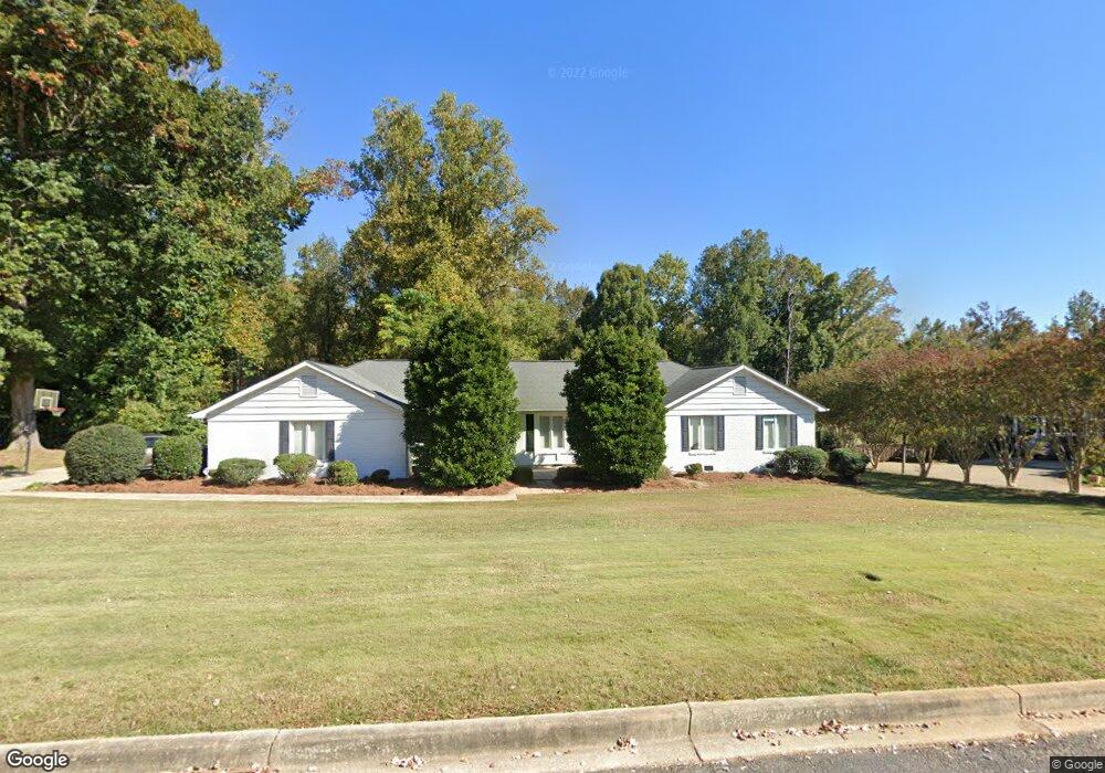
702 Westchester Dr Anderson, SC 29621
Estimated Value: $304,727 - $338,000
--
Bed
--
Bath
2,123
Sq Ft
$150/Sq Ft
Est. Value
About This Home
This home is located at 702 Westchester Dr, Anderson, SC 29621 and is currently estimated at $318,682, approximately $150 per square foot. 702 Westchester Dr is a home located in Anderson County with nearby schools including Concord Elementary School, McCants Middle School, and T.L. Hanna High School.
Ownership History
Date
Name
Owned For
Owner Type
Purchase Details
Closed on
Aug 16, 2005
Sold by
Harbin Beth M
Bought by
Harbin Matthew C
Current Estimated Value
Home Financials for this Owner
Home Financials are based on the most recent Mortgage that was taken out on this home.
Original Mortgage
$142,000
Outstanding Balance
$74,499
Interest Rate
5.64%
Mortgage Type
New Conventional
Estimated Equity
$244,183
Purchase Details
Closed on
Jun 27, 2002
Sold by
Russell Sylvia S
Bought by
Harbin Matthew C
Create a Home Valuation Report for This Property
The Home Valuation Report is an in-depth analysis detailing your home's value as well as a comparison with similar homes in the area
Home Values in the Area
Average Home Value in this Area
Purchase History
| Date | Buyer | Sale Price | Title Company |
|---|---|---|---|
| Harbin Matthew C | -- | -- | |
| Harbin Matthew C | $152,000 | -- | |
| Putnam Jodi L | $85,750 | -- |
Source: Public Records
Mortgage History
| Date | Status | Borrower | Loan Amount |
|---|---|---|---|
| Open | Harbin Matthew C | $142,000 |
Source: Public Records
Tax History Compared to Growth
Tax History
| Year | Tax Paid | Tax Assessment Tax Assessment Total Assessment is a certain percentage of the fair market value that is determined by local assessors to be the total taxable value of land and additions on the property. | Land | Improvement |
|---|---|---|---|---|
| 2024 | $2,111 | $9,990 | $1,380 | $8,610 |
| 2023 | $2,111 | $9,990 | $1,380 | $8,610 |
| 2022 | $2,091 | $9,990 | $1,380 | $8,610 |
| 2021 | $1,906 | $8,330 | $1,000 | $7,330 |
| 2020 | $1,903 | $8,330 | $1,000 | $7,330 |
| 2019 | $1,903 | $8,330 | $1,000 | $7,330 |
| 2018 | $1,920 | $8,330 | $1,000 | $7,330 |
| 2017 | -- | $8,330 | $1,000 | $7,330 |
| 2016 | $1,730 | $7,790 | $1,000 | $6,790 |
| 2015 | $1,751 | $7,790 | $1,000 | $6,790 |
| 2014 | $1,746 | $7,790 | $1,000 | $6,790 |
Source: Public Records
Map
Nearby Homes
- 700 Westchester Dr
- 704 Westchester Dr
- 703 Westchester Dr
- 606 Westchester Dr
- 705 Westchester Dr
- 706 Westchester Dr
- 1405 Kimberly Rd
- 1314 Northampton Rd
- 604 Westchester Dr
- 107 Buckingham Ct
- 305 Avenue of Oaks
- 1319 Northampton Rd
- 1403 Kimberly Rd
- 1406 Kimberly Rd
- 105 Buckingham Ct
- 300 Avenue of Oaks Unit Lot 51
- 300 Avenue of Oaks
- 201 Middle Brooke Dr
- 602 Westchester Dr
- 1317 Northampton Rd