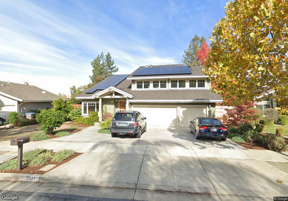
7021 Burnside Dr San Jose, CA 95120
Graystone NeighborhoodEstimated Value: $2,861,000 - $3,155,000
5
Beds
3
Baths
3,046
Sq Ft
$987/Sq Ft
Est. Value
About This Home
This home is located at 7021 Burnside Dr, San Jose, CA 95120 and is currently estimated at $3,007,704, approximately $987 per square foot. 7021 Burnside Dr is a home located in Santa Clara County with nearby schools including Graystone Elementary School, Bret Harte Middle School, and Leland High School.
Ownership History
Date
Name
Owned For
Owner Type
Purchase Details
Closed on
Mar 15, 2019
Sold by
Raimondi Anne C and Raimondi Samuel S
Bought by
Raimondi Samuel S and Raimondi Anne C
Current Estimated Value
Purchase Details
Closed on
Jun 28, 2004
Sold by
Rooke Mark Lee and Rooke Jana Aan
Bought by
Raimondi Samuel S and Raimondi Anne C
Home Financials for this Owner
Home Financials are based on the most recent Mortgage that was taken out on this home.
Original Mortgage
$333,700
Interest Rate
6.27%
Mortgage Type
Purchase Money Mortgage
Purchase Details
Closed on
Aug 14, 2000
Sold by
Rooke Mark L and Rooke Jana A
Bought by
Rooke Mark Lee and Rooke Jana Aan
Create a Home Valuation Report for This Property
The Home Valuation Report is an in-depth analysis detailing your home's value as well as a comparison with similar homes in the area
Home Values in the Area
Average Home Value in this Area
Purchase History
| Date | Buyer | Sale Price | Title Company |
|---|---|---|---|
| Raimondi Samuel S | -- | None Available | |
| Raimondi Anne C | -- | None Available | |
| Raimondi Samuel S | $1,258,000 | Alliance Title Company | |
| Rooke Mark Lee | -- | -- | |
| Rooke Mark Lee | -- | -- |
Source: Public Records
Mortgage History
| Date | Status | Borrower | Loan Amount |
|---|---|---|---|
| Closed | Raimondi Samuel S | $333,700 | |
| Closed | Raimondi Samuel S | $420,000 |
Source: Public Records
Tax History Compared to Growth
Tax History
| Year | Tax Paid | Tax Assessment Tax Assessment Total Assessment is a certain percentage of the fair market value that is determined by local assessors to be the total taxable value of land and additions on the property. | Land | Improvement |
|---|---|---|---|---|
| 2025 | $21,644 | $1,782,420 | $906,038 | $876,382 |
| 2024 | $21,644 | $1,747,472 | $888,273 | $859,199 |
| 2023 | $21,268 | $1,713,208 | $870,856 | $842,352 |
| 2022 | $21,073 | $1,679,617 | $853,781 | $825,836 |
| 2021 | $20,691 | $1,646,685 | $837,041 | $809,644 |
| 2020 | $20,268 | $1,629,802 | $828,459 | $801,343 |
| 2019 | $19,857 | $1,597,846 | $812,215 | $785,631 |
| 2018 | $19,679 | $1,566,517 | $796,290 | $770,227 |
| 2017 | $19,536 | $1,535,802 | $780,677 | $755,125 |
| 2016 | $19,294 | $1,505,689 | $765,370 | $740,319 |
| 2015 | $19,184 | $1,483,073 | $753,874 | $729,199 |
| 2014 | $18,619 | $1,454,022 | $739,107 | $714,915 |
Source: Public Records
Map
Nearby Homes
- 7025 Bret Harte Dr
- 21287 Almaden Rd
- 6898 Shearwater Dr
- 993 Woodview Place
- 6698 Charter Oak Place
- 18950 Graystone Ln
- 6805 Almaden Rd
- 1120 Valley Quail Cir
- 765 Finchwood Way
- 1066 Quail Creek Cir
- 6803 Lenwood Way
- 1171 Wilhelmina Way
- 1128 Foxhurst Way
- 20560 Henwood Rd
- 7003 Hollow Lake Way
- 1140 Mallard Ridge Loop
- 7111 Echo Loop
- 6628 Wildwood Ct
- 6565 Stonehill Dr
- 6579 Cooperage Ct
- 7019 Burnside Dr
- 7023 Burnside Dr
- 6963 Bret Harte Dr
- 7017 Burnside Dr
- 6961 Maiden Ln
- 7025 Burnside Dr
- 6957 Maiden Ln
- 6965 Maiden Ln
- 7024 Burnside Dr
- 7015 Burnside Dr
- 7022 Burnside Dr
- 7027 Burnside Dr
- 6953 Maiden Ln
- 7026 Burnside Dr
- 7020 Burnside Dr
- 7011 Burnside Dr
- 7028 Burnside Dr
- 6949 Maiden Ln
- 7029 Burnside Dr
- 6960 Bret Harte Dr