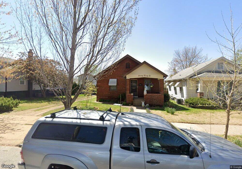
7026 Sutherland Ave Saint Louis, MO 63109
Lindenwood Park NeighborhoodEstimated Value: $210,239 - $221,000
--
Bed
1
Bath
1,872
Sq Ft
$116/Sq Ft
Est. Value
About This Home
This home is located at 7026 Sutherland Ave, Saint Louis, MO 63109 and is currently estimated at $216,560, approximately $115 per square foot. 7026 Sutherland Ave is a home located in St. Louis City with nearby schools including Mason Elementary School, Long International Middle School, and Roosevelt High School.
Ownership History
Date
Name
Owned For
Owner Type
Purchase Details
Closed on
May 27, 2004
Sold by
Hutchison Mildred
Bought by
Light Joseph C
Current Estimated Value
Home Financials for this Owner
Home Financials are based on the most recent Mortgage that was taken out on this home.
Original Mortgage
$109,250
Outstanding Balance
$53,477
Interest Rate
6.02%
Mortgage Type
Purchase Money Mortgage
Estimated Equity
$163,083
Create a Home Valuation Report for This Property
The Home Valuation Report is an in-depth analysis detailing your home's value as well as a comparison with similar homes in the area
Home Values in the Area
Average Home Value in this Area
Purchase History
| Date | Buyer | Sale Price | Title Company |
|---|---|---|---|
| Light Joseph C | -- | -- |
Source: Public Records
Mortgage History
| Date | Status | Borrower | Loan Amount |
|---|---|---|---|
| Open | Light Joseph C | $109,250 |
Source: Public Records
Tax History Compared to Growth
Tax History
| Year | Tax Paid | Tax Assessment Tax Assessment Total Assessment is a certain percentage of the fair market value that is determined by local assessors to be the total taxable value of land and additions on the property. | Land | Improvement |
|---|---|---|---|---|
| 2025 | $2,084 | $29,070 | $2,000 | $27,070 |
| 2024 | $900 | $24,560 | $2,000 | $22,560 |
| 2023 | $900 | $24,560 | $2,000 | $22,560 |
| 2022 | $1,920 | $22,890 | $2,000 | $20,890 |
| 2021 | $1,917 | $22,890 | $2,000 | $20,890 |
| 2020 | $1,733 | $20,820 | $2,000 | $18,820 |
| 2019 | $1,727 | $20,830 | $2,000 | $18,830 |
| 2018 | $1,528 | $17,820 | $1,820 | $16,000 |
| 2017 | $1,503 | $17,820 | $1,820 | $16,000 |
| 2016 | $1,410 | $16,490 | $1,820 | $14,670 |
| 2015 | $1,280 | $16,490 | $1,820 | $14,670 |
| 2014 | $1,266 | $16,490 | $1,820 | $14,670 |
| 2013 | -- | $16,320 | $1,820 | $14,500 |
Source: Public Records
Map
Nearby Homes
- 7059 Lansdowne Ave
- 7044 Lansdowne Ave
- 7048 Lansdowne Ave
- 6968 Lansdowne Ave
- 7114 Bancroft Ave
- 6968 Winona Ave
- 7120 Bancroft Ave
- 6927-6931 Sutherland Ave
- 6973 Winona Ave
- 7127 Bancroft Ave
- 3815 Mccausland Ave Unit 4
- 6968 Hillsland Ave
- 6709 Lansdowne Ave
- 4719 Jamieson Ave Unit 4
- 4721 Jamieson Ave Unit 6
- 7047 Tholozan Ave
- 7038 Pernod Ave
- 6637 Devonshire Ave Unit 2
- 7304 Murdoch Ave
- 6646 Mardel Ave
- 7030 Sutherland Ave
- 7022 Sutherland Ave
- 7020 Sutherland Ave
- 7036 Sutherland Ave
- 7016 Sutherland Ave
- 7040 Sutherland Ave
- 7027 Lansdowne Ave
- 7023 Lansdowne Ave
- 7033 Lansdowne Ave
- 7012 Sutherland Ave
- 7044 Sutherland Ave
- 7035 Lansdowne Ave
- 7021 Lansdowne Ave
- 7039 Lansdowne Ave
- 7017 Lansdowne Ave
- 7008 Sutherland Ave
- 7048 Sutherland Ave
- 7029 Sutherland Ave
- 7031 Sutherland Ave
- 7025 Sutherland Ave