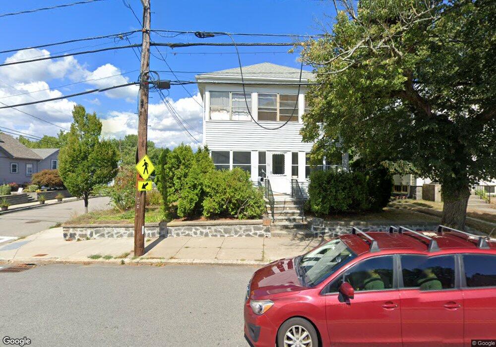
703 Lagrange St West Roxbury, MA 02132
West Roxbury NeighborhoodEstimated Value: $846,000 - $1,044,000
4
Beds
2
Baths
2,308
Sq Ft
$407/Sq Ft
Est. Value
About This Home
This home is located at 703 Lagrange St, West Roxbury, MA 02132 and is currently estimated at $939,152, approximately $406 per square foot. 703 Lagrange St is a home located in Suffolk County with nearby schools including St Theresa School, The Roxbury Latin School, and Catholic Memorial School.
Ownership History
Date
Name
Owned For
Owner Type
Purchase Details
Closed on
Dec 8, 2021
Sold by
703 Lagrange Street T
Bought by
Anderberg-Millican Lynne
Current Estimated Value
Purchase Details
Closed on
Nov 9, 2016
Sold by
Cusick Joanne M
Bought by
703 Lagrange Street T
Purchase Details
Closed on
Jun 26, 1997
Sold by
Harris John F
Bought by
Cusick Joanne M
Purchase Details
Closed on
Oct 29, 1996
Sold by
Tripp Barbara A
Bought by
Lagrange St T 703
Create a Home Valuation Report for This Property
The Home Valuation Report is an in-depth analysis detailing your home's value as well as a comparison with similar homes in the area
Home Values in the Area
Average Home Value in this Area
Purchase History
| Date | Buyer | Sale Price | Title Company |
|---|---|---|---|
| Anderberg-Millican Lynne | -- | None Available | |
| 703 Lagrange Street T | -- | -- | |
| Cusick Joanne M | $61,333 | -- | |
| Lagrange St T 703 | $61,666 | -- |
Source: Public Records
Tax History Compared to Growth
Tax History
| Year | Tax Paid | Tax Assessment Tax Assessment Total Assessment is a certain percentage of the fair market value that is determined by local assessors to be the total taxable value of land and additions on the property. | Land | Improvement |
|---|---|---|---|---|
| 2025 | $8,966 | $774,300 | $319,500 | $454,800 |
| 2024 | $7,978 | $731,900 | $223,300 | $508,600 |
| 2023 | $7,347 | $684,100 | $208,700 | $475,400 |
| 2022 | $7,225 | $664,100 | $202,600 | $461,500 |
| 2021 | $7,086 | $664,100 | $202,600 | $461,500 |
| 2020 | $6,999 | $662,800 | $182,500 | $480,300 |
| 2019 | $6,598 | $626,000 | $160,800 | $465,200 |
| 2018 | $6,133 | $585,200 | $160,800 | $424,400 |
| 2017 | $5,903 | $557,400 | $160,800 | $396,600 |
| 2016 | $5,895 | $535,900 | $160,800 | $375,100 |
| 2015 | $5,838 | $482,100 | $185,900 | $296,200 |
| 2014 | $5,554 | $441,500 | $185,900 | $255,600 |
Source: Public Records
Map
Nearby Homes
- 89 Dwinell St
- 9 Carroll St
- 76 Vermont St
- 331 Vermont St
- 577 Baker St Unit 577
- 845 Lagrange St Unit 4
- 865 Lagrange St Unit 5
- 539 Lagrange St
- 37 Pomfret St
- 76 Potomac St
- 701 Vfw Pkwy
- 579 Baker St Unit 579
- 105 Chesbrough Rd
- 183 Temple St
- 139 Newfield St
- 168 Maple St
- 73 Dent St Unit 1
- 59 Chesbrough Rd
- 37 Hastings St Unit 103
- 931 Lagrange St
- 687 Lagrange St
- 133 Lasell St
- 709 Lagrange St
- 683 Lagrange St
- 135 Lasell St
- 711 Lagrange St
- 137 Lasell St
- 134 Lasell St
- 692 Lagrange St
- 679 Lagrange St
- 688 Lagrange St
- 108 Lasell St
- 14 Newfield St
- 713 Lagrange St
- 138 Lasell St
- 139 Lasell St
- 12 Newfield St
- 680 Lagrange St
- 716 Lagrange St
- 675 Lagrange St