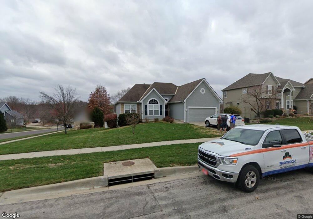
703 Rock Creek Dr Lansing, KS 66043
Estimated Value: $403,645 - $419,000
4
Beds
3
Baths
1,777
Sq Ft
$232/Sq Ft
Est. Value
About This Home
This home is located at 703 Rock Creek Dr, Lansing, KS 66043 and is currently estimated at $411,411, approximately $231 per square foot. 703 Rock Creek Dr is a home located in Leavenworth County with nearby schools including Lansing Elementary School, Lansing Middle 6-8, and Lansing High 9-12.
Ownership History
Date
Name
Owned For
Owner Type
Purchase Details
Closed on
Sep 1, 2003
Bought by
Ray Michael N and Ray Esther L
Current Estimated Value
Home Financials for this Owner
Home Financials are based on the most recent Mortgage that was taken out on this home.
Original Mortgage
$237,754
Outstanding Balance
$52,874
Interest Rate
6.32%
Mortgage Type
VA
Estimated Equity
$358,537
Create a Home Valuation Report for This Property
The Home Valuation Report is an in-depth analysis detailing your home's value as well as a comparison with similar homes in the area
Home Values in the Area
Average Home Value in this Area
Purchase History
| Date | Buyer | Sale Price | Title Company |
|---|---|---|---|
| Ray Michael N | $240,000 | -- |
Source: Public Records
Mortgage History
| Date | Status | Borrower | Loan Amount |
|---|---|---|---|
| Open | Ray Michael N | $237,754 | |
| Closed | Ray Michael N | $280,175 |
Source: Public Records
Tax History Compared to Growth
Tax History
| Year | Tax Paid | Tax Assessment Tax Assessment Total Assessment is a certain percentage of the fair market value that is determined by local assessors to be the total taxable value of land and additions on the property. | Land | Improvement |
|---|---|---|---|---|
| 2025 | $6,091 | $46,812 | $6,243 | $40,569 |
| 2024 | $5,792 | $45,011 | $6,243 | $38,768 |
| 2023 | $5,792 | $44,424 | $6,243 | $38,181 |
| 2022 | $5,496 | $39,863 | $5,279 | $34,584 |
| 2021 | $5,180 | $35,913 | $5,279 | $30,634 |
| 2020 | $5,013 | $34,203 | $5,279 | $28,924 |
| 2019 | $5,020 | $34,203 | $5,279 | $28,924 |
| 2018 | $4,748 | $32,382 | $5,279 | $27,103 |
| 2017 | $4,619 | $31,439 | $5,279 | $26,160 |
| 2016 | $4,621 | $31,439 | $5,279 | $26,160 |
| 2015 | $4,607 | $31,439 | $5,279 | $26,160 |
| 2014 | $4,326 | $30,154 | $5,279 | $24,875 |
Source: Public Records
Map
Nearby Homes
- 875 Clearview Dr
- 833 Rock Creek Dr
- 866 Clearview Dr
- 1322 Rock Creek Ct
- 1221 S Desoto Rd
- 922 Southfork St
- 24431 139th St
- 811 4-H Rd
- 13965 Mc Intyre Rd
- 000 4-H Rd
- 13788 McIntyre1 Rd
- 13788 Mcintyre Rd
- 13788 McIntyre2 Rd
- 527 S Valley Dr
- 401 W Olive St
- 104 Olive St
- 522 Forestglen Ln
- 24303 131st St
- 202 S Main St
- 124 S Main St
- 611 Rock Creek Dr
- 704 Cottonwood Dr
- 707 Rock Creek Dr
- 1416 Corey Ln
- 608 Cottonwood Dr
- 706 Cottonwood Dr
- 609 Rock Creek Dr
- 1415 Corey Ln
- 709 Rock Creek Dr
- 708 Cottonwood Dr
- 1414 Corey Ln
- 606 Cottonwood Dr
- 713 Canyon View Dr
- 607 Rock Creek Dr
- 710 Cottonwood Dr
- 1413 Corey Ln
- 711 Rock Creek Dr
- 703 Cottonwood Dr
- 1412 Corey Ln
- 705 Cottonwood Dr