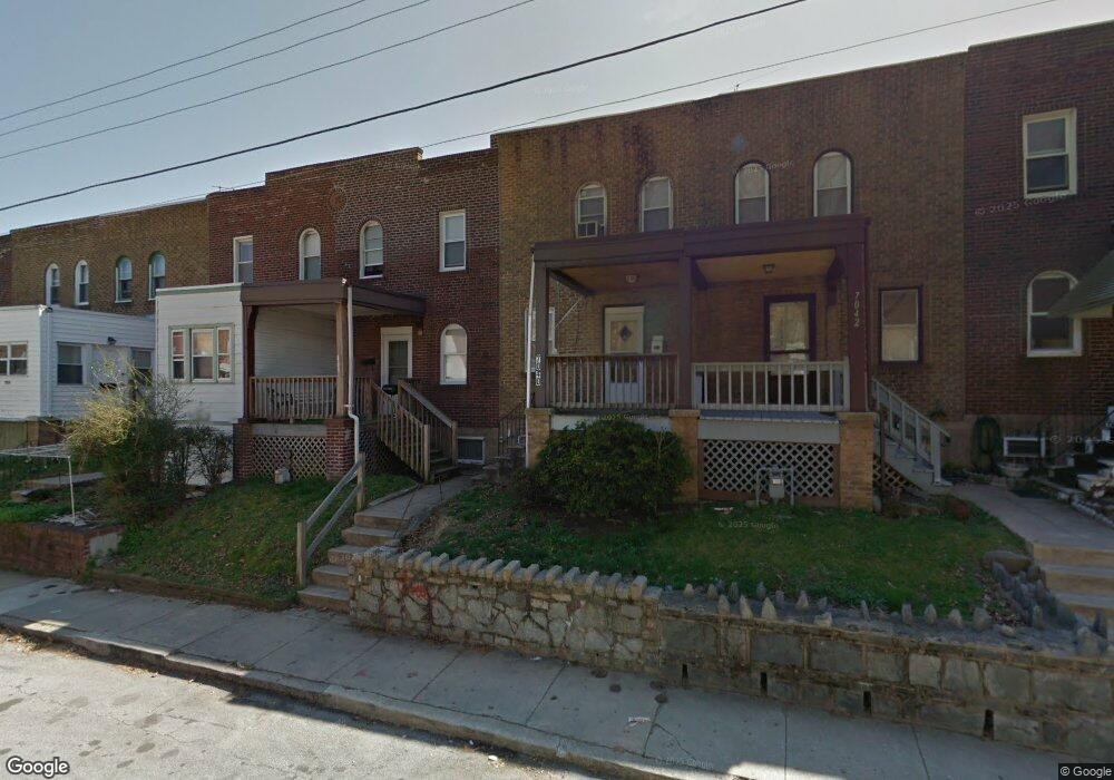
7038 Clinton Rd Upper Darby, PA 19082
Estimated Value: $103,000 - $123,349
2
Beds
1
Bath
902
Sq Ft
$128/Sq Ft
Est. Value
About This Home
This home is located at 7038 Clinton Rd, Upper Darby, PA 19082 and is currently estimated at $115,837, approximately $128 per square foot. 7038 Clinton Rd is a home located in Delaware County with nearby schools including Upper Darby Kdg Center, Upper Darby High School, and SS. Cyril & Philomena Catholic School.
Ownership History
Date
Name
Owned For
Owner Type
Purchase Details
Closed on
Feb 26, 2009
Sold by
Tommarelli Franco and Tommarelli Franco
Bought by
Delldog Inc
Current Estimated Value
Purchase Details
Closed on
Jul 29, 2003
Sold by
Horiel Robert J and Horiel Joan I
Bought by
Tommarelli Franco and Tommarelli Franco
Home Financials for this Owner
Home Financials are based on the most recent Mortgage that was taken out on this home.
Original Mortgage
$29,500
Interest Rate
5.28%
Mortgage Type
Purchase Money Mortgage
Create a Home Valuation Report for This Property
The Home Valuation Report is an in-depth analysis detailing your home's value as well as a comparison with similar homes in the area
Home Values in the Area
Average Home Value in this Area
Purchase History
| Date | Buyer | Sale Price | Title Company |
|---|---|---|---|
| Delldog Inc | $49,000 | None Available | |
| Tommarelli Franco | $20,000 | Ta Title |
Source: Public Records
Mortgage History
| Date | Status | Borrower | Loan Amount |
|---|---|---|---|
| Previous Owner | Tommarelli Franco | $29,500 |
Source: Public Records
Tax History
| Year | Tax Paid | Tax Assessment Tax Assessment Total Assessment is a certain percentage of the fair market value that is determined by local assessors to be the total taxable value of land and additions on the property. | Land | Improvement |
|---|---|---|---|---|
| 2025 | $2,562 | $60,590 | $13,640 | $46,950 |
| 2024 | $2,562 | $60,590 | $13,640 | $46,950 |
| 2023 | $2,538 | $60,590 | $13,640 | $46,950 |
| 2022 | $2,470 | $60,590 | $13,640 | $46,950 |
| 2021 | $3,331 | $60,590 | $13,640 | $46,950 |
| 2020 | $1,560 | $24,120 | $12,400 | $11,720 |
| 2019 | $1,533 | $24,120 | $12,400 | $11,720 |
| 2018 | $1,515 | $24,120 | $0 | $0 |
| 2017 | $1,476 | $24,120 | $0 | $0 |
| 2016 | $135 | $24,120 | $0 | $0 |
| 2015 | $135 | $24,120 | $0 | $0 |
| 2014 | $135 | $24,120 | $0 | $0 |
Source: Public Records
Map
Nearby Homes
- 6993 Guilford Rd
- 7042 Clinton Rd
- 6997 Guilford Rd
- 7023 Guilford Rd
- 7043 Radbourne Rd
- 614 Littlecroft Rd
- 540 Snowden Rd
- 7160 Clover Ln
- 535 Wiltshire Rd
- 7000 Greenwood Ave
- 7123 Seaford Rd
- 7218 Radbourne Rd
- 519 Littlecroft Rd
- 7117 Atlantic Ave
- 402 Long Ln
- 607 Briarcliff Rd
- 7010 Atlantic Ave
- 424 Woodcliffe Rd
- 411 Millbank Rd
- 346 Long Ln
- 7030 Clinton Rd
- 7032 Clinton Rd
- 7028 Clinton Rd
- 7026 Clinton Rd
- 7034 Clinton Rd
- 7036 Clinton Rd
- 7002 Clinton Rd
- 7000 Clinton Rd
- 7022 Clinton Rd
- 7062 Clinton Rd
- 7020 Clinton Rd
- 7018 Clinton Rd
- 7123 Radbourne Rd
- 7121 Radbourne Rd
- 7119 Radbourne Rd
- 7040 Clinton Rd
- 7125 Radbourne Rd
- 7117 Radbourne Rd
- 7016 Clinton Rd
- 7127 Radbourne Rd
Your Personal Tour Guide
Ask me questions while you tour the home.