Estimated Value: $211,000 - $269,000
3
Beds
2
Baths
1,550
Sq Ft
$151/Sq Ft
Est. Value
About This Home
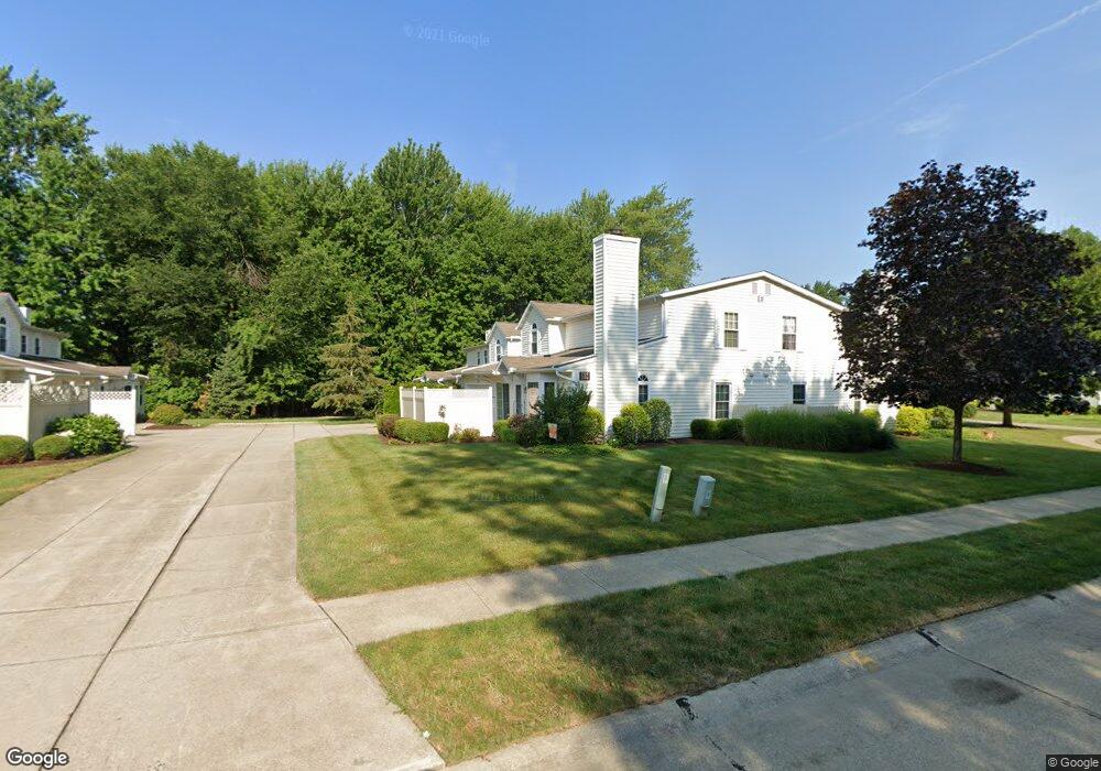
This home is located at 704 S Point Trail Unit 17E, Berea, OH 44017 and is currently estimated at $234,530, approximately $151 per square foot. 704 S Point Trail Unit 17E is a home located in Cuyahoga County with nearby schools including Grindstone Elementary School, Berea-Midpark Middle School, and Berea-Midpark High School.
Ownership History
Date
Name
Owned For
Owner Type
Purchase Details
Closed on
Dec 2, 2003
Sold by
Zastrow Elloy E and Heitz Ronda J
Bought by
Mazer Carol A
Current Estimated Value
Home Financials for this Owner
Home Financials are based on the most recent Mortgage that was taken out on this home.
Original Mortgage
$50,000
Interest Rate
6.1%
Mortgage Type
Unknown
Purchase Details
Closed on
Feb 4, 1994
Bought by
Zastrow Elloy E
Purchase Details
Closed on
Jan 1, 1994
Bought by
Chandler Enterprises Inc
Create a Home Valuation Report for This Property
The Home Valuation Report is an in-depth analysis detailing your home's value as well as a comparison with similar homes in the area
Home Values in the Area
Average Home Value in this Area
Purchase History
| Date | Buyer | Sale Price | Title Company |
|---|---|---|---|
| Mazer Carol A | $139,000 | Real Living Title Agency Ltd | |
| Zastrow Elloy E | $115,500 | -- | |
| Chandler Enterprises Inc | -- | -- |
Source: Public Records
Mortgage History
| Date | Status | Borrower | Loan Amount |
|---|---|---|---|
| Closed | Mazer Carol A | $50,000 |
Source: Public Records
Tax History Compared to Growth
Tax History
| Year | Tax Paid | Tax Assessment Tax Assessment Total Assessment is a certain percentage of the fair market value that is determined by local assessors to be the total taxable value of land and additions on the property. | Land | Improvement |
|---|---|---|---|---|
| 2024 | $3,949 | $78,050 | $7,280 | $70,770 |
| 2023 | $2,975 | $52,050 | $5,220 | $46,830 |
| 2022 | $2,985 | $52,050 | $5,220 | $46,830 |
| 2021 | $2,953 | $52,050 | $5,220 | $46,830 |
| 2020 | $2,510 | $41,300 | $4,130 | $37,170 |
| 2019 | $2,443 | $118,000 | $11,800 | $106,200 |
| 2018 | $2,177 | $41,300 | $4,130 | $37,170 |
| 2017 | $2,061 | $34,340 | $3,430 | $30,910 |
| 2016 | $2,046 | $34,340 | $3,430 | $30,910 |
| 2015 | $2,354 | $34,340 | $3,430 | $30,910 |
| 2014 | $2,354 | $39,940 | $3,990 | $35,950 |
Source: Public Records
Map
Nearby Homes
- 84 Sprague Rd
- 104 Whitehall Dr
- 8627 Courtland Dr
- 740 Fair St
- 8036 Fair Rd
- 243 Jananna Dr
- 9401 Pheasant Run Place
- 154 Best St
- 74 Aaron St
- 23 Hamilton St
- 8902 Lincolnshire Blvd
- 255 Fairpark Dr
- 21292 Creekside Dr
- 458 Sprague Rd
- 19419 Fowles Rd
- 9829 Plum Brook Ln
- 28 Crocker St
- 214 Race St
- 147 Adams St
- 9598 Pebble Brook Ln
- 700 S Point Trail Unit 18E
- 702 S Point Trail
- 698 S Point Trail
- 636 S Point Trail S
- 706 S Point Trail Unit D-16
- 710 S Point Trail Unit D15
- 708 S Point Trail Unit D14
- 712 S Point Trail Unit D13
- 706 S Point Trail
- 687 S Point Trail Unit G25
- 688 S Point Trail
- 686 S Point Trail
- 689 S Point Trail
- 687 S Point Trail Unit G
- 692 S Point Trail
- 693 S Point Trail Unit H31
- 691 S Point Trail Unit H32
- 690 S Point Trail
- 682 S Point Trail Unit F23
- 685 S Point Trail Unit F22