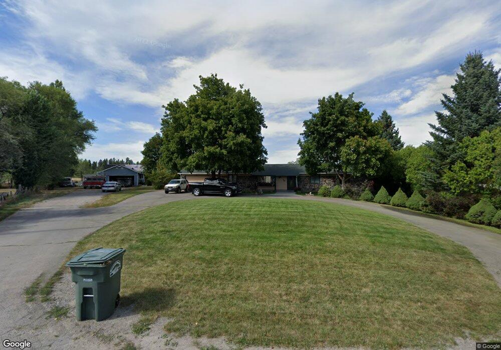
704 Shadow Ln Kalispell, MT 59901
Estimated Value: $508,000 - $570,000
3
Beds
2
Baths
1,440
Sq Ft
$382/Sq Ft
Est. Value
About This Home
This home is located at 704 Shadow Ln, Kalispell, MT 59901 and is currently estimated at $550,268, approximately $382 per square foot. 704 Shadow Ln is a home located in Flathead County with nearby schools including East Evergreen School, Evergreen Junior High School (7-8), and Glacier High School.
Ownership History
Date
Name
Owned For
Owner Type
Purchase Details
Closed on
Nov 20, 2019
Sold by
Peck Mark L and Peck Theresa J
Bought by
Knoble Cody A
Current Estimated Value
Home Financials for this Owner
Home Financials are based on the most recent Mortgage that was taken out on this home.
Original Mortgage
$231,000
Outstanding Balance
$202,813
Interest Rate
3.5%
Mortgage Type
VA
Estimated Equity
$347,455
Purchase Details
Closed on
Oct 12, 2007
Sold by
Botkin Lori M and Botkin Steven R
Bought by
Peck Mark L and Peck Theresa J
Home Financials for this Owner
Home Financials are based on the most recent Mortgage that was taken out on this home.
Original Mortgage
$244,900
Interest Rate
6.4%
Mortgage Type
VA
Create a Home Valuation Report for This Property
The Home Valuation Report is an in-depth analysis detailing your home's value as well as a comparison with similar homes in the area
Purchase History
| Date | Buyer | Sale Price | Title Company |
|---|---|---|---|
| Knoble Cody A | -- | First American Title Company | |
| Peck Mark L | -- | Stewart Title Of Flathead Co |
Source: Public Records
Mortgage History
| Date | Status | Borrower | Loan Amount |
|---|---|---|---|
| Open | Knoble Cody A | $231,000 | |
| Previous Owner | Peck Mark L | $244,900 |
Source: Public Records
Tax History
| Year | Tax Paid | Tax Assessment Tax Assessment Total Assessment is a certain percentage of the fair market value that is determined by local assessors to be the total taxable value of land and additions on the property. | Land | Improvement |
|---|---|---|---|---|
| 2025 | $2,545 | $573,700 | $0 | $0 |
| 2024 | $2,377 | $371,400 | $0 | $0 |
| 2023 | $2,433 | $371,400 | $0 | $0 |
| 2022 | $2,154 | $235,700 | $0 | $0 |
| 2021 | $2,217 | $235,700 | $0 | $0 |
| 2020 | $2,292 | $231,500 | $0 | $0 |
| 2019 | $2,506 | $257,700 | $0 | $0 |
| 2018 | $2,174 | $220,400 | $0 | $0 |
| 2017 | $2,165 | $220,400 | $0 | $0 |
| 2016 | $1,753 | $182,400 | $0 | $0 |
| 2015 | $1,717 | $182,400 | $0 | $0 |
| 2014 | $1,906 | $125,610 | $0 | $0 |
Source: Public Records
Map
Nearby Homes
- 692 Shadow Ln
- 672 Shadow Ln
- 623 Saint Regis Dr
- 136 Weimar Way
- 1056 Clark Fork Dr
- 227 Drake Dr
- 696 Mountain View Dr
- 130 E Reserve Dr
- 3091 Elderberry Ave
- 10 Cheery Lynn Ct
- 223 Cooperative Way
- 435 Margrethe Rd
- 430 Judith Rd
- 335 Rosewater Loop
- 103 Spring Creek Dr
- 227 E Nicklaus Ave
- 217 E Nicklaus Ave
- 218 E Nicklaus Ave
- 284 W Nicklaus Ave
- 269 W Nicklaus Ave
Your Personal Tour Guide
Ask me questions while you tour the home.