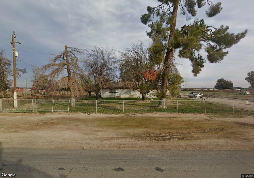
7048 Houghton Rd Bakersfield, CA 93313
Estimated Value: $215,577 - $587,000
3
Beds
1
Bath
1,122
Sq Ft
$397/Sq Ft
Est. Value
About This Home
This home is located at 7048 Houghton Rd, Bakersfield, CA 93313 and is currently estimated at $444,894, approximately $396 per square foot. 7048 Houghton Rd is a home located in Kern County with nearby schools including Lakeside School, General Shafter Elementary School, and Independence High School.
Ownership History
Date
Name
Owned For
Owner Type
Purchase Details
Closed on
Nov 17, 2022
Sold by
Lorne Mccan And Carrie Mccan 2007 Family
Bought by
Lorne Mccan And Carrie Mccan 2007 Family Trus
Current Estimated Value
Home Financials for this Owner
Home Financials are based on the most recent Mortgage that was taken out on this home.
Original Mortgage
$200,000
Outstanding Balance
$193,798
Interest Rate
6.95%
Mortgage Type
New Conventional
Estimated Equity
$251,096
Purchase Details
Closed on
Jun 17, 2011
Sold by
Mccan Charles R
Bought by
Mccan Lorne and Mccan Carrie
Purchase Details
Closed on
Jan 24, 2001
Sold by
Mccan Ruby M and Barringer Lisa Mccan
Bought by
Mccan Ruby M
Purchase Details
Closed on
Jan 16, 1998
Sold by
Mccan Ruby M and Robinson Ruby Mae
Bought by
Mccan Ruby M and Barringer Lisa Mccan
Create a Home Valuation Report for This Property
The Home Valuation Report is an in-depth analysis detailing your home's value as well as a comparison with similar homes in the area
Home Values in the Area
Average Home Value in this Area
Purchase History
| Date | Buyer | Sale Price | Title Company |
|---|---|---|---|
| Lorne Mccan And Carrie Mccan 2007 Family Trus | -- | Wfg National Title | |
| Mccan Lorne | -- | None Available | |
| Mccan Ruby M | -- | -- | |
| Mccan Ruby M | -- | -- |
Source: Public Records
Mortgage History
| Date | Status | Borrower | Loan Amount |
|---|---|---|---|
| Open | Lorne Mccan And Carrie Mccan 2007 Family Trus | $200,000 |
Source: Public Records
Tax History Compared to Growth
Tax History
| Year | Tax Paid | Tax Assessment Tax Assessment Total Assessment is a certain percentage of the fair market value that is determined by local assessors to be the total taxable value of land and additions on the property. | Land | Improvement |
|---|---|---|---|---|
| 2025 | $884 | $28,230 | $10,700 | $17,530 |
| 2024 | $846 | $27,678 | $10,491 | $17,187 |
| 2023 | $846 | $27,136 | $10,286 | $16,850 |
| 2022 | $784 | $26,605 | $10,085 | $16,520 |
| 2021 | $709 | $26,085 | $9,888 | $16,197 |
| 2020 | $709 | $25,818 | $9,787 | $16,031 |
| 2019 | $653 | $25,818 | $9,787 | $16,031 |
| 2018 | $627 | $24,817 | $9,408 | $15,409 |
| 2017 | $595 | $24,331 | $9,224 | $15,107 |
| 2016 | $346 | $23,855 | $9,044 | $14,811 |
| 2015 | $344 | $23,498 | $8,909 | $14,589 |
| 2014 | $338 | $23,039 | $8,735 | $14,304 |
Source: Public Records
Map
Nearby Homes
- 7925 Houghton Rd
- 7544 Clifford Ct
- 11217 Gosford Rd
- 15313 Gosford Rd
- 6200 Whaleback Ave
- 9801 Packwood Dr
- 5831 Mardal Ave
- 6021 Bogart Dr
- 6028 Bogart Dr
- 6230 Taft Hwy
- 5808 Esmerelda Ave
- 7926 Bear Mountain Blvd
- Lark Plan at Village at Gosford - East Village
- Oriole Plan at Village at Gosford - East Village
- Sparrow Plan at Village at Gosford - East Village
- Wren Plan at Village at Gosford - East Village
- 6201 Cape Cod Ave
- 6115 Cape Cod Ave
- 9402 Cobble Mountain Rd
- 6225 Thorton Ave
- 0 Houghton Rd Unit 202408431
- 0 Houghton Rd Unit 27017839
- 0 Houghton Rd Unit 28008252
- 0 Houghton Rd Unit 29001198
- 0 Houghton Rd Unit 21102329
- 0 Houghton Rd Unit 21206141
- 0 Houghton Rd Unit 21302498
- 0 Houghton Rd Unit 21305821
- 0 Houghton Rd Unit 21310219
- 0 Houghton Rd Unit 21307261
- 0 Houghton Rd Unit 21305521
- 0 Houghton Rd Unit 21406607
- 0 Houghton Rd Unit 21410408
- 0 Houghton Rd Unit 21406810
- 0 Houghton Rd Unit 21402703
- 0 Houghton Rd Unit 21402651
- 0 Houghton Rd Unit 21413011
- 0 Houghton Rd Unit 21602183
- 0 Houghton Rd Unit 202111231
- 0 Houghton Rd Unit IV22030913